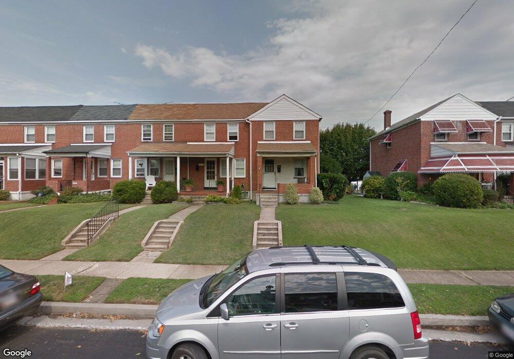
6912 Broening Rd Dundalk, MD 21222
Saint Helena NeighborhoodEstimated Value: $167,485 - $204,000
Studio
1
Bath
1,024
Sq Ft
$180/Sq Ft
Est. Value
About This Home
This home is located at 6912 Broening Rd, Dundalk, MD 21222 and is currently estimated at $184,621, approximately $180 per square foot. 6912 Broening Rd is a home located in Baltimore County with nearby schools including Logan Elementary, Dundalk Middle School, and Dundalk High School.
Ownership History
Date
Name
Owned For
Owner Type
Purchase Details
Closed on
May 24, 2005
Sold by
Rews Norma M
Bought by
Selby Christopher E and Selby Tricia D
Current Estimated Value
Home Financials for this Owner
Home Financials are based on the most recent Mortgage that was taken out on this home.
Original Mortgage
$84,250
Outstanding Balance
$44,236
Interest Rate
6.05%
Mortgage Type
FHA
Estimated Equity
$140,385
Purchase Details
Closed on
Dec 19, 1985
Sold by
Glotfelty Clarence Edward
Bought by
Andrews Kenneth L
Create a Home Valuation Report for This Property
The Home Valuation Report is an in-depth analysis detailing your home's value as well as a comparison with similar homes in the area
Home Values in the Area
Average Home Value in this Area
Purchase History
| Date | Buyer | Sale Price | Title Company |
|---|---|---|---|
| Selby Christopher E | $85,000 | -- | |
| Andrews Kenneth L | $50,000 | -- |
Source: Public Records
Mortgage History
| Date | Status | Borrower | Loan Amount |
|---|---|---|---|
| Open | Selby Christopher E | $84,250 | |
| Closed | Selby Christopher E | $3,000 |
Source: Public Records
Tax History
| Year | Tax Paid | Tax Assessment Tax Assessment Total Assessment is a certain percentage of the fair market value that is determined by local assessors to be the total taxable value of land and additions on the property. | Land | Improvement |
|---|---|---|---|---|
| 2025 | $2,275 | $149,567 | -- | -- |
| 2024 | $2,275 | $137,233 | $0 | $0 |
| 2023 | $2,047 | $124,900 | $34,000 | $90,900 |
| 2022 | $2,102 | $122,400 | $0 | $0 |
| 2020 | $1,423 | $117,400 | $34,000 | $83,400 |
| 2019 | $1,383 | $114,133 | $0 | $0 |
| 2018 | $1,344 | $110,867 | $0 | $0 |
| 2017 | $1,842 | $107,600 | $0 | $0 |
| 2016 | -- | $107,567 | $0 | $0 |
| 2015 | $1,707 | $107,533 | $0 | $0 |
| 2014 | $1,707 | $107,500 | $0 | $0 |
Source: Public Records
Map
Nearby Homes
- 6832 Broening Rd
- 6948 Broening Rd
- 3436 Dunran Rd
- 6843 Dunbar Rd
- 7022 Dunbar Rd
- 3325 Mcshane Way
- 3022 Dunglow Rd
- 3408 Yardley Dr
- 3536 Mcshane Way
- 3145 Yorkway
- 3129 Yorkway
- 3506 Cornwall Ct
- 3421 Cornwall Rd
- 2990 Yorkway
- 3135 Sollers Point Rd
- 3458 Liberty Pkwy
- 2953 Yorkway
- 6757 Woodley Rd
- 402 Chestnut Ct
- 3145 Baybriar Rd
- 6910 Broening Rd
- 6914 Broening Rd
- 6908 Broening Rd
- 6916 Broening Rd
- 6906 Broening Rd
- 6918 Broening Rd
- 6904 Broening Rd
- 6920 Broening Rd
- 6902 Broening Rd
- 6924 Broening Rd
- 6913 Belclare Rd
- 6915 Belclare Rd
- 6900 Broening Rd
- 6911 Belclare Rd
- 6917 Belclare Rd
- 6909 Belclare Rd
- 6907 Belclare Rd
- 6926 Broening Rd
- 6921 Belclare Rd
- 6905 Belclare Rd
Your Personal Tour Guide
Ask me questions while you tour the home.