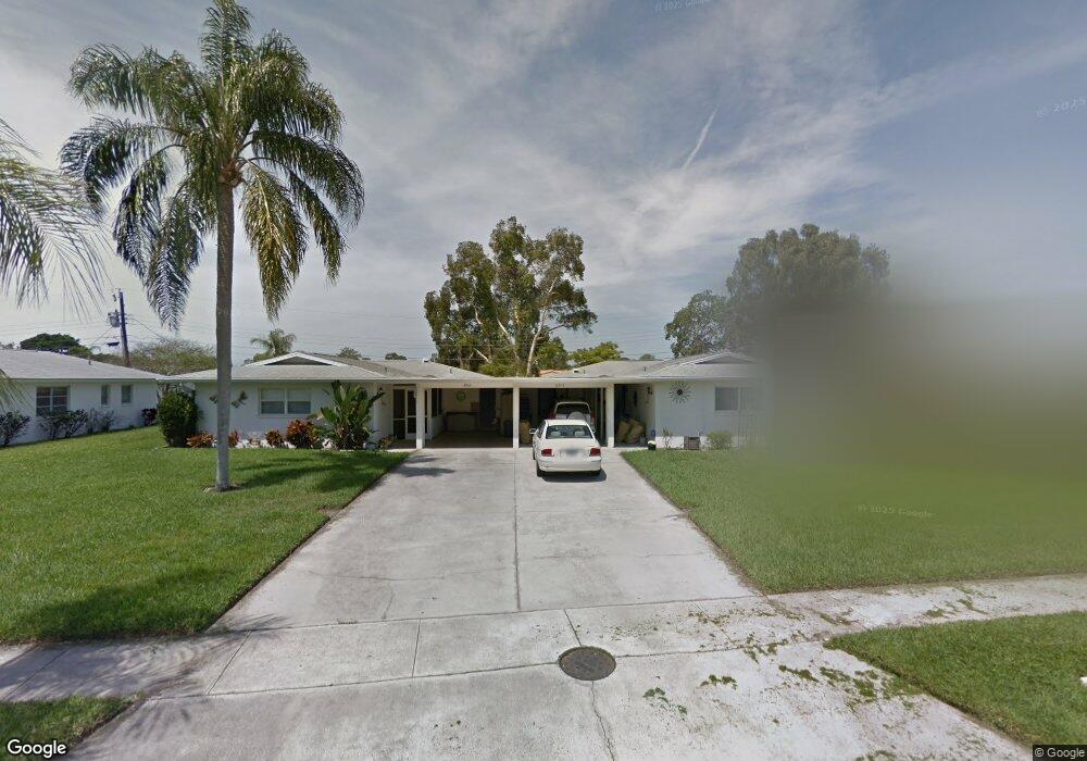
6912 Curtiss Ave Unit 133 Sarasota, FL 34231
Estimated Value: $243,000 - $298,000
2
Beds
2
Baths
1,170
Sq Ft
$228/Sq Ft
Est. Value
About This Home
This home is located at 6912 Curtiss Ave Unit 133, Sarasota, FL 34231 and is currently estimated at $266,222, approximately $227 per square foot. 6912 Curtiss Ave Unit 133 is a home located in Sarasota County with nearby schools including Gulf Gate Elementary School, Riverview High School, and Brookside Middle School.
Ownership History
Date
Name
Owned For
Owner Type
Purchase Details
Closed on
Oct 22, 2018
Sold by
Decelle Sherry and Cramer Heidi Ann
Bought by
Hartsock Robert D
Current Estimated Value
Home Financials for this Owner
Home Financials are based on the most recent Mortgage that was taken out on this home.
Original Mortgage
$128,250
Outstanding Balance
$111,842
Interest Rate
4.5%
Mortgage Type
New Conventional
Estimated Equity
$154,380
Purchase Details
Closed on
Apr 28, 2016
Sold by
Decelle Sherry
Bought by
Decelle Sherry and Cramer Heidi Ann
Purchase Details
Closed on
Jul 23, 1999
Sold by
Kent Elise C
Bought by
Decelle Sherry
Home Financials for this Owner
Home Financials are based on the most recent Mortgage that was taken out on this home.
Original Mortgage
$62,000
Interest Rate
7.66%
Create a Home Valuation Report for This Property
The Home Valuation Report is an in-depth analysis detailing your home's value as well as a comparison with similar homes in the area
Home Values in the Area
Average Home Value in this Area
Purchase History
| Date | Buyer | Sale Price | Title Company |
|---|---|---|---|
| Hartsock Robert D | $173,000 | Stewart Title Co | |
| Decelle Sherry | -- | None Available | |
| Decelle Sherry | $72,000 | -- |
Source: Public Records
Mortgage History
| Date | Status | Borrower | Loan Amount |
|---|---|---|---|
| Open | Hartsock Robert D | $128,250 | |
| Previous Owner | Decelle Sherry | $62,000 |
Source: Public Records
Tax History Compared to Growth
Tax History
| Year | Tax Paid | Tax Assessment Tax Assessment Total Assessment is a certain percentage of the fair market value that is determined by local assessors to be the total taxable value of land and additions on the property. | Land | Improvement |
|---|---|---|---|---|
| 2024 | $2,936 | $149,754 | -- | -- |
| 2023 | $2,936 | $248,400 | $0 | $248,400 |
| 2022 | $2,655 | $223,900 | $0 | $223,900 |
| 2021 | $2,053 | $133,000 | $0 | $133,000 |
| 2020 | $2,007 | $128,500 | $0 | $128,500 |
| 2019 | $1,818 | $115,400 | $0 | $115,400 |
| 2018 | $803 | $73,893 | $0 | $0 |
| 2017 | $803 | $72,373 | $0 | $0 |
| 2016 | $827 | $96,000 | $0 | $96,000 |
| 2015 | $839 | $90,500 | $0 | $90,500 |
| 2014 | $836 | $68,800 | $0 | $0 |
Source: Public Records
Map
Nearby Homes
- 3276 Westford Ln
- 6735 Keystone Dr
- 6717 Roxbury Dr
- 6637 Bowline Dr
- 3312 Kenmore Dr
- 3003 Bispham Rd
- 6636 Easton Dr
- 7164 Rue de Palisades Unit 5
- 7160 Rue de Palisades Unit 4
- 7156 Rue de Palisades Unit 3
- 3632 Beneva Oaks Blvd
- 6675 Easton Dr
- 3648 Beneva Oaks Blvd
- 3639 Beneva Oaks Blvd
- 3835 Alamanda Dr
- 7160 Del Lago Dr
- 3829 Alamanda Dr
- 6993 Easton Ct
- 7157 Del Lago Dr
- 3828 Easton St
- 3211 Westford Ln
- 3311 Fuller St Unit 104
- 3276 Westford Ln Unit 117
- 3339 Fuller St Unit 108
- 6924 Curtiss Ave Unit 135
- 3321 Fuller St Unit 105
- 6918 Curtiss Ave Unit 134
- 3270 Westford Ln Unit 118
- 3312 Westford Ln Unit 114
- 3210 Westford Ln Unit 101
- 6960 Curtiss Ave Unit 141
- 6966 Curtiss Ave Unit 142
- 3336 Westford Ln Unit 110
- 7014 Curtiss Ave Unit 144
- 6930 Curtiss Ave Unit 136
- 3306 Westford Ln Unit 115
- 3222 Westford Ln Unit 127
- 3311 Fuller St
- 3325 Fuller St Unit 106
- 3252 Westford Ln Unit 122