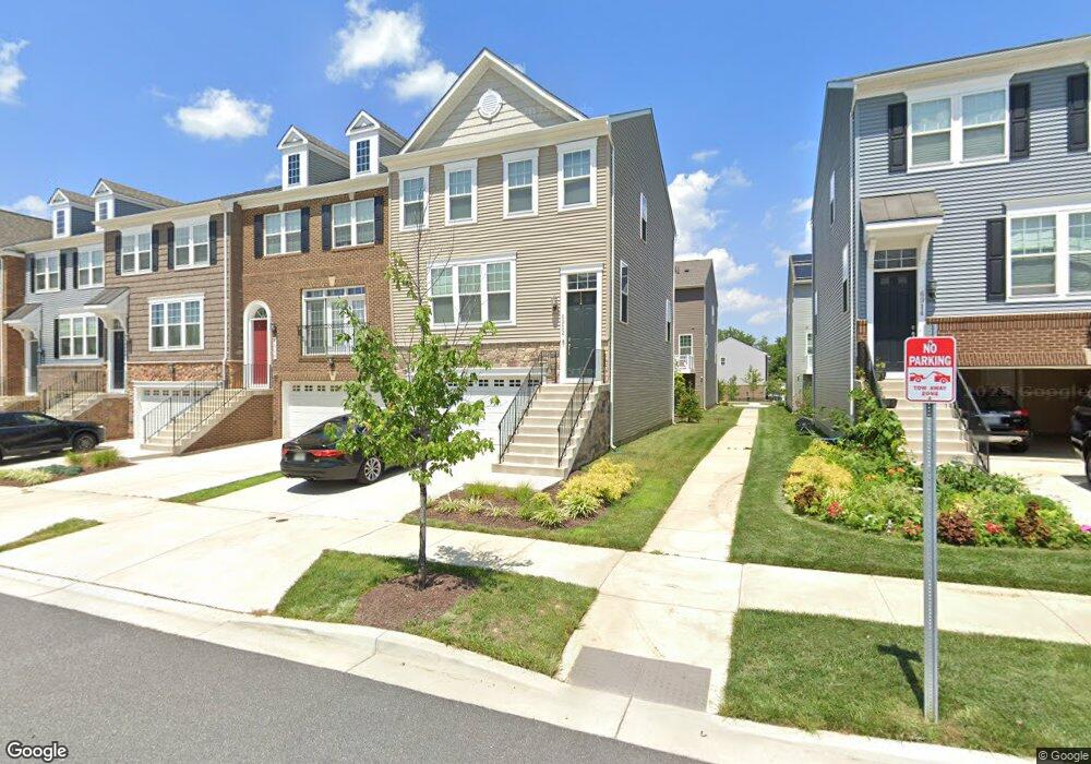
6912 Stansbury Ln Landover, MD 20785
Greater Landover NeighborhoodEstimated Value: $459,000 - $562,000
3
Beds
4
Baths
2,314
Sq Ft
$216/Sq Ft
Est. Value
About This Home
This home is located at 6912 Stansbury Ln, Landover, MD 20785 and is currently estimated at $500,355, approximately $216 per square foot. 6912 Stansbury Ln is a home located in Prince George's County with nearby schools including Dodge Park Elementary School, Kenmoor Middle School, and Duval High School.
Ownership History
Date
Name
Owned For
Owner Type
Purchase Details
Closed on
Feb 25, 2025
Sold by
Mclaughlin Ashton E
Bought by
A E Mclaughlin Family Trust and Mclaughlin
Current Estimated Value
Purchase Details
Closed on
Dec 3, 2018
Sold by
Sm Landover Llc
Bought by
Mclaughlin Ashton E
Home Financials for this Owner
Home Financials are based on the most recent Mortgage that was taken out on this home.
Original Mortgage
$367,750
Interest Rate
4.8%
Mortgage Type
VA
Create a Home Valuation Report for This Property
The Home Valuation Report is an in-depth analysis detailing your home's value as well as a comparison with similar homes in the area
Home Values in the Area
Average Home Value in this Area
Purchase History
| Date | Buyer | Sale Price | Title Company |
|---|---|---|---|
| A E Mclaughlin Family Trust | -- | None Listed On Document | |
| Mclaughlin Ashton E | $374,570 | First Excel Title Llc |
Source: Public Records
Mortgage History
| Date | Status | Borrower | Loan Amount |
|---|---|---|---|
| Previous Owner | Mclaughlin Ashton E | $367,750 |
Source: Public Records
Tax History Compared to Growth
Tax History
| Year | Tax Paid | Tax Assessment Tax Assessment Total Assessment is a certain percentage of the fair market value that is determined by local assessors to be the total taxable value of land and additions on the property. | Land | Improvement |
|---|---|---|---|---|
| 2025 | $6,476 | $438,933 | -- | -- |
| 2024 | $6,476 | $410,367 | $0 | $0 |
| 2023 | $6,050 | $381,800 | $75,000 | $306,800 |
| 2022 | $5,634 | $353,767 | $0 | $0 |
| 2021 | $5,217 | $325,733 | $0 | $0 |
| 2020 | $4,801 | $297,700 | $75,000 | $222,700 |
| 2019 | $4,050 | $282,833 | $0 | $0 |
| 2018 | $98 | $5,200 | $5,200 | $0 |
| 2017 | $77 | $5,200 | $0 | $0 |
Source: Public Records
Map
Nearby Homes
- 2917 Duvall Ridge Rd Unit 559
- 3015 Duvall Ridge Rd
- 2714 Pinebrook Rd
- 6892 Hawthorne St
- 2503 Kent Town Place
- 7012 E Lombard St
- 7103 E Kilmer St
- 2417 Kent Village Place
- 7003 Fairwood Rd
- 7403 Hawthorne St
- 2211 Vermont Ave
- 6909 Standish Dr
- 7512 Hawthorne St Unit 2
- 7512 Hawthorne St Unit 3
- 2500 Markham Ln Unit 2
- 2217 Columbia Place
- 3815 71st Ave
- 2208 Columbia Place
- 2116 Columbia Ave
- 3732 Ingalls Ave
- 6910 Stansbury Ln
- 6914 Stansbury Ln
- 6908 Stansbury Ln
- 6916 Stansbury Ln
- 6906 Stansbury Ln
- 6911 Saint Ambrose Way
- 6918 Stansbury Ln
- 6913 Saint Ambrose Way
- 6915 Saint Ambrose Way
- 6909 Saint Ambrose Way
- 6920 Stansbury Ln
- 6904 Stansbury Ln
- 6902 Stansbury Ln
- 6907 Saint Ambrose Way
- 6905 Saint Ambrose Way
- 6919 Saint Ambrose Way
- 6917 Saint Ambrose Way
- 6900 Stansbury Ln
- 6909 Stansbury Ln
- 6913 Stansbury Ln