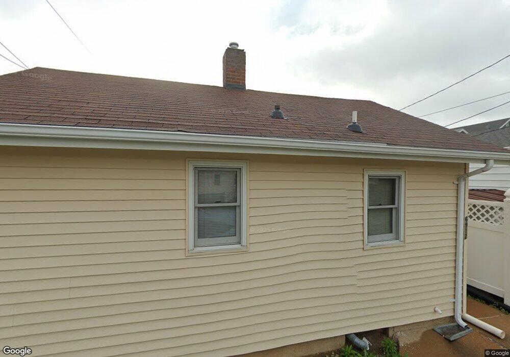
6912 Sutherland Ave Saint Louis, MO 63109
Lindenwood Park NeighborhoodEstimated Value: $119,000 - $170,000
--
Bed
1
Bath
1,440
Sq Ft
$98/Sq Ft
Est. Value
About This Home
This home is located at 6912 Sutherland Ave, Saint Louis, MO 63109 and is currently estimated at $141,298, approximately $98 per square foot. 6912 Sutherland Ave is a home located in St. Louis City with nearby schools including Mason Elementary School, Long International Middle School, and Roosevelt High School.
Ownership History
Date
Name
Owned For
Owner Type
Purchase Details
Closed on
Dec 19, 2025
Sold by
Peer Corree and Peer Lauren Kortas
Bought by
Peer Holdings Llc
Current Estimated Value
Home Financials for this Owner
Home Financials are based on the most recent Mortgage that was taken out on this home.
Original Mortgage
$93,750
Outstanding Balance
$93,750
Interest Rate
6.22%
Mortgage Type
New Conventional
Estimated Equity
$47,548
Purchase Details
Closed on
Apr 17, 1997
Sold by
Kresser Christopher H and Kresser Kathleen
Bought by
Revocable Living Tr Christopher H Kresse
Create a Home Valuation Report for This Property
The Home Valuation Report is an in-depth analysis detailing your home's value as well as a comparison with similar homes in the area
Home Values in the Area
Average Home Value in this Area
Purchase History
| Date | Buyer | Sale Price | Title Company |
|---|---|---|---|
| Peer Holdings Llc | -- | None Listed On Document | |
| Revocable Living Tr Christopher H Kresse | -- | -- |
Source: Public Records
Mortgage History
| Date | Status | Borrower | Loan Amount |
|---|---|---|---|
| Open | Peer Holdings Llc | $93,750 |
Source: Public Records
Tax History
| Year | Tax Paid | Tax Assessment Tax Assessment Total Assessment is a certain percentage of the fair market value that is determined by local assessors to be the total taxable value of land and additions on the property. | Land | Improvement |
|---|---|---|---|---|
| 2025 | $944 | $15,430 | $910 | $14,520 |
| 2024 | $2,129 | $10,940 | $910 | $10,030 |
| 2023 | $2,129 | $27,280 | $2,200 | $25,080 |
| 2022 | $2,129 | $25,420 | $2,200 | $23,220 |
| 2021 | $2,126 | $25,420 | $2,200 | $23,220 |
| 2020 | $2,198 | $26,490 | $2,200 | $24,290 |
| 2019 | $2,190 | $26,480 | $2,200 | $24,280 |
| 2018 | $1,955 | $22,870 | $2,010 | $20,860 |
| 2017 | $1,921 | $22,880 | $2,010 | $20,860 |
| 2016 | $1,845 | $21,680 | $2,010 | $19,670 |
| 2015 | $1,673 | $21,680 | $2,010 | $19,670 |
| 2014 | $1,634 | $21,680 | $2,010 | $19,670 |
| 2013 | -- | $21,160 | $2,010 | $19,150 |
Source: Public Records
Map
Nearby Homes
- 6927-6931 Sutherland Ave
- 4313 Jamieson Ave
- 6962 Sutherland Ave
- 6968 Lansdowne Ave
- 6732 Sutherland Ave
- 3947 Jamieson Ave
- 6709 Lansdowne Ave
- 6714 Bancroft Ave
- 6973 Winona Ave
- 6957 Chippewa St
- 6663 Devonshire Ave
- 4719 Jamieson Ave Unit 4
- 6637 Devonshire Ave Unit 2
- 3903 Prather Ave
- 7081 Winona Ave
- 6515 Devonshire Ave
- 6758 Neosho St
- 7132 Lindenwood Place
- 6935 Pernod Ave
- 6409 Sutherland Ave
- 4401 Jamieson Ave
- 4405 Jamieson Ave
- 4409 Jamieson Ave
- 6916 Sutherland Ave
- 4325 Jamieson Ave
- 4413 Jamieson Ave
- 6920 Sutherland Ave
- 4415 Jamieson Ave
- 4321 Jamieson Ave
- 6915 Sutherland Ave
- 6922 Sutherland Ave
- 4317 Jamieson Ave
- 6919 Sutherland Ave
- 6915 Lansdowne Ave
- 6926 Sutherland Ave
- 6923 Sutherland Ave
- 4400 Jamieson Ave
- 6923 Lansdowne Ave
- 4404 Jamieson Ave
- 4408 Jamieson Ave
Your Personal Tour Guide
Ask me questions while you tour the home.