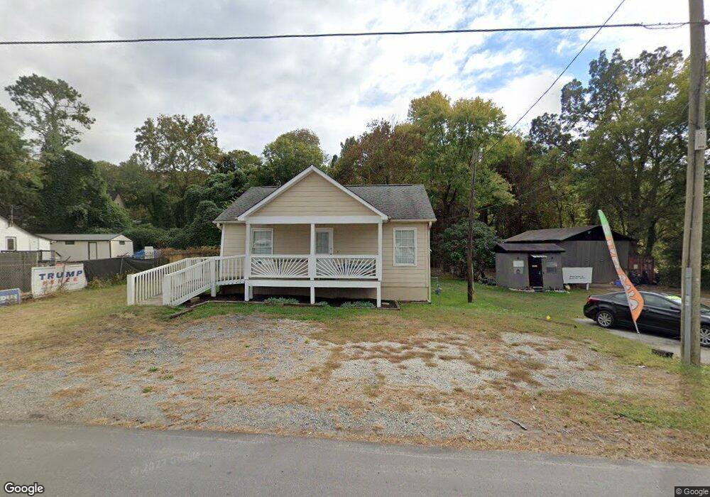
6913 N Main St SE Acworth, GA 30101
Estimated Value: $166,000 - $304,000
2
Beds
1
Bath
950
Sq Ft
$236/Sq Ft
Est. Value
About This Home
This home is located at 6913 N Main St SE, Acworth, GA 30101 and is currently estimated at $224,667, approximately $236 per square foot. 6913 N Main St SE is a home located in Bartow County with nearby schools including Emerson Elementary School, Red Top Middle School, and Woodland High School.
Ownership History
Date
Name
Owned For
Owner Type
Purchase Details
Closed on
Feb 2, 2011
Sold by
Donnelly David R
Bought by
Donnelly Jean
Current Estimated Value
Purchase Details
Closed on
Feb 28, 2007
Sold by
Stringer Linda
Bought by
Donnelly David R
Home Financials for this Owner
Home Financials are based on the most recent Mortgage that was taken out on this home.
Original Mortgage
$150,000
Interest Rate
6.3%
Mortgage Type
New Conventional
Create a Home Valuation Report for This Property
The Home Valuation Report is an in-depth analysis detailing your home's value as well as a comparison with similar homes in the area
Home Values in the Area
Average Home Value in this Area
Purchase History
| Date | Buyer | Sale Price | Title Company |
|---|---|---|---|
| Donnelly Jean | -- | -- | |
| Donnelly David R | $150,000 | -- |
Source: Public Records
Mortgage History
| Date | Status | Borrower | Loan Amount |
|---|---|---|---|
| Previous Owner | Donnelly David R | $150,000 |
Source: Public Records
Tax History Compared to Growth
Tax History
| Year | Tax Paid | Tax Assessment Tax Assessment Total Assessment is a certain percentage of the fair market value that is determined by local assessors to be the total taxable value of land and additions on the property. | Land | Improvement |
|---|---|---|---|---|
| 2024 | $1,381 | $57,435 | $8,040 | $49,395 |
| 2023 | $1,396 | $51,223 | $12,000 | $39,223 |
| 2022 | $1,250 | $49,236 | $12,000 | $37,236 |
| 2021 | $948 | $35,550 | $12,000 | $23,550 |
| 2020 | $977 | $35,550 | $12,000 | $23,550 |
| 2019 | $919 | $33,120 | $9,000 | $24,120 |
| 2018 | $1,567 | $28,120 | $4,000 | $24,120 |
| 2017 | $787 | $28,120 | $4,000 | $24,120 |
| 2016 | $793 | $28,120 | $4,000 | $24,120 |
| 2015 | $795 | $28,120 | $4,000 | $24,120 |
| 2014 | $595 | $20,400 | $2,800 | $17,600 |
| 2013 | -- | $24,280 | $2,800 | $21,480 |
Source: Public Records
Map
Nearby Homes
- 125 Lake Picketts Dr
- 175 Lakeshore Cir SE
- 188 Eidson St SE
- 5948 Mccoy Rd
- 5650 Mccoy Rd NW
- 0 Sandtown Rd SE Unit 7631495
- 0 Sandtown Rd SE Unit 10585642
- 500 Gayle Dr SE
- 49 Lake Top Dr SE
- 5440 Portside Dr
- 124 Main Lake Dr SE
- 5098 Gwendolyn Ct NW
- 55 E Green Ridge Rd SE
- 5094 Gwendolyn Ct NW
- 5198 W Holiday Ct SE
- 5115 W Holiday Ct SE
- 4413 Oglethorpe Loop NW Unit 37
- 4413 Oglethorpe Loop NW
- 4687 Hilltop Dr NW
- 6080 Simone St
- 6901 N Main St SE
- 6901 Highway 293
- 6901 Hwy 293
- 110 Florence Dr SE
- 108 Florence Dr SE
- 106 Florence Dr SE Unit 8
- 106 Florence Dr SE
- 104 Florence Dr
- 6885 N Main St SE
- 109 Highpine Dr
- 6893 N Main St SE
- 105 Shirley Ln SE
- 112 Highpine Dr
- 112 Highpine Dr
- 5637 3rd Army Rd SE
- 5634 Third Army Rd SE
- 6853 Highway 293
- 6853 N Main St SE
- 112 Oak Dr SE
- 113 Shirley Ln SE