Estimated Value: $382,782 - $588,000
--
Bed
--
Bath
2,075
Sq Ft
$246/Sq Ft
Est. Value
About This Home
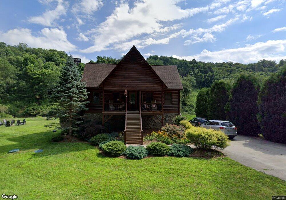
This home is located at 6913 Railroad Grade Rd, Todd, NC 28684 and is currently estimated at $510,196, approximately $245 per square foot. 6913 Railroad Grade Rd is a home.
Ownership History
Date
Name
Owned For
Owner Type
Purchase Details
Closed on
Oct 16, 2020
Sold by
Bumgarner Eddie L and Bumgarner Sandra K
Bought by
Bilbro Christopher M and Bilbro Jennifer K
Current Estimated Value
Home Financials for this Owner
Home Financials are based on the most recent Mortgage that was taken out on this home.
Original Mortgage
$251,235
Outstanding Balance
$223,460
Interest Rate
2.9%
Mortgage Type
New Conventional
Estimated Equity
$286,736
Purchase Details
Closed on
May 18, 2006
Sold by
Hart Timothy K and Hart Beverly K
Bought by
Bumgarner Eddie L and Bumgarner Sandra K
Create a Home Valuation Report for This Property
The Home Valuation Report is an in-depth analysis detailing your home's value as well as a comparison with similar homes in the area
Home Values in the Area
Average Home Value in this Area
Purchase History
| Date | Buyer | Sale Price | Title Company |
|---|---|---|---|
| Bilbro Christopher M | $400,000 | None Available | |
| Bumgarner Eddie L | $257,000 | -- |
Source: Public Records
Mortgage History
| Date | Status | Borrower | Loan Amount |
|---|---|---|---|
| Open | Bilbro Christopher M | $251,235 |
Source: Public Records
Tax History Compared to Growth
Tax History
| Year | Tax Paid | Tax Assessment Tax Assessment Total Assessment is a certain percentage of the fair market value that is determined by local assessors to be the total taxable value of land and additions on the property. | Land | Improvement |
|---|---|---|---|---|
| 2025 | $1,419 | $265,700 | $70,000 | $195,700 |
| 2024 | $2,155 | $419,300 | $70,000 | $349,300 |
| 2023 | $2,155 | $419,300 | $70,000 | $349,300 |
| 2022 | $1,782 | $276,600 | $70,000 | $206,600 |
| 2021 | $1,782 | $276,600 | $70,000 | $206,600 |
| 2020 | $1,597 | $276,600 | $70,000 | $206,600 |
| 2019 | $1,565 | $276,600 | $70,000 | $206,600 |
| 2018 | $0 | $281,000 | $70,000 | $211,000 |
| 2016 | $1,572 | $281,000 | $70,000 | $211,000 |
| 2015 | $1,471 | $281,000 | $70,000 | $211,000 |
| 2014 | $1,471 | $285,400 | $70,000 | $215,400 |
Source: Public Records
Map
Nearby Homes
- 123 Railroad Grade Rd
- TBD Green Meadows Dr
- 11 Knob Hill Dr
- Lot 3 Sec 11 Talons Dr
- TBD Mill Creek Rd
- Lot 2 Sec II Talon Dr
- Lot 1 Sec II Talon Dr
- 281 New River Farms Rd
- Lot #25 Cedar Ridge Dr
- 133 Pinewood Cir
- 340 Wildflower Trail
- TBD Todd Railroad Grade Rd
- 120 Raccoon Run
- 177 Eagle Nest Ln
- 358 Bear Ridge Trail
- 384 Bear Ridge Trail
- Tbd Cranberry Springs Rd
- 528 Bear Ridge Trail
- 165 All Hallows Rd Unit 201
- TBD Forever Dr
- 6891 Railroad Grade Rd
- 6945 Railroad Grade Rd
- 6975 Railroad Grade Rd
- 6887 Railroad Grade Rd
- Lot 28 Green Meadows Dr
- 614 Green Meadows Dr
- 6996 Railroad Grade Rd
- 638 Green Meadows Dr
- 654 Green Meadows Dr
- 676 Green Meadows Dr
- 570 Green Meadows Dr
- 6822 Railroad Grade Rd
- 643 Green Meadows Dr
- 597 Green Meadows Dr
- 669 Green Meadows Dr
- 7056 Railroad Grade Rd
- 703 Green Meadows Dr
- Lot 31 Green Meadows Dr
- 437 Green Meadows Dr
- 7088 Railroad Grade Rd