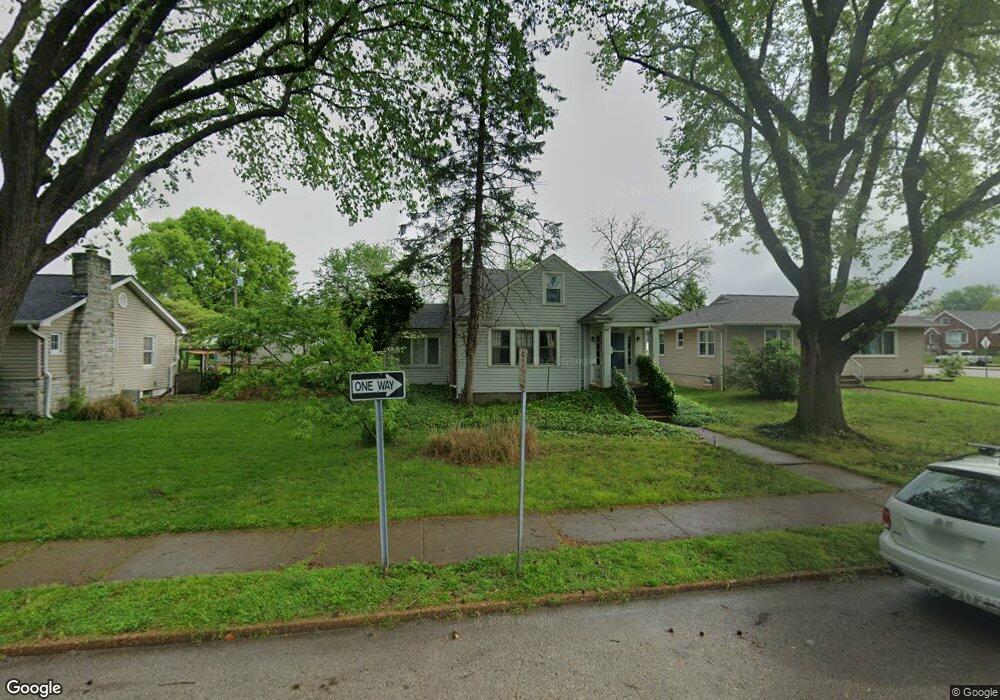
6915 Pernod Ave Saint Louis, MO 63139
Lindenwood Park NeighborhoodEstimated Value: $192,247 - $257,000
--
Bed
1
Bath
2,136
Sq Ft
$109/Sq Ft
Est. Value
About This Home
This home is located at 6915 Pernod Ave, Saint Louis, MO 63139 and is currently estimated at $233,812, approximately $109 per square foot. 6915 Pernod Ave is a home located in St. Louis City with nearby schools including Mason Elementary School, Long International Middle School, and Roosevelt High School.
Ownership History
Date
Name
Owned For
Owner Type
Purchase Details
Closed on
May 1, 2006
Sold by
Byrd Barbara C
Bought by
Mosley Dylan and Abbadessa Joline
Current Estimated Value
Home Financials for this Owner
Home Financials are based on the most recent Mortgage that was taken out on this home.
Original Mortgage
$105,000
Outstanding Balance
$60,672
Interest Rate
6.36%
Mortgage Type
Fannie Mae Freddie Mac
Estimated Equity
$173,140
Create a Home Valuation Report for This Property
The Home Valuation Report is an in-depth analysis detailing your home's value as well as a comparison with similar homes in the area
Home Values in the Area
Average Home Value in this Area
Purchase History
| Date | Buyer | Sale Price | Title Company |
|---|---|---|---|
| Mosley Dylan | -- | None Available |
Source: Public Records
Mortgage History
| Date | Status | Borrower | Loan Amount |
|---|---|---|---|
| Open | Mosley Dylan | $105,000 |
Source: Public Records
Tax History Compared to Growth
Tax History
| Year | Tax Paid | Tax Assessment Tax Assessment Total Assessment is a certain percentage of the fair market value that is determined by local assessors to be the total taxable value of land and additions on the property. | Land | Improvement |
|---|---|---|---|---|
| 2025 | $2,513 | $35,060 | $2,850 | $32,210 |
| 2024 | $2,391 | $29,690 | $2,850 | $26,840 |
| 2023 | $2,391 | $29,690 | $2,850 | $26,840 |
| 2022 | $2,280 | $27,250 | $2,850 | $24,400 |
| 2021 | $2,277 | $27,250 | $2,850 | $24,400 |
| 2020 | $2,062 | $24,830 | $2,850 | $21,980 |
| 2019 | $2,055 | $24,830 | $2,850 | $21,980 |
| 2018 | $1,784 | $20,860 | $2,620 | $18,240 |
| 2017 | $1,754 | $20,860 | $2,620 | $18,240 |
| 2016 | $1,678 | $19,680 | $2,620 | $17,060 |
| 2015 | $1,522 | $19,680 | $2,620 | $17,060 |
| 2014 | $1,488 | $19,680 | $2,620 | $17,060 |
| 2013 | -- | $19,250 | $2,620 | $16,630 |
Source: Public Records
Map
Nearby Homes
- 6656 Oleatha Ave
- 6811 Marquette Ave
- 6659 Tholozan Ave
- 7038 Pernod Ave
- 6631 Pernod Ave
- 7047 Tholozan Ave
- 6621 Tholozan Ave
- 3815 Mccausland Ave Unit 4
- 6611 Pernod Ave
- 3558 Wabash Ave
- 6953 Arthur Ave
- 6973 Winona Ave
- 6653 Hancock Ave
- 3308 Jamieson Ave
- 6625 Hancock Ave
- 6565 Winnebago St
- 6541 Lindenwood Place
- 7081 Winona Ave
- 6517 Tholozan Ave
- 7081 Bancroft Ave
- 6923 Pernod Ave
- 6909 Pernod Ave
- 6925 Pernod Ave
- 6929 Pernod Ave
- 3601 Jamieson Ave
- 6914 Oleatha Ave
- 6918 Oleatha Ave
- 3600 Berger Ave
- 6910 Oleatha Ave
- 6924 Oleatha Ave
- 6908 Oleatha Ave
- 3604 Berger Ave
- 3607 Jamieson Ave
- 6928 Oleatha Ave
- 6939 Pernod Ave
- 3608 Berger Ave
- 6934 Oleatha Ave
- 3562 Jamieson Ave
- 3560 Jamieson Ave
- 3615 Jamieson Ave