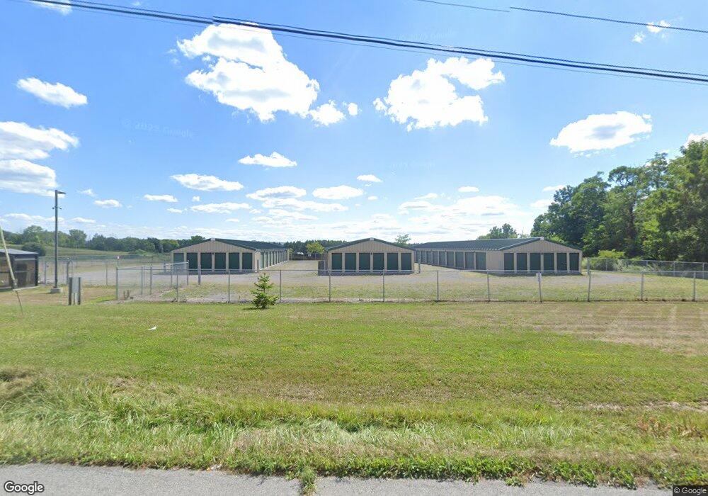
6915 State Route 5 and 20 Bloomfield, NY 14469
Estimated Value: $948,934
--
Bed
--
Bath
22,780
Sq Ft
$42/Sq Ft
Est. Value
About This Home
This home is located at 6915 State Route 5 and 20, Bloomfield, NY 14469 and is currently estimated at $948,934, approximately $41 per square foot. 6915 State Route 5 and 20 is a home located in Ontario County with nearby schools including Bloomfield Elementary School, Bloomfield Middle School, and Bloomfield High School.
Ownership History
Date
Name
Owned For
Owner Type
Purchase Details
Closed on
Sep 25, 2020
Sold by
Fjm Development Llc
Bought by
Performance Industrial Pk
Current Estimated Value
Purchase Details
Closed on
May 14, 2020
Sold by
Fjm Development Llc
Bought by
2Ts Properites Llc
Home Financials for this Owner
Home Financials are based on the most recent Mortgage that was taken out on this home.
Original Mortgage
$200,000
Interest Rate
3.2%
Mortgage Type
Commercial
Purchase Details
Closed on
Jan 12, 2007
Sold by
Marianacci Frank
Bought by
Fjm Development Llc
Create a Home Valuation Report for This Property
The Home Valuation Report is an in-depth analysis detailing your home's value as well as a comparison with similar homes in the area
Home Values in the Area
Average Home Value in this Area
Purchase History
| Date | Buyer | Sale Price | Title Company |
|---|---|---|---|
| Performance Industrial Pk | $600,000 | Stewart Title | |
| 2Ts Properites Llc | $450,000 | None Available | |
| Fjm Development Llc | -- | William Kenyon |
Source: Public Records
Mortgage History
| Date | Status | Borrower | Loan Amount |
|---|---|---|---|
| Previous Owner | 2Ts Properites Llc | $200,000 |
Source: Public Records
Tax History Compared to Growth
Tax History
| Year | Tax Paid | Tax Assessment Tax Assessment Total Assessment is a certain percentage of the fair market value that is determined by local assessors to be the total taxable value of land and additions on the property. | Land | Improvement |
|---|---|---|---|---|
| 2024 | $16,233 | $650,000 | $113,000 | $537,000 |
| 2023 | $21,048 | $600,000 | $112,000 | $488,000 |
| 2022 | $20,347 | $600,000 | $112,000 | $488,000 |
| 2021 | $8,420 | $600,000 | $112,000 | $488,000 |
| 2020 | $9,493 | $620,000 | $75,000 | $545,000 |
| 2019 | $0 | $620,000 | $75,000 | $545,000 |
| 2018 | $0 | $620,000 | $75,000 | $545,000 |
| 2017 | $0 | $595,000 | $75,000 | $520,000 |
| 2016 | $23,062 | $595,000 | $75,000 | $520,000 |
| 2015 | -- | $595,000 | $75,000 | $520,000 |
| 2014 | -- | $555,000 | $75,000 | $480,000 |
Source: Public Records
Map
Nearby Homes
- 6514 State Route 5 and 20
- 39 South Ave
- 47 South Ave
- 35 State St
- 15 Elm St
- 2569 Wheeler Station Rd
- 3354 Wheeler Station Rd
- 3620 Oakmount Rd
- 3634 Oakmount Rd
- 6165 State Route 5 and 20
- 3100 County Road 40
- 3724 Oakmount Rd
- 6511 Fisher Hill Rd
- 7786 State Route 5 and 20
- Lot State Route 444 Rd
- 6979 Tilton Rd
- 6126 Rossier Rd
- 3055 Sand Rd
- 0 Wesley Rd
- 6557 County Road 32
- 6905 State Route 5 and 20
- 6900 State Route 5 and 20
- 6900 State Route 5 & 20
- 6883 State Route 5 and 20
- 6883 State Route 5 & 20
- 6884 State Route 5 and 20
- 2998 Flatiron Rd
- 2915 State Route 444
- 2909 State Route 444
- 2907 Ny-444 Unit 1
- 2907 Ny-444 Unit 2
- 2907 State Route 444
- 6862 Gauss Rd
- 2897 State Route 444 Unit 2899
- 00 Rt 5 & 20
- 2891 State Route 444
- 7005 Gauss Rd
- 6989 State Route 5 and 20
- 6996 State Route 5 and 20
- 2974 Ashman Rd