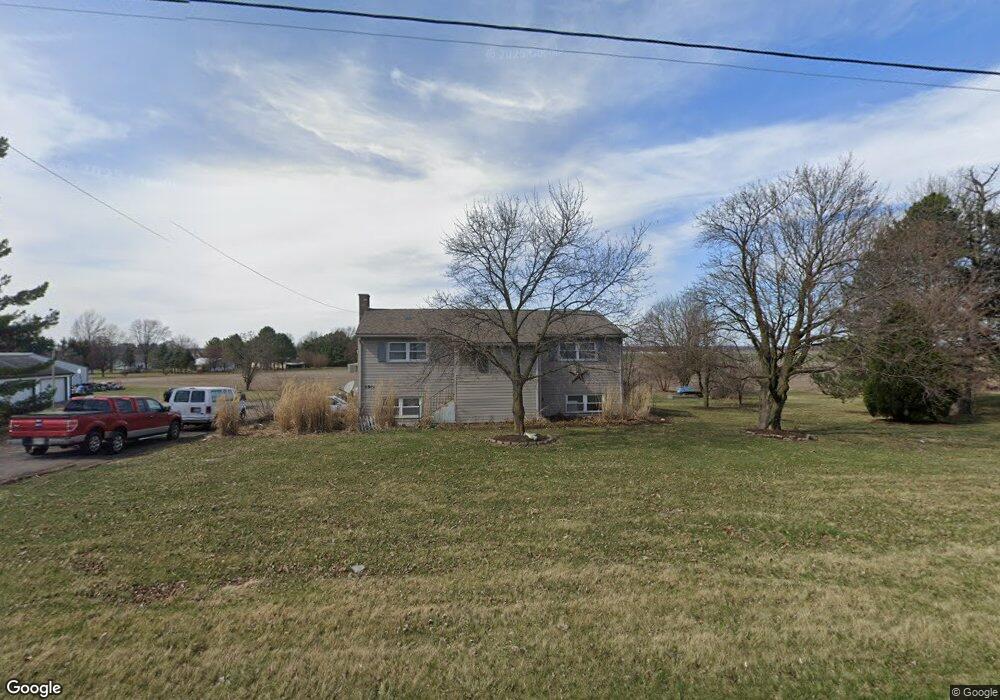
6915 W State Route 12 Findlay, OH 45840
Estimated Value: $213,000 - $326,000
2
Beds
1
Bath
2,280
Sq Ft
$110/Sq Ft
Est. Value
About This Home
This home is located at 6915 W State Route 12, Findlay, OH 45840 and is currently estimated at $250,513, approximately $109 per square foot. 6915 W State Route 12 is a home located in Hancock County with nearby schools including Liberty-Benton Elementary School, Liberty-Benton Middle School, and Liberty-Benton High School.
Ownership History
Date
Name
Owned For
Owner Type
Purchase Details
Closed on
Oct 30, 2003
Sold by
Helms Paul P and Helms Sheila J
Bought by
Kern John A and Kern Melissa A
Current Estimated Value
Home Financials for this Owner
Home Financials are based on the most recent Mortgage that was taken out on this home.
Original Mortgage
$108,202
Interest Rate
6.04%
Mortgage Type
FHA
Create a Home Valuation Report for This Property
The Home Valuation Report is an in-depth analysis detailing your home's value as well as a comparison with similar homes in the area
Home Values in the Area
Average Home Value in this Area
Purchase History
| Date | Buyer | Sale Price | Title Company |
|---|---|---|---|
| Kern John A | $109,900 | Golden Key Title |
Source: Public Records
Mortgage History
| Date | Status | Borrower | Loan Amount |
|---|---|---|---|
| Closed | Kern John A | $108,202 |
Source: Public Records
Tax History Compared to Growth
Tax History
| Year | Tax Paid | Tax Assessment Tax Assessment Total Assessment is a certain percentage of the fair market value that is determined by local assessors to be the total taxable value of land and additions on the property. | Land | Improvement |
|---|---|---|---|---|
| 2024 | $2,007 | $53,980 | $12,890 | $41,090 |
| 2023 | $1,959 | $53,980 | $12,890 | $41,090 |
| 2022 | $1,940 | $53,980 | $12,890 | $41,090 |
| 2021 | $1,983 | $48,690 | $13,210 | $35,480 |
| 2020 | $2,000 | $48,690 | $13,210 | $35,480 |
| 2019 | $1,920 | $48,690 | $13,210 | $35,480 |
| 2018 | $1,512 | $42,370 | $11,480 | $30,890 |
| 2017 | $780 | $42,370 | $11,480 | $30,890 |
| 2016 | $1,524 | $42,370 | $11,480 | $30,890 |
| 2015 | $1,256 | $34,240 | $10,230 | $24,010 |
| 2014 | $1,267 | $34,240 | $10,230 | $24,010 |
| 2012 | $1,353 | $35,020 | $10,230 | $24,790 |
Source: Public Records
Map
Nearby Homes
- 11741 Township Road 10
- 9984 State Route 235
- 7780 Township Road 89
- 9307 W State Route 12
- 10601 County Road 9
- 12159 County Road 12
- 9653 Early Dr
- 9307 Hiegel Dr
- 3833 Bearcat Way
- 4516 W US Route 224
- 2201 W Main Cross St
- 6659 Scenic View Dr
- 0 Bushwillow Dr Unit Lot 154
- 0 Bushwillow Dr Lot 156 Unit 6079046
- 0 Rock Candy Rd Lot 162 Unit 6079070
- 0 Bushwillow Dr Unit Lot 156
- 0 Bearcat Way Or 0 Rock Candy Rd Lot 167 Unit 6079083
- 0 Bushwillow Dr Lot 154 Unit 6079043
- 0 Rock Candy Rd Lot 171 Unit 6079088
- 0 County Road 99 Lot 2 Unit 6081480
- 6931 W State Route 12
- 6901 W State Route 12
- 6943 W State Route 12
- 6924 W State Route 12
- 6887 W State Route 12
- 6906 W State Route 12
- 6869 Ohio 12
- 6948 W State Route 12
- 6959 W State Route 12
- 6902 Ohio 12
- 6902 W State Route 12
- 6869 W State Route 12
- 6964 Ohio 12
- 6964 W State Route 12
- 6864 W State Route 12
- 6855 W State Route 12
- 6987 W State Route 12
- 6987 W State Route 12
- 6982 State Route
- 6982 W State Route 12