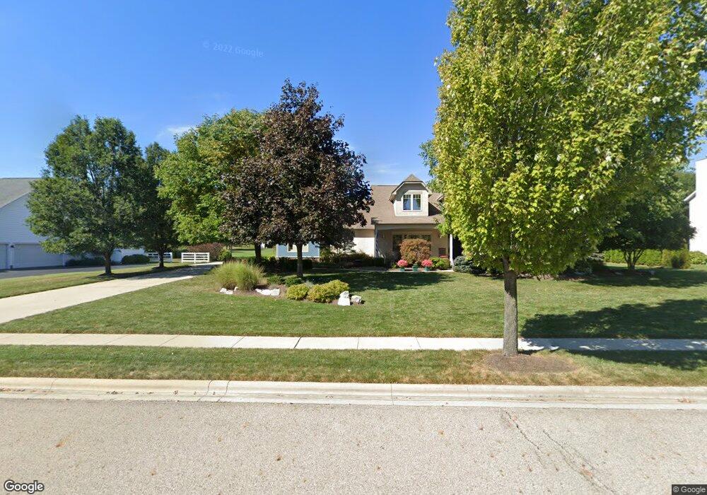
6916 Whitetail Ln Westerville, OH 43082
Genoa NeighborhoodEstimated Value: $612,344 - $668,000
3
Beds
3
Baths
2,288
Sq Ft
$280/Sq Ft
Est. Value
About This Home
This home is located at 6916 Whitetail Ln, Westerville, OH 43082 and is currently estimated at $639,836, approximately $279 per square foot. 6916 Whitetail Ln is a home located in Delaware County with nearby schools including Alcott Elementary School, Genoa Middle School, and Westerville Central High School.
Ownership History
Date
Name
Owned For
Owner Type
Purchase Details
Closed on
May 9, 2005
Sold by
Uhl Rebecca A and Uhl Brian R
Bought by
Uhl Rebecca A and The Rebecca A Uhl Revocable Li
Current Estimated Value
Purchase Details
Closed on
Nov 1, 2002
Sold by
Barrett Mtg Services
Bought by
Uhl Brian R and Uhl Rebecca A
Home Financials for this Owner
Home Financials are based on the most recent Mortgage that was taken out on this home.
Original Mortgage
$230,000
Outstanding Balance
$97,470
Interest Rate
6.18%
Mortgage Type
New Conventional
Estimated Equity
$542,366
Purchase Details
Closed on
Apr 10, 2002
Sold by
The Shore Co Ltd
Bought by
Barrett Mortgage Services Inc
Create a Home Valuation Report for This Property
The Home Valuation Report is an in-depth analysis detailing your home's value as well as a comparison with similar homes in the area
Home Values in the Area
Average Home Value in this Area
Purchase History
| Date | Buyer | Sale Price | Title Company |
|---|---|---|---|
| Uhl Rebecca A | -- | -- | |
| Uhl Brian R | -- | -- | |
| Uhl Brian R | $338,315 | -- | |
| Barrett Mortgage Services Inc | $414,000 | -- |
Source: Public Records
Mortgage History
| Date | Status | Borrower | Loan Amount |
|---|---|---|---|
| Open | Uhl Brian R | $230,000 |
Source: Public Records
Tax History Compared to Growth
Tax History
| Year | Tax Paid | Tax Assessment Tax Assessment Total Assessment is a certain percentage of the fair market value that is determined by local assessors to be the total taxable value of land and additions on the property. | Land | Improvement |
|---|---|---|---|---|
| 2024 | $9,317 | $189,350 | $36,400 | $152,950 |
| 2023 | $9,160 | $189,350 | $36,400 | $152,950 |
| 2022 | $7,958 | $129,190 | $24,500 | $104,690 |
| 2021 | $8,038 | $129,190 | $24,500 | $104,690 |
| 2020 | $8,086 | $129,190 | $24,500 | $104,690 |
| 2019 | $7,752 | $119,670 | $24,500 | $95,170 |
| 2018 | $7,510 | $119,670 | $24,500 | $95,170 |
| 2017 | $7,829 | $124,050 | $22,090 | $101,960 |
| 2016 | $8,382 | $124,050 | $22,090 | $101,960 |
| 2015 | $8,315 | $124,050 | $22,090 | $101,960 |
| 2014 | $8,214 | $124,050 | $22,090 | $101,960 |
| 2013 | $7,913 | $119,180 | $22,090 | $97,090 |
Source: Public Records
Map
Nearby Homes
- 6685 Tussic Street Rd
- 7568 Park Bend Ct
- 6618 Wild Rose Ln
- 656 Olde Mill Dr
- 6460 Bromfield Dr
- 754 Kingsmead Rd Unit 18754
- 7663 Rolling Ridge Way
- 7268 Clancy Way
- 6082 Hilmar Dr
- 718 Sugar Ct
- 7581 Lanetta Ln
- 6086 Hemingway Place
- 6410 Steinbeck Way
- 1155 Ashford Ct
- 6050 Medallion Dr W
- 974 Lakeland Dr
- 0 Paul Rd Unit 225001038
- 912 Lakeway Ct E
- 547 County Line Rd
- 5840 Heron Ct
- 6892 Whitetail Ln
- 6938 Whitetail Ln
- 6915 Whitetail Ln
- 6937 Whitetail Ln
- 6893 Whitetail Ln
- 6907 Tussic St
- 6872 Whitetail Ln
- 6929 Tussic St
- 6907 Tussic Street Rd
- 6862 Whitetail Ln
- 6945 Tussic Street Rd
- 6929 Tussic Street Rd
- 6961 Whitetail Ln
- 6871 Whitetail Ln
- 6945 Tussic St
- 6881 Tussic St
- 6850 Whitetail Ln
- 6986 Whitetail Ln
- 6881 Morningstar Loop
- 6851 Merom Landing