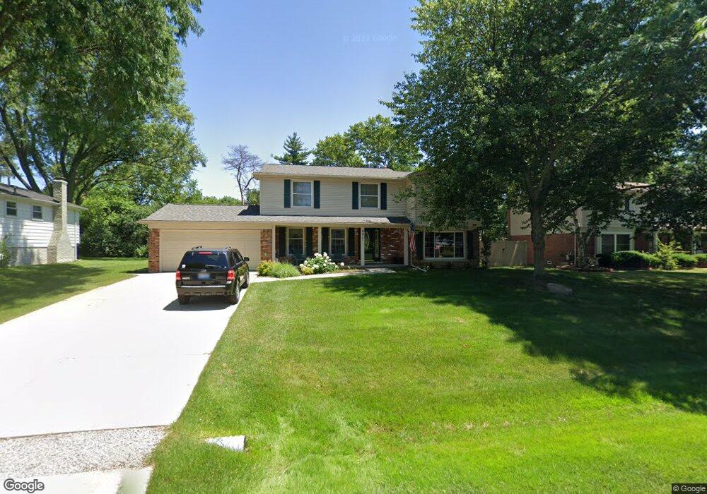
6917 Beverly Crest Dr West Bloomfield, MI 48322
Estimated Value: $377,000 - $437,000
5
Beds
3
Baths
2,047
Sq Ft
$198/Sq Ft
Est. Value
About This Home
This home is located at 6917 Beverly Crest Dr, West Bloomfield, MI 48322 and is currently estimated at $404,325, approximately $197 per square foot. 6917 Beverly Crest Dr is a home located in Oakland County with nearby schools including Sheiko Elementary School, West Bloomfield Middle School, and Bloomfield Maples Montessori.
Ownership History
Date
Name
Owned For
Owner Type
Purchase Details
Closed on
Nov 8, 2013
Sold by
Colleen Cottrell Revocable Living Trust
Bought by
Cottrell Patrick and Cottrell Carrie E
Current Estimated Value
Purchase Details
Closed on
May 28, 2009
Sold by
Cottrell Colleen
Bought by
Liv Cottrell Colleen and Liv Colleen Cottrell Revocable
Create a Home Valuation Report for This Property
The Home Valuation Report is an in-depth analysis detailing your home's value as well as a comparison with similar homes in the area
Home Values in the Area
Average Home Value in this Area
Purchase History
| Date | Buyer | Sale Price | Title Company |
|---|---|---|---|
| Cottrell Patrick | $160,000 | None Available | |
| Liv Cottrell Colleen | -- | None Available |
Source: Public Records
Tax History Compared to Growth
Tax History
| Year | Tax Paid | Tax Assessment Tax Assessment Total Assessment is a certain percentage of the fair market value that is determined by local assessors to be the total taxable value of land and additions on the property. | Land | Improvement |
|---|---|---|---|---|
| 2024 | $2,611 | $182,510 | $0 | $0 |
| 2022 | $2,500 | $151,070 | $35,190 | $115,880 |
| 2021 | $3,741 | $146,870 | $0 | $0 |
| 2020 | $2,411 | $145,400 | $35,190 | $110,210 |
| 2018 | $3,605 | $119,780 | $27,070 | $92,710 |
| 2015 | -- | $96,640 | $0 | $0 |
| 2014 | -- | $86,680 | $0 | $0 |
| 2011 | -- | $93,030 | $0 | $0 |
Source: Public Records
Map
Nearby Homes
- 7027 Beverly Crest Dr
- 6843 Leslee Crest Dr
- 6769 Heather Heath
- 7023 Wild Ridge Ln
- 6624 Mellow Wood Ln
- 6651 Hearthside Ct Unit 1
- 6614 Embers Ct
- 6621 Bellows Ct Unit 62
- 7335 Coach Ln
- 7421 Heather Heath
- 4161 Breckenridge Dr
- 4392 Gateway Cir Unit 59
- 7477 Heather Heath
- 7251 N Briarcliff Knoll Dr
- 6322 Pepper Hill St Unit 62
- 6222 Pepper Hill St
- 6564 Alderley Way
- 6151 Orchard Lake Rd Unit 103
- 6145 Orchard Lake Rd Unit 204
- 30515 W 14 Mile Rd Unit 30
- 6933 Beverly Crest Dr
- 6897 Beverly Crest Dr
- 6912 Lee Crest Dr
- 6886 Lee Crest Dr
- 6879 Beverly Crest Dr
- 6932 Lee Crest Dr
- 6945 Beverly Crest Dr
- 6916 Beverly Crest Dr
- 6870 Lee Crest Dr
- 6932 Beverly Crest Dr
- 6896 Beverly Crest Dr
- 6954 Lee Crest Dr
- 6878 Beverly Crest Dr
- 6851 Beverly Crest Dr
- 6948 Beverly Crest Dr
- 6854 Lee Crest Dr
- 6965 Beverly Crest Dr
- 6972 Lee Crest Dr
- 6850 Beverly Crest Dr
- 6907 Leslee Crest Dr