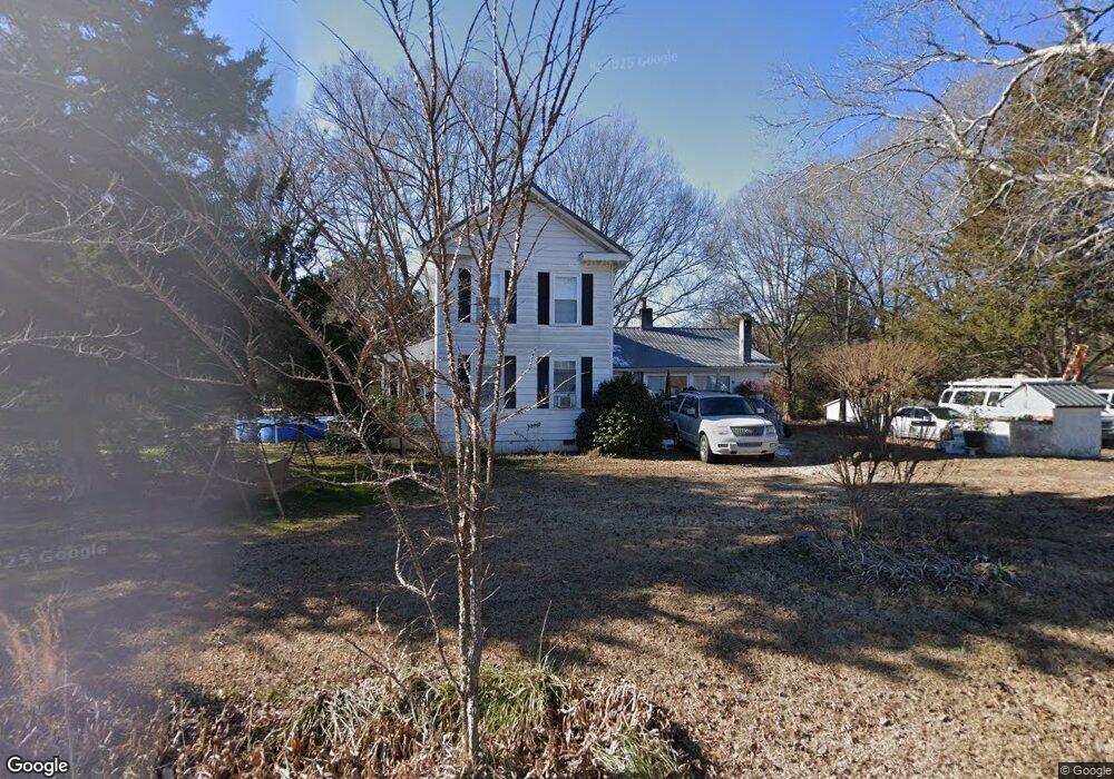
6918 Herndon Rd Durham, NC 27713
Estimated Value: $477,000 - $587,000
3
Beds
1
Bath
1,804
Sq Ft
$303/Sq Ft
Est. Value
About This Home
This home is located at 6918 Herndon Rd, Durham, NC 27713 and is currently estimated at $545,857, approximately $302 per square foot. 6918 Herndon Rd is a home located in Durham County with nearby schools including Lowe's Grove Middle, Hillside High School, and Kestrel Heights School.
Ownership History
Date
Name
Owned For
Owner Type
Purchase Details
Closed on
Mar 21, 2025
Sold by
Boling Property Llc
Bought by
Chohan Siraj and Chohan Hani
Current Estimated Value
Purchase Details
Closed on
Jun 1, 2020
Sold by
Cutts Judy Herdon
Bought by
Boling Porperty Llc
Purchase Details
Closed on
Mar 28, 2012
Sold by
Fleeman Patricia Cutts and Fleeman William Michael
Bought by
Herndon Byron M
Purchase Details
Closed on
Jul 11, 2008
Sold by
Herndon Byron M
Bought by
Cutts Patricia Dale
Create a Home Valuation Report for This Property
The Home Valuation Report is an in-depth analysis detailing your home's value as well as a comparison with similar homes in the area
Home Values in the Area
Average Home Value in this Area
Purchase History
| Date | Buyer | Sale Price | Title Company |
|---|---|---|---|
| Chohan Siraj | -- | None Listed On Document | |
| Chohan Siraj | -- | None Listed On Document | |
| Boling Porperty Llc | $355,000 | None Available | |
| Herndon Byron M | -- | None Available | |
| Cutts Patricia Dale | -- | None Available |
Source: Public Records
Tax History Compared to Growth
Tax History
| Year | Tax Paid | Tax Assessment Tax Assessment Total Assessment is a certain percentage of the fair market value that is determined by local assessors to be the total taxable value of land and additions on the property. | Land | Improvement |
|---|---|---|---|---|
| 2025 | $4,629 | $683,118 | $553,440 | $129,678 |
| 2024 | $2,666 | $260,184 | $157,377 | $102,807 |
| 2023 | $2,568 | $260,184 | $157,377 | $102,807 |
| 2022 | $2,495 | $260,184 | $157,377 | $102,807 |
| 2021 | $2,282 | $260,184 | $157,377 | $102,807 |
| 2020 | $2,230 | $260,184 | $157,377 | $102,807 |
| 2019 | $2,204 | $260,184 | $157,377 | $102,807 |
| 2018 | $2,069 | $224,173 | $135,712 | $88,461 |
| 2017 | $2,002 | $224,173 | $135,712 | $88,461 |
| 2016 | $2,652 | $306,436 | $188,490 | $117,946 |
| 2015 | $1,116 | $105,787 | $64,372 | $41,415 |
| 2014 | -- | $105,787 | $64,372 | $41,415 |
Source: Public Records
Map
Nearby Homes
- 1019 Pondfield Way
- 205 Landreth Ct
- 1219 Pondfield Way
- 6701 Winding Arch Dr
- 611 Basil Dr
- 617 Wellingham Dr
- 6705 Somerknoll Dr
- 6609 Hunters Ln
- 12 Haycox Ct
- 9 Monteith Ct
- 211 Cool Spring Rd
- 515 Wellingham Dr
- 5 Huckleberry Ct
- 6612 Rossford Ln
- 903 Adeline Ct
- 124 White Crane Ct
- 6304 Amhurst Rd
- 120 James Ross Drive Rd
- 616 Cheselden Dr
- 7409 Chesley Ln
- 7001 Herndon Rd
- 7005 Herndon Rd
- 6903 Herndon Rd
- 7011 Herndon Rd
- 104 Landreth Ct
- 102 Landreth Ct
- 7017 Herndon Rd
- 103 Landreth Ct
- 1009 Pondfield Way
- 1005 Pondfield Way
- 1013 Pondfield Way
- 1011 Pondfield Way
- 1015 Pondfield Way
- 1017 Pondfield Way
- 233 Shalimar Dr
- 235 Shalimar Dr
- 701 Ainsley Ct
- 6801 Herndon Rd
- 231 Shalimar Dr
- 105 Landreth Ct