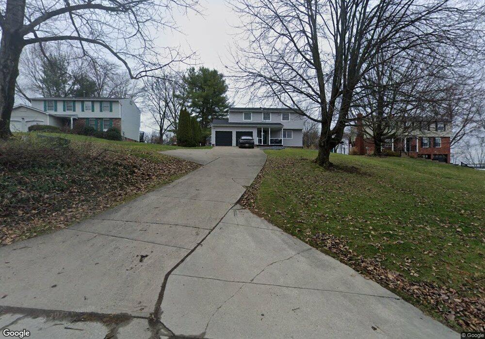
6918 Mellon Rd Export, PA 15632
Estimated Value: $169,759 - $447,000
4
Beds
3
Baths
--
Sq Ft
35,589
Sq Ft Lot
About This Home
This home is located at 6918 Mellon Rd, Export, PA 15632 and is currently estimated at $327,940. 6918 Mellon Rd is a home located in Westmoreland County with nearby schools including Penn Trafford High School.
Ownership History
Date
Name
Owned For
Owner Type
Purchase Details
Closed on
Aug 8, 2005
Sold by
Weichert Relocation Resources Inc
Bought by
Lewis Renee M
Current Estimated Value
Home Financials for this Owner
Home Financials are based on the most recent Mortgage that was taken out on this home.
Original Mortgage
$142,400
Outstanding Balance
$73,052
Interest Rate
5.79%
Mortgage Type
Fannie Mae Freddie Mac
Estimated Equity
$254,888
Purchase Details
Closed on
Jul 25, 2005
Sold by
Buban Ronald and Buban Margaret S
Bought by
Weichert Relocation Resources Inc
Home Financials for this Owner
Home Financials are based on the most recent Mortgage that was taken out on this home.
Original Mortgage
$142,400
Outstanding Balance
$73,052
Interest Rate
5.79%
Mortgage Type
Fannie Mae Freddie Mac
Estimated Equity
$254,888
Create a Home Valuation Report for This Property
The Home Valuation Report is an in-depth analysis detailing your home's value as well as a comparison with similar homes in the area
Home Values in the Area
Average Home Value in this Area
Purchase History
| Date | Buyer | Sale Price | Title Company |
|---|---|---|---|
| Lewis Renee M | $178,000 | -- | |
| Weichert Relocation Resources Inc | $178,000 | -- |
Source: Public Records
Mortgage History
| Date | Status | Borrower | Loan Amount |
|---|---|---|---|
| Open | Lewis Renee M | $142,400 | |
| Closed | Weichert Relocation Resources Inc | $26,700 |
Source: Public Records
Tax History
| Year | Tax Paid | Tax Assessment Tax Assessment Total Assessment is a certain percentage of the fair market value that is determined by local assessors to be the total taxable value of land and additions on the property. | Land | Improvement |
|---|---|---|---|---|
| 2026 | $5,214 | $37,000 | $7,170 | $29,830 |
| 2025 | $5,066 | $37,000 | $7,170 | $29,830 |
| 2024 | $5,029 | $37,000 | $7,170 | $29,830 |
| 2023 | $4,771 | $37,000 | $7,170 | $29,830 |
| 2022 | $4,715 | $37,000 | $7,170 | $29,830 |
| 2021 | $4,678 | $37,000 | $7,170 | $29,830 |
| 2020 | $4,641 | $37,000 | $7,170 | $29,830 |
| 2019 | $4,530 | $37,000 | $7,170 | $29,830 |
| 2018 | $4,401 | $37,000 | $7,170 | $29,830 |
| 2017 | $4,290 | $37,000 | $7,170 | $29,830 |
| 2016 | $4,164 | $37,000 | $7,170 | $29,830 |
| 2015 | $4,164 | $37,000 | $7,170 | $29,830 |
| 2014 | $4,090 | $37,000 | $7,170 | $29,830 |
Source: Public Records
Map
Nearby Homes
- 37 Hones Rd
- 5866 Claridge Rd
- 5934 Graybrook Dr
- 5812 Torrance Dr
- 1316 S Valley Dr
- 1044 Hillstone Village Dr
- 2358 Mount Vernon Ave
- 1213 Harrison Ct
- 1022 Lexington Dr
- 1001 Black Sands Dr
- 1002 Black Sands Dr
- 6004 Augusta Ln
- 2001 Blackthorne Dr
- 1277 Harrison City Export Rd
- 2667 Puckety Dr
- 1012 Country Club Dr
- 1049 Black Sands Dr
- 1053 Black Sands Dr
- 4009 Alexander Ct Unit 4009
- 4005 School Rd
Your Personal Tour Guide
Ask me questions while you tour the home.