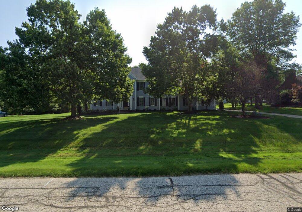
6919 Saint Ives Blvd Hudson, OH 44236
Estimated Value: $656,142 - $751,000
4
Beds
4
Baths
3,208
Sq Ft
$222/Sq Ft
Est. Value
About This Home
This home is located at 6919 Saint Ives Blvd, Hudson, OH 44236 and is currently estimated at $712,536, approximately $222 per square foot. 6919 Saint Ives Blvd is a home located in Summit County with nearby schools including Ellsworth Hill Elementary School, East Woods Intermediate School, and Hudson Middle School.
Ownership History
Date
Name
Owned For
Owner Type
Purchase Details
Closed on
Apr 25, 2002
Sold by
Hogan William G and Hogan Janet M
Bought by
Spohn Michael T and Spohn Suzanne D
Current Estimated Value
Home Financials for this Owner
Home Financials are based on the most recent Mortgage that was taken out on this home.
Original Mortgage
$200,000
Outstanding Balance
$83,956
Interest Rate
7.13%
Estimated Equity
$628,580
Purchase Details
Closed on
Jan 22, 2001
Sold by
Mixon Lonnie M and Mixon Penny M
Bought by
Hogan William G and Hogan Janet M
Home Financials for this Owner
Home Financials are based on the most recent Mortgage that was taken out on this home.
Original Mortgage
$260,000
Interest Rate
6.12%
Purchase Details
Closed on
Jul 27, 1995
Sold by
Brown William A
Bought by
Mixon Lonnie M and Mixon Penny M
Home Financials for this Owner
Home Financials are based on the most recent Mortgage that was taken out on this home.
Original Mortgage
$282,600
Interest Rate
7.59%
Mortgage Type
New Conventional
Create a Home Valuation Report for This Property
The Home Valuation Report is an in-depth analysis detailing your home's value as well as a comparison with similar homes in the area
Home Values in the Area
Average Home Value in this Area
Purchase History
| Date | Buyer | Sale Price | Title Company |
|---|---|---|---|
| Spohn Michael T | $375,000 | Chicago Title Insurance Comp | |
| Hogan William G | $360,000 | Resource Title Agency Inc | |
| Mixon Lonnie M | $297,500 | -- |
Source: Public Records
Mortgage History
| Date | Status | Borrower | Loan Amount |
|---|---|---|---|
| Open | Spohn Michael T | $200,000 | |
| Previous Owner | Hogan William G | $260,000 | |
| Previous Owner | Mixon Lonnie M | $282,600 |
Source: Public Records
Tax History Compared to Growth
Tax History
| Year | Tax Paid | Tax Assessment Tax Assessment Total Assessment is a certain percentage of the fair market value that is determined by local assessors to be the total taxable value of land and additions on the property. | Land | Improvement |
|---|---|---|---|---|
| 2025 | $9,440 | $178,234 | $30,478 | $147,756 |
| 2024 | $9,094 | $178,234 | $30,478 | $147,756 |
| 2023 | $9,094 | $178,234 | $30,478 | $147,756 |
| 2022 | $8,640 | $151,117 | $25,827 | $125,290 |
| 2021 | $8,654 | $151,117 | $25,827 | $125,290 |
| 2020 | $8,502 | $151,120 | $25,830 | $125,290 |
| 2019 | $9,696 | $159,800 | $28,410 | $131,390 |
| 2018 | $9,662 | $159,800 | $28,410 | $131,390 |
| 2017 | $8,504 | $159,800 | $28,410 | $131,390 |
| 2016 | $8,565 | $136,550 | $25,830 | $110,720 |
| 2015 | $8,504 | $136,550 | $25,830 | $110,720 |
| 2014 | $8,528 | $136,550 | $25,830 | $110,720 |
| 2013 | $7,756 | $121,150 | $25,830 | $95,320 |
Source: Public Records
Map
Nearby Homes
- 9085 Sandpiper Dr
- 139 Mccracken Rd
- 701 Gold Leaf Ct
- 9005 Sandpiper Dr
- 10252 Wellman Rd Unit 8
- 9011 Wood Thursh
- 6167 Burr Oak Way
- 572 David Dr
- 8929 Falcon Dr
- 9381 Hickory Ridge Dr
- 708 Diane Ave
- 792 State Route 303
- 7753 Red Fox Trail
- 7449 Hudson Park Dr
- 2714 Blue Heron Dr
- 939 State Route 303
- 10101 Ravenwood Ct
- 9251 Chestnut Ct
- 9247 Chestnut Ct
- 1011 Ashwood Ln
- 6935 Saint Ives Blvd
- 6903 Saint Ives Blvd
- 6920 Saint Regis Blvd
- 6918 Saint Ives Blvd
- 6934 Saint Regis Blvd
- 6904 Saint Regis Blvd
- 6934 Saint Ives Blvd
- 6902 Saint Ives Blvd
- 6887 Saint Ives Blvd
- 6968 Saint Regis Blvd
- 6952 Saint Regis Blvd
- 6950 Saint Ives Blvd
- 6888 Saint Regis Blvd
- 6886 Saint Ives Blvd
- 6933 Saint Regis Blvd
- 6947 Saint Regis Blvd
- 6917 Saint Regis Blvd
- 6966 Saint Ives Blvd
- 6871 Saint Ives Blvd
- 6872 Saint Regis Blvd