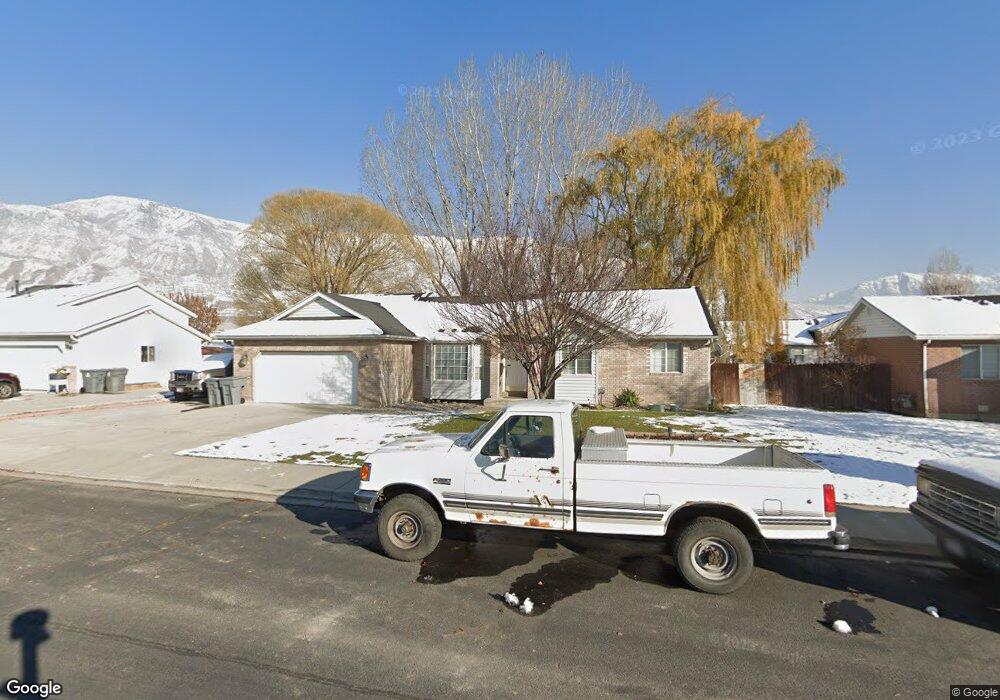
692 N 1010 W Pleasant Grove, UT 84062
Estimated Value: $501,000 - $546,000
3
Beds
3
Baths
1,575
Sq Ft
$333/Sq Ft
Est. Value
About This Home
This home is located at 692 N 1010 W, Pleasant Grove, UT 84062 and is currently estimated at $525,226, approximately $333 per square foot. 692 N 1010 W is a home located in Utah County with nearby schools including Mount Mahogany School, Pleasant Grove Junior High School, and Pleasant Grove High School.
Ownership History
Date
Name
Owned For
Owner Type
Purchase Details
Closed on
Jul 25, 2014
Sold by
Friedman Amber L
Bought by
Strode Michael R and Strode Nancy
Current Estimated Value
Purchase Details
Closed on
Oct 23, 2008
Sold by
Newton Carolyn
Bought by
Newton Carolyn R
Purchase Details
Closed on
Nov 14, 2007
Sold by
Nygaard John
Bought by
Newton Carolyn
Purchase Details
Closed on
Jul 31, 2007
Sold by
Newton Carolyn
Bought by
Newton Carolyn
Purchase Details
Closed on
Mar 22, 2005
Sold by
Wood Richard C and Wood Monica G
Bought by
Newton Carolyn and Nygaard John
Home Financials for this Owner
Home Financials are based on the most recent Mortgage that was taken out on this home.
Original Mortgage
$130,000
Interest Rate
5.62%
Mortgage Type
New Conventional
Purchase Details
Closed on
Sep 25, 2002
Sold by
Backus Lisa L
Bought by
Wood Richard C and Wood Monica G
Home Financials for this Owner
Home Financials are based on the most recent Mortgage that was taken out on this home.
Original Mortgage
$147,155
Interest Rate
6.16%
Purchase Details
Closed on
Mar 6, 2002
Sold by
Backus Lisa L and Kasper James M
Bought by
Backus Lisa L
Home Financials for this Owner
Home Financials are based on the most recent Mortgage that was taken out on this home.
Original Mortgage
$152,000
Interest Rate
6.99%
Purchase Details
Closed on
Aug 23, 2001
Sold by
Beckstrand Neal J and Beckstrand Kristi L
Bought by
Kasper James M and Backus Lisa L
Home Financials for this Owner
Home Financials are based on the most recent Mortgage that was taken out on this home.
Original Mortgage
$149,103
Interest Rate
7.21%
Mortgage Type
FHA
Purchase Details
Closed on
Sep 24, 1996
Sold by
Landmark Builders L C
Bought by
Beckstrand Neal J and Beckstrand Kristi L
Home Financials for this Owner
Home Financials are based on the most recent Mortgage that was taken out on this home.
Original Mortgage
$123,500
Interest Rate
7.87%
Create a Home Valuation Report for This Property
The Home Valuation Report is an in-depth analysis detailing your home's value as well as a comparison with similar homes in the area
Home Values in the Area
Average Home Value in this Area
Purchase History
| Date | Buyer | Sale Price | Title Company |
|---|---|---|---|
| Strode Michael R | -- | Backman Title Services Ltd | |
| Newton Carolyn R | -- | None Available | |
| Newton Carolyn | -- | None Available | |
| Newton Carolyn | -- | None Available | |
| Newton Carolyn | -- | Utah First Title Insurance | |
| Wood Richard C | -- | Title West Title Co | |
| Backus Lisa L | -- | Title West Title Co | |
| Kasper James M | -- | First American Title Insuran | |
| Beckstrand Neal J | -- | -- |
Source: Public Records
Mortgage History
| Date | Status | Borrower | Loan Amount |
|---|---|---|---|
| Previous Owner | Newton Carolyn | $130,000 | |
| Previous Owner | Wood Richard C | $147,155 | |
| Previous Owner | Backus Lisa L | $152,000 | |
| Previous Owner | Kasper James M | $149,103 | |
| Previous Owner | Beckstrand Neal J | $123,500 |
Source: Public Records
Tax History Compared to Growth
Tax History
| Year | Tax Paid | Tax Assessment Tax Assessment Total Assessment is a certain percentage of the fair market value that is determined by local assessors to be the total taxable value of land and additions on the property. | Land | Improvement |
|---|---|---|---|---|
| 2025 | $2,007 | $254,650 | $197,400 | $265,600 |
| 2024 | $2,007 | $239,580 | $0 | $0 |
| 2023 | $1,973 | $241,065 | $0 | $0 |
| 2022 | $2,145 | $260,755 | $0 | $0 |
| 2021 | $1,897 | $351,100 | $132,200 | $218,900 |
| 2020 | $1,737 | $315,200 | $118,000 | $197,200 |
| 2019 | $1,532 | $287,500 | $114,400 | $173,100 |
| 2018 | $1,453 | $257,800 | $107,300 | $150,500 |
| 2017 | $1,345 | $127,050 | $0 | $0 |
| 2016 | $1,286 | $117,315 | $0 | $0 |
| 2015 | $1,272 | $109,835 | $0 | $0 |
| 2014 | $1,201 | $102,740 | $0 | $0 |
Source: Public Records
Map
Nearby Homes
- 1130 W State Rd
- 685 W 1000 N
- 167 N Romney Ln Unit 203
- 909 W 1180 N
- 123 N Romney Ln Unit 103
- 1078 W 70 N
- 1443 W 1010 N
- 150 N 1300 W
- 1249 W Cambria Dr Unit 101
- 1491 W 1010 N
- 1065 N 1420 W
- 1096 N 1420 St W Unit 27
- 1598 W 220 N
- 1525 W 300 N
- 1515 W 1010 St N
- 295 N 1580 W
- 1541 W 250 N
- 1429 W 110 N
- 1498 W 1060 N Unit 5
- Lytham Plan at Grove Acres