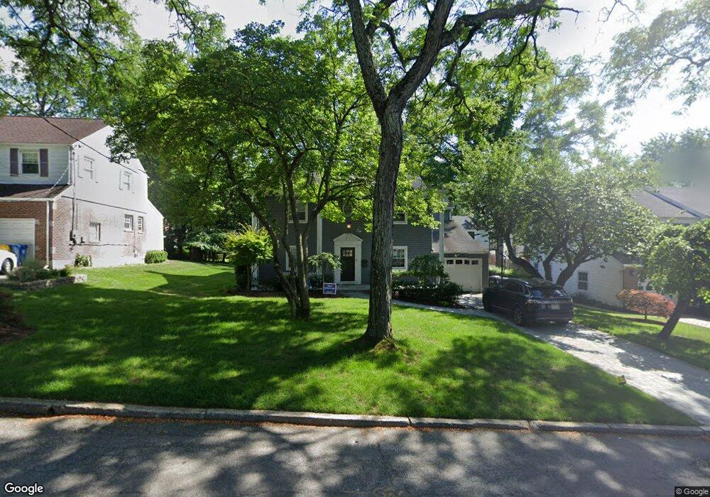
692 Sunderland Rd Teaneck, NJ 07666
Estimated Value: $1,137,478 - $1,274,000
--
Bed
--
Bath
2,833
Sq Ft
$424/Sq Ft
Est. Value
About This Home
This home is located at 692 Sunderland Rd, Teaneck, NJ 07666 and is currently estimated at $1,201,870, approximately $424 per square foot. 692 Sunderland Rd is a home located in Bergen County with nearby schools including Teaneck Senior High School, Teaneck Community Charter School, and Grace Lutheran School.
Ownership History
Date
Name
Owned For
Owner Type
Purchase Details
Closed on
Jul 10, 2003
Sold by
Bierstein Andrew
Bought by
Tilem Ellen and Tilem Peter
Current Estimated Value
Home Financials for this Owner
Home Financials are based on the most recent Mortgage that was taken out on this home.
Original Mortgage
$396,000
Outstanding Balance
$169,374
Interest Rate
5.34%
Estimated Equity
$1,032,496
Create a Home Valuation Report for This Property
The Home Valuation Report is an in-depth analysis detailing your home's value as well as a comparison with similar homes in the area
Home Values in the Area
Average Home Value in this Area
Purchase History
| Date | Buyer | Sale Price | Title Company |
|---|---|---|---|
| Tilem Ellen | $495,000 | -- |
Source: Public Records
Mortgage History
| Date | Status | Borrower | Loan Amount |
|---|---|---|---|
| Open | Tilem Ellen | $396,000 |
Source: Public Records
Tax History Compared to Growth
Tax History
| Year | Tax Paid | Tax Assessment Tax Assessment Total Assessment is a certain percentage of the fair market value that is determined by local assessors to be the total taxable value of land and additions on the property. | Land | Improvement |
|---|---|---|---|---|
| 2025 | $22,303 | $1,008,000 | $418,700 | $589,300 |
| 2024 | $18,977 | $1,021,200 | $418,700 | $602,500 |
| 2023 | $18,603 | $574,700 | $249,400 | $325,300 |
| 2022 | $18,603 | $574,700 | $249,400 | $325,300 |
| 2021 | $18,712 | $574,700 | $249,400 | $325,300 |
| 2020 | $18,586 | $574,700 | $249,400 | $325,300 |
| 2019 | $18,373 | $574,700 | $249,400 | $325,300 |
| 2018 | $18,235 | $574,700 | $249,400 | $325,300 |
| 2017 | $18,063 | $574,700 | $249,400 | $325,300 |
| 2016 | $17,793 | $574,700 | $249,400 | $325,300 |
| 2015 | $17,511 | $574,700 | $249,400 | $325,300 |
| 2014 | $16,015 | $622,900 | $349,400 | $273,500 |
Source: Public Records
Map
Nearby Homes
- 711 Camperdown Rd
- 665 Northumberland Rd
- 565 N Forest Dr
- 654 Suffern Rd
- 506 Sunderland Rd
- 700 Ramapo Rd
- 1106 Bromley Ave
- 710 Ramapo Rd
- 606 Standish Rd
- 543 Sagamore Ave
- 526 Rutland Ave
- 536 Sagamore Ave
- 600 Martense Ave
- 1105 Belle Ave
- 451 Sagamore Ave
- 1329 Dickerson Rd
- 995 Grace Terrace
- 591 Warwick Ave
- 364 Billington Rd
- 867 River Rd
- 698 Sunderland Rd
- 684 Sunderland Rd
- 693 Forest Ave
- 685 Forest Ave
- 704 Sunderland Rd
- 676 Sunderland Rd
- 679 Forest Ave
- 705 Forest Ave
- 693 Sunderland Rd
- 685 Sunderland Rd
- 701 Sunderland Rd
- 671 N Forest Dr
- 1225 River Rd
- 670 Sunderland Rd
- 714 Sunderland Rd
- 709 Sunderland Rd
- 1219 River Rd
- 673 Sunderland Rd
- 665 N Forest Dr
- 713 Forest Ave