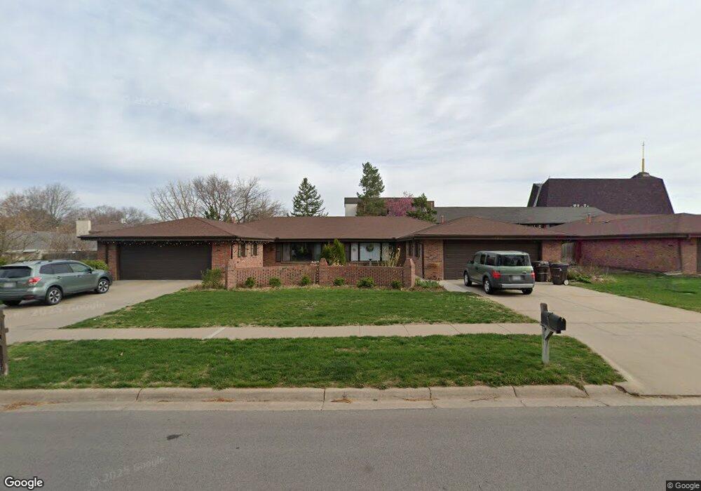
6920 Sumner St Unit 6920 Lincoln, NE 68506
Central Lincoln NeighborhoodEstimated Value: $324,000 - $363,000
3
Beds
3
Baths
2,946
Sq Ft
$118/Sq Ft
Est. Value
About This Home
This home is located at 6920 Sumner St Unit 6920, Lincoln, NE 68506 and is currently estimated at $346,954, approximately $117 per square foot. 6920 Sumner St Unit 6920 is a home located in Lancaster County with nearby schools including Morley Elementary School, Lux Middle School, and Lincoln East High School.
Ownership History
Date
Name
Owned For
Owner Type
Purchase Details
Closed on
Dec 9, 2011
Sold by
Union Bank & Trust Co Lincoln Nebraska and Fisher Jack J
Bought by
Novak Carl D and Novak Mary Lou
Current Estimated Value
Purchase Details
Closed on
Mar 16, 2006
Sold by
Kontras Gus J and Kontras Sophia
Bought by
Union Bank & Trust Co
Create a Home Valuation Report for This Property
The Home Valuation Report is an in-depth analysis detailing your home's value as well as a comparison with similar homes in the area
Home Values in the Area
Average Home Value in this Area
Purchase History
| Date | Buyer | Sale Price | Title Company |
|---|---|---|---|
| Novak Carl D | $170,000 | Union Title Company Llc | |
| Union Bank & Trust Co | $225,000 | None Available |
Source: Public Records
Tax History Compared to Growth
Tax History
| Year | Tax Paid | Tax Assessment Tax Assessment Total Assessment is a certain percentage of the fair market value that is determined by local assessors to be the total taxable value of land and additions on the property. | Land | Improvement |
|---|---|---|---|---|
| 2025 | $3,821 | $298,500 | $55,000 | $243,500 |
| 2024 | $3,821 | $274,300 | $40,000 | $234,300 |
| 2023 | $4,405 | $262,800 | $40,000 | $222,800 |
| 2022 | $4,751 | $238,400 | $35,000 | $203,400 |
| 2021 | $4,495 | $238,400 | $28,000 | $210,400 |
| 2020 | $4,311 | $225,600 | $28,000 | $197,600 |
| 2019 | $4,311 | $225,600 | $28,000 | $197,600 |
| 2018 | $4,000 | $208,400 | $24,000 | $184,400 |
| 2017 | $4,037 | $208,400 | $24,000 | $184,400 |
| 2016 | $3,719 | $191,000 | $30,000 | $161,000 |
| 2015 | $3,694 | $191,000 | $30,000 | $161,000 |
| 2014 | $3,684 | $189,400 | $30,000 | $159,400 |
| 2013 | -- | $189,400 | $30,000 | $159,400 |
Source: Public Records
Map
Nearby Homes
- 1521 Kingston Rd
- 1830 E Bermuda Dr
- 1850 E Bermuda Dr
- 1900 Lori Ln
- 7100 Lincolnshire Rd
- 2036 Greenbriar Ln
- 7101 South St Unit 1
- 1600 Regency Dr
- 6341 Rainier Dr
- 7300 South St Unit 13
- 7300 South St Unit 4
- 2001 Morningside Dr
- 1731 E Manor Dr
- 1920 Riviera Dr
- 6220 Sumner St
- 1701 Buckingham Dr
- 6123 A St
- 6545 Flint Ridge Place
- 7410 Old Post Rd Unit 5
- 1625 S 77th St
- 6922 Sumner St
- 1624 Kingston Rd Unit 1624
- 1620 Kingston Rd
- 1612 Kingston Rd Unit 1612
- 6932 Sumner St Unit 6932
- 1610 Kingston Rd
- 6919 Sumner St
- 6940 Sumner St Unit 6940
- 6911 Sumner St
- 1602 Kingston Rd
- 6933 Sumner St
- 6901 Sumner St
- 1621 Kingston Rd
- 6939 Sumner St
- 6942 Sumner St Unit 6942
- 1600 Kingston Rd
- 1611 Kingston Rd
- 6831 Sumner St
- 6941 Sumner St
- 1601 Kingston Rd