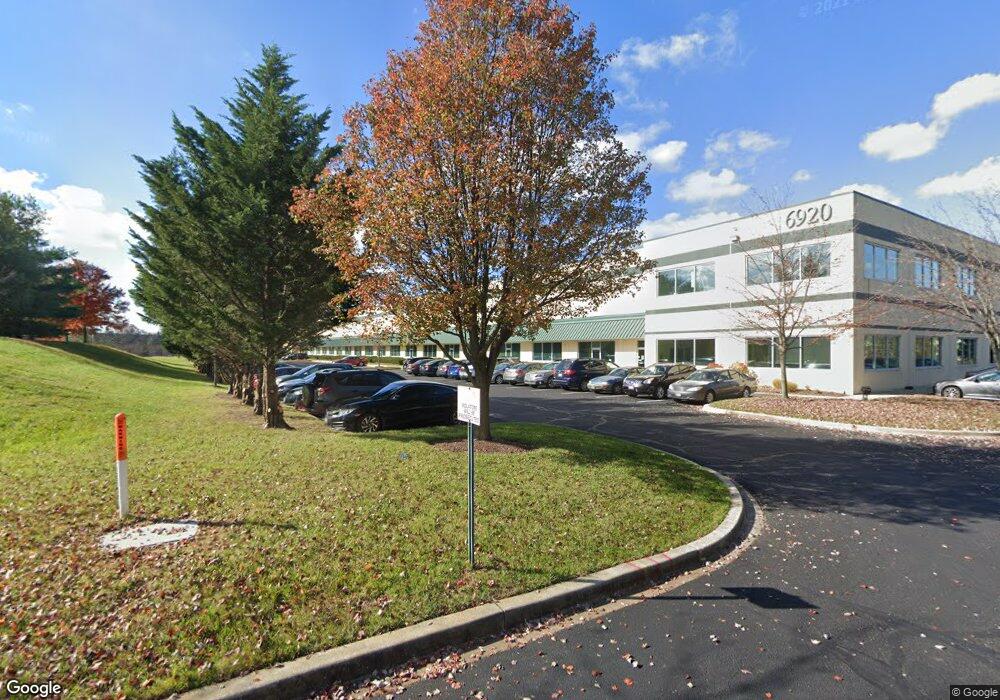
6920 Tudsbury Rd Windsor Mill, MD 21244
Estimated Value: $18,851,586
--
Bed
--
Bath
82,320
Sq Ft
$229/Sq Ft
Est. Value
About This Home
This home is located at 6920 Tudsbury Rd, Windsor Mill, MD 21244 and is currently estimated at $18,851,586, approximately $229 per square foot. 6920 Tudsbury Rd is a home located in Baltimore County with nearby schools including Featherbed Lane Elementary, Woodlawn Middle School, and Woodlawn High School.
Ownership History
Date
Name
Owned For
Owner Type
Purchase Details
Closed on
Sep 30, 2021
Sold by
Bre Foxtrot 6920 Tudsbury Road Llc
Bought by
Coleman Logistics Assets Llc
Current Estimated Value
Purchase Details
Closed on
May 21, 2018
Sold by
Frp Windsor Llc
Bought by
Bre Foxfort 6920 Tudsburyu Road Llc
Purchase Details
Closed on
Aug 4, 1999
Sold by
Windsor Corporate
Bought by
Frp Windsor Llc
Purchase Details
Closed on
Jan 13, 1999
Sold by
Windsor Corporate Center Llp
Bought by
Windsor Corporate and Center 4 Llc
Create a Home Valuation Report for This Property
The Home Valuation Report is an in-depth analysis detailing your home's value as well as a comparison with similar homes in the area
Home Values in the Area
Average Home Value in this Area
Purchase History
| Date | Buyer | Sale Price | Title Company |
|---|---|---|---|
| Coleman Logistics Assets Llc | $15,728,400 | None Available | |
| Coleman Logistics Assets Llc | $15,728,400 | None Listed On Document | |
| Bre Foxfort 6920 Tudsburyu Road Llc | $5,600,000 | None Available | |
| Frp Windsor Llc | $690,221 | -- | |
| Frp Windsor Llc | $690,221 | -- | |
| Windsor Corporate | $634,425 | -- |
Source: Public Records
Tax History Compared to Growth
Tax History
| Year | Tax Paid | Tax Assessment Tax Assessment Total Assessment is a certain percentage of the fair market value that is determined by local assessors to be the total taxable value of land and additions on the property. | Land | Improvement |
|---|---|---|---|---|
| 2025 | $88,235 | $7,249,733 | -- | -- |
| 2024 | $88,235 | $6,742,500 | $1,585,500 | $5,157,000 |
| 2023 | $42,004 | $6,175,267 | $0 | $0 |
| 2022 | $72,893 | $5,608,033 | $0 | $0 |
| 2021 | $66,665 | $5,040,800 | $1,585,500 | $3,455,300 |
| 2020 | $58,321 | $4,811,933 | $0 | $0 |
| 2019 | $55,547 | $4,583,067 | $0 | $0 |
| 2018 | $55,416 | $4,354,200 | $1,585,500 | $2,768,700 |
| 2017 | $54,378 | $4,444,200 | $0 | $0 |
| 2016 | $52,050 | $4,171,400 | $0 | $0 |
| 2015 | $52,050 | $3,898,600 | $0 | $0 |
| 2014 | $52,050 | $3,898,600 | $0 | $0 |
Source: Public Records
Map
Nearby Homes
- 2616 Camberwell Ct
- 6953 Rockfield Rd
- 2633 Molton Way
- 2604 Molton Way
- 2610 Hallam Ct
- 7115 Sandown Cir
- 7201 Bogley Rd Unit 203
- 7205 Bogley Rd Unit 202
- 7105 Rutherford Green Cir
- 2607 Claybrooke Dr
- 7530 Haystack Dr
- 6768 Real Princess Ln
- 7207 Rutherford Green Cir
- 12 Rollwin Rd
- 2004 Wildlife Dr
- 7031 Glen Spring Rd
- 2106 N Rolling Rd
- 1958 Featherbed Ln
- 7420 Hindon Cir Unit 103
- 1960 Featherbed Ln
- 2617 N Rolling Rd
- 6960 Tudsbury Rd
- 6940 Tudsbury Rd
- 2700 Lord Baltimore Dr
- 2622 Lord Baltimore Dr
- 2760 Lord Baltimore Dr
- 2707 N Rolling Rd
- 2607 Rolling Rd Unit 209
- 6980 Tudsbury Rd
- 7222 Ambassador Rd
- 2621 Lord Baltimore Dr
- 7000 Tudsbury Rd
- 2600 Lord Baltimore Dr
- 2615 N Rolling Rd
- 7020 Tudsbury Rd
- 2701 N Rolling Rd
- 2801 Lord Baltimore Dr
- 2705 N Rolling Rd
- 6956 Rockfield Rd
- 2611 Camberwell Ct