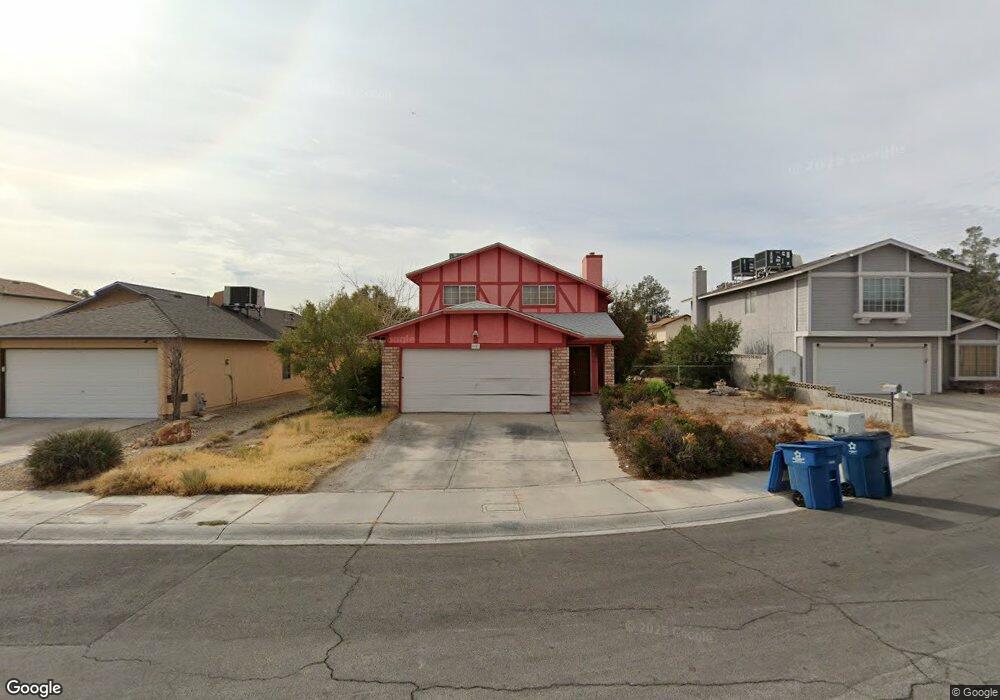
6921 Delorean Cir Las Vegas, NV 89108
Woodcrest NeighborhoodEstimated Value: $364,000 - $404,000
2
Beds
3
Baths
1,597
Sq Ft
$240/Sq Ft
Est. Value
About This Home
This home is located at 6921 Delorean Cir, Las Vegas, NV 89108 and is currently estimated at $382,603, approximately $239 per square foot. 6921 Delorean Cir is a home located in Clark County with nearby schools including R.E. Tobler Elementary School, Irwin & Susan Molasky Junior High School, and Cheyenne High School.
Ownership History
Date
Name
Owned For
Owner Type
Purchase Details
Closed on
Jun 11, 1999
Sold by
Welch Ileana A
Bought by
Warren Michael and Warren Kimberly
Current Estimated Value
Home Financials for this Owner
Home Financials are based on the most recent Mortgage that was taken out on this home.
Original Mortgage
$86,250
Outstanding Balance
$22,672
Interest Rate
7.01%
Estimated Equity
$359,931
Create a Home Valuation Report for This Property
The Home Valuation Report is an in-depth analysis detailing your home's value as well as a comparison with similar homes in the area
Home Values in the Area
Average Home Value in this Area
Purchase History
| Date | Buyer | Sale Price | Title Company |
|---|---|---|---|
| Warren Michael | $115,000 | Fidelity National Title |
Source: Public Records
Mortgage History
| Date | Status | Borrower | Loan Amount |
|---|---|---|---|
| Open | Warren Michael | $86,250 |
Source: Public Records
Tax History Compared to Growth
Tax History
| Year | Tax Paid | Tax Assessment Tax Assessment Total Assessment is a certain percentage of the fair market value that is determined by local assessors to be the total taxable value of land and additions on the property. | Land | Improvement |
|---|---|---|---|---|
| 2025 | $1,757 | $66,096 | $27,650 | $38,446 |
| 2024 | $1,411 | $66,096 | $27,650 | $38,446 |
| 2023 | $1,411 | $67,533 | $30,100 | $37,433 |
| 2022 | $1,264 | $58,725 | $24,150 | $34,575 |
| 2021 | $1,170 | $53,957 | $20,650 | $33,307 |
| 2020 | $1,084 | $52,913 | $19,600 | $33,313 |
| 2019 | $1,016 | $49,582 | $16,450 | $33,132 |
| 2018 | $969 | $47,499 | $15,400 | $32,099 |
| 2017 | $1,478 | $45,094 | $12,250 | $32,844 |
| 2016 | $1,182 | $43,061 | $9,660 | $33,401 |
| 2015 | $1,095 | $40,183 | $6,930 | $33,253 |
| 2014 | $1,370 | $29,344 | $5,775 | $23,569 |
Source: Public Records
Map
Nearby Homes
- 3740 Broadriver Dr
- 3737 Broadriver Dr
- 6917 Raleigh Ave
- 3608 Lisandro St Unit 104
- 3609 Galatea St Unit 102
- 3600 Monarcas St Unit 202
- 3608 Pierida St Unit 101
- 6660 Joe Michael Way
- 3660 Renovah St Unit 202
- 6645 Telegraph Rd
- 4012 Castle Cove Dr
- 6641 Telegraph Rd
- 3601 Spanish Butterfly St Unit 202
- 6809 Cobre Azul Ave Unit 202
- 7061 Roscoe Ave Unit 101
- 6700 Amarinta Ave Unit 103
- 3805 Twig Ln
- 4052 Cape Sand Dr
- 6808 Elm Creek Dr Unit 104
- 6808 Elm Creek Dr Unit 203
- 6917 Delorean Cir
- 6925 Delorean Cir
- 6932 Senton Ave
- 6928 Senton Ave
- 6936 Senton Ave
- 6913 Delorean Cir
- 6924 Senton Ave
- 6929 Delorean Cir
- 6920 Senton Ave
- 6920 Delorean Cir
- 6932 Delorean Cir
- 6916 Delorean Cir
- 6916 Delorean Cir Unit n
- 6909 Delorean Cir
- 6940 Senton Ave
- 6916 Senton Ave
- 6924 Delorean Cir
- 6928 Delorean Cir
- 6912 Delorean Cir
- 6912 Senton Ave