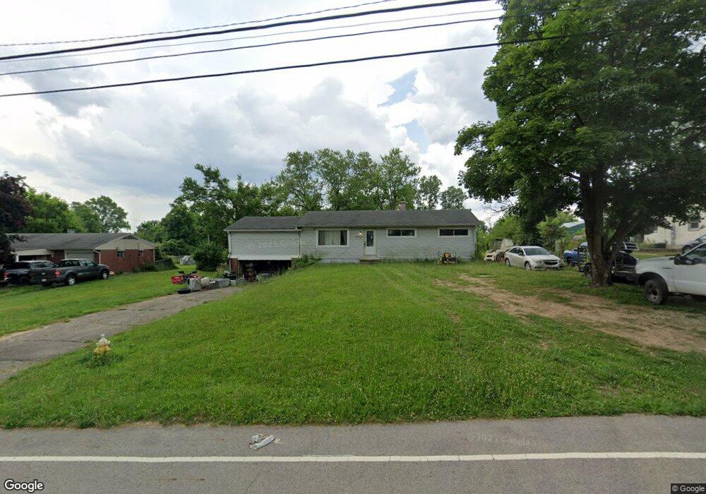
6921 Homestretch Rd Dayton, OH 45414
Estimated Value: $155,646 - $195,000
3
Beds
1
Bath
1,144
Sq Ft
$150/Sq Ft
Est. Value
About This Home
This home is located at 6921 Homestretch Rd, Dayton, OH 45414 and is currently estimated at $171,912, approximately $150 per square foot. 6921 Homestretch Rd is a home located in Montgomery County with nearby schools including Demmitt Elementary School, Smith Middle School, and Butler High School.
Ownership History
Date
Name
Owned For
Owner Type
Purchase Details
Closed on
Aug 15, 2012
Sold by
U S Bank Na
Bought by
Decker Gregory S and Decker Dana M
Current Estimated Value
Purchase Details
Closed on
Dec 1, 2011
Sold by
Thyne Cheryl A
Bought by
Us Bank National Association
Purchase Details
Closed on
Dec 3, 2009
Sold by
Thyne Cheryl A
Bought by
Fonseca Antonio D and Sharifa Trust
Create a Home Valuation Report for This Property
The Home Valuation Report is an in-depth analysis detailing your home's value as well as a comparison with similar homes in the area
Home Values in the Area
Average Home Value in this Area
Purchase History
| Date | Buyer | Sale Price | Title Company |
|---|---|---|---|
| Decker Gregory S | $32,000 | Omega Title Agency Llc | |
| Us Bank National Association | $58,500 | None Available | |
| Fonseca Antonio D | -- | None Available |
Source: Public Records
Tax History Compared to Growth
Tax History
| Year | Tax Paid | Tax Assessment Tax Assessment Total Assessment is a certain percentage of the fair market value that is determined by local assessors to be the total taxable value of land and additions on the property. | Land | Improvement |
|---|---|---|---|---|
| 2024 | $1,593 | $29,580 | $9,240 | $20,340 |
| 2023 | $1,593 | $29,580 | $9,240 | $20,340 |
| 2022 | $2,020 | $29,580 | $9,240 | $20,340 |
| 2021 | $2,052 | $29,580 | $9,240 | $20,340 |
| 2020 | $2,271 | $29,580 | $9,240 | $20,340 |
| 2019 | $1,849 | $25,570 | $9,240 | $16,330 |
| 2018 | $1,853 | $25,570 | $9,240 | $16,330 |
| 2017 | $1,840 | $25,570 | $9,240 | $16,330 |
| 2016 | $1,850 | $25,250 | $9,240 | $16,010 |
| 2015 | $1,827 | $25,250 | $9,240 | $16,010 |
| 2014 | $1,827 | $25,250 | $9,240 | $16,010 |
| 2012 | -- | $35,580 | $9,240 | $26,340 |
Source: Public Records
Map
Nearby Homes
- 679 Deerhurst Dr
- 715 Deerhurst Dr
- 710 Deerhurst Dr
- 678 Deerhurst Dr
- Fairfax Plan at Foxfire - Maple Street Collection
- Yosemite Plan at Foxfire - Maple Street Collection
- Cumberland Plan at Foxfire - Maple Street Collection
- Jensen Plan at Foxfire - Maple Street Collection
- Beacon Plan at Foxfire - Maple Street Collection
- Wesley Plan at Foxfire - Maple Street Collection
- Breckenridge Plan at Foxfire - Maple Street Collection
- Danville Plan at Foxfire - Maple Street Collection
- DaVinci Plan at Foxfire - Maple Street Collection
- Greenbriar Plan at Foxfire - Maple Street Collection
- 3320 Benchwood Rd
- 668 Deerhurst Dr
- 3291 Benchwood Rd
- 3280 Benchwood Rd
- 6494 Shore Dr
- 6512 Shore Dr
- 6931 Homestretch Rd
- 6911 Homestretch Rd
- 6922 Homestretch Rd
- 6912 Homestretch Rd
- 6887 Homestretch Rd
- 6837 Homestretch Rd
- 6827 Homestretch Rd
- 6819 Homestretch Rd
- 6868 Homestretch Rd
- 7030 Poe Ave
- 6800 Homestretch Rd
- 6790 Homestretch Rd
- 3908 Image Dr
- 0 Homestretch Rd Unit 578611
- 6640 Poe Ave
- 7070 Miller Ln
- 0 Homestretch Rd
- 7250 Poe Ave
- 3920 Space Dr
- 7285 Poe Ave