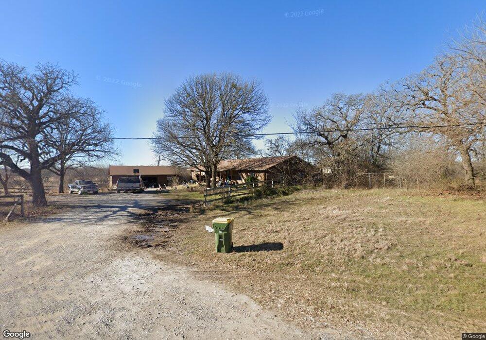
6921 S Fm 730 Decatur, TX 76234
Estimated Value: $532,000 - $552,000
4
Beds
3
Baths
2,720
Sq Ft
$199/Sq Ft
Est. Value
About This Home
This home is located at 6921 S Fm 730, Decatur, TX 76234 and is currently estimated at $542,391, approximately $199 per square foot. 6921 S Fm 730 is a home located in Wise County with nearby schools including Boyd Elementary School, Boyd Middle School, and Boyd High School.
Ownership History
Date
Name
Owned For
Owner Type
Purchase Details
Closed on
Aug 23, 2013
Sold by
Adams Thomas D and Adams Laurie H
Bought by
Adams Matthew
Current Estimated Value
Home Financials for this Owner
Home Financials are based on the most recent Mortgage that was taken out on this home.
Original Mortgage
$179,200
Outstanding Balance
$133,105
Interest Rate
4.36%
Mortgage Type
New Conventional
Estimated Equity
$409,286
Purchase Details
Closed on
Oct 19, 2012
Sold by
Vanschuyver Linda
Bought by
Adams Thomas D and Adams Laurie H
Purchase Details
Closed on
Oct 3, 1994
Bought by
Adams Matthew
Purchase Details
Closed on
Oct 3, 1986
Bought by
Adams Matthew
Purchase Details
Closed on
Jan 1, 1901
Bought by
Adams Matthew
Create a Home Valuation Report for This Property
The Home Valuation Report is an in-depth analysis detailing your home's value as well as a comparison with similar homes in the area
Home Values in the Area
Average Home Value in this Area
Purchase History
| Date | Buyer | Sale Price | Title Company |
|---|---|---|---|
| Adams Matthew | -- | Guardian Title Co | |
| Adams Thomas D | -- | Guardian Titel Co | |
| Adams Matthew | -- | -- | |
| Adams Matthew | -- | -- | |
| Adams Matthew | -- | -- |
Source: Public Records
Mortgage History
| Date | Status | Borrower | Loan Amount |
|---|---|---|---|
| Open | Adams Matthew | $179,200 |
Source: Public Records
Tax History Compared to Growth
Tax History
| Year | Tax Paid | Tax Assessment Tax Assessment Total Assessment is a certain percentage of the fair market value that is determined by local assessors to be the total taxable value of land and additions on the property. | Land | Improvement |
|---|---|---|---|---|
| 2025 | $3,614 | $418,836 | -- | -- |
| 2024 | $3,614 | $380,760 | $0 | $0 |
| 2023 | $4,134 | $346,145 | $0 | $0 |
| 2022 | $4,673 | $314,677 | $0 | $0 |
| 2021 | $4,547 | $319,620 | $100,410 | $219,210 |
| 2020 | $4,144 | $302,180 | $89,910 | $212,270 |
| 2019 | $4,015 | $271,050 | $89,910 | $181,140 |
| 2018 | $3,815 | $250,350 | $74,940 | $175,410 |
| 2017 | $3,468 | $210,590 | $46,480 | $164,110 |
| 2016 | $3,153 | $177,630 | $35,980 | $141,650 |
| 2015 | -- | $174,840 | $31,470 | $143,370 |
| 2014 | -- | $174,840 | $31,470 | $143,370 |
Source: Public Records
Map
Nearby Homes
- 149 Highgate Ct
- 540 County Road 4470
- 132 Parkview Ln
- 120 Parkview Ln
- Caleb Plan at Highland Oaks
- Camden Plan at Highland Oaks
- Carson Plan at Highland Oaks
- Caitlyn Plan at Highland Oaks
- Connor Plan at Highland Oaks
- Caitlyn II Plan at Highland Oaks
- Catherine Plan at Highland Oaks
- 128 Highgate Ct
- 360 County Road 4358
- TBD Abel Ln
- 177 Private Road 4394
- 000 County Road 4360
- 2150 County Road 4371
- 2160 County Road 4371
- 0 County Road 4371
- 100 N Agnew St
- TBD Private Road 4464
- 109 County Road 4471
- 134 Private Road 4464
- 177 County Road 4471
- 241 County Road 4470
- 241 County Road 4470
- 8434 S Fm 730
- 8434 S Fm 730
- 178 County Road 4471
- 184 County Road 4471
- 2292 County Road 4360
- TBD County Road 4360
- 296 County Road 4470
- 198 County Road 4471
- 124 County Road 4472
- 124 County Road 4472
- 2170 County Road 4360
- 359 County Road 4470
- 165 Hilltop Dr
- 174 County Road 4472