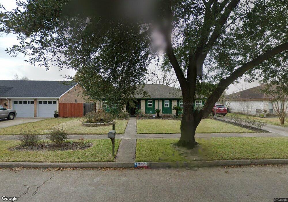
6922 Cloud Swept Ln Houston, TX 77086
North Houston NeighborhoodEstimated Value: $229,000 - $255,000
3
Beds
2
Baths
1,862
Sq Ft
$131/Sq Ft
Est. Value
About This Home
This home is located at 6922 Cloud Swept Ln, Houston, TX 77086 and is currently estimated at $244,218, approximately $131 per square foot. 6922 Cloud Swept Ln is a home located in Harris County with nearby schools including Kujawa EC/Pre-K/K School, Carmichael Elementary School, and Shotwell Middle School.
Ownership History
Date
Name
Owned For
Owner Type
Purchase Details
Closed on
Oct 9, 2002
Sold by
Kasowski Edward J and Kasowski Loretta
Bought by
Rodriguez Ivan A and Rodriguez Delmy
Current Estimated Value
Home Financials for this Owner
Home Financials are based on the most recent Mortgage that was taken out on this home.
Original Mortgage
$66,600
Outstanding Balance
$28,003
Interest Rate
6.2%
Mortgage Type
Stand Alone First
Estimated Equity
$216,215
Create a Home Valuation Report for This Property
The Home Valuation Report is an in-depth analysis detailing your home's value as well as a comparison with similar homes in the area
Home Values in the Area
Average Home Value in this Area
Purchase History
| Date | Buyer | Sale Price | Title Company |
|---|---|---|---|
| Rodriguez Ivan A | -- | Startex Title Company |
Source: Public Records
Mortgage History
| Date | Status | Borrower | Loan Amount |
|---|---|---|---|
| Open | Rodriguez Ivan A | $66,600 |
Source: Public Records
Tax History Compared to Growth
Tax History
| Year | Tax Paid | Tax Assessment Tax Assessment Total Assessment is a certain percentage of the fair market value that is determined by local assessors to be the total taxable value of land and additions on the property. | Land | Improvement |
|---|---|---|---|---|
| 2025 | $3,325 | $241,379 | $39,589 | $201,790 |
| 2024 | $3,325 | $244,884 | $39,589 | $205,295 |
| 2023 | $3,325 | $253,289 | $39,589 | $213,700 |
| 2022 | $4,018 | $210,570 | $33,550 | $177,020 |
| 2021 | $3,644 | $174,998 | $33,550 | $141,448 |
| 2020 | $3,682 | $165,465 | $33,550 | $131,915 |
| 2019 | $3,481 | $162,244 | $17,101 | $145,143 |
| 2018 | $1,260 | $151,614 | $17,101 | $134,513 |
| 2017 | $2,774 | $142,827 | $15,356 | $127,471 |
| 2016 | $2,522 | $129,495 | $15,356 | $114,139 |
| 2015 | $1,790 | $122,076 | $15,356 | $106,720 |
| 2014 | $1,790 | $92,237 | $15,356 | $76,881 |
Source: Public Records
Map
Nearby Homes
- 6911 Silver Star Dr
- 6822 Dusty Dawn Dr
- 7023 Sandswept Ln
- 7002 Sandswept Ln
- 10307 Bammel North Houston Rd
- 6830 Desert Rose Ln
- 6722 Winding Trace Dr
- 10306 Jillana Kaye Dr
- 6703 Deer Ridge Ln
- 10614 Mackenzie Dr
- 7302 Seton Lake Dr
- 7307 Silver Star Dr
- 6615 Winding Trace Dr
- 9815 Lonsford Dr
- 6654 Brownie Campbell Rd
- 7218 Winding Trace Dr
- 10711 Heather Hill Dr
- 6630 Brownie Campbell Rd
- 10214 Trade Winds Dr
- 6502 Trail Valley Way
- 6926 Cloud Swept Ln
- 6918 Cloud Swept Ln
- 6907 Silver Star Dr
- 6903 Silver Star Dr
- 6914 Cloud Swept Ln
- 6930 Cloud Swept Ln
- 6915 Silver Star Dr
- 6923 Cloud Swept Ln
- 6919 Cloud Swept Ln
- 6839 Silver Star Dr
- 6915 Cloud Swept Ln
- 6910 Cloud Swept Ln
- 6919 Silver Star Dr
- 6931 Cloud Swept Ln
- 6934 Cloud Swept Ln
- 6911 Cloud Swept Ln
- 6835 Silver Star Dr
- 6935 Cloud Swept Ln
- 6923 Silver Star Dr
- 6906 Cloud Swept Ln