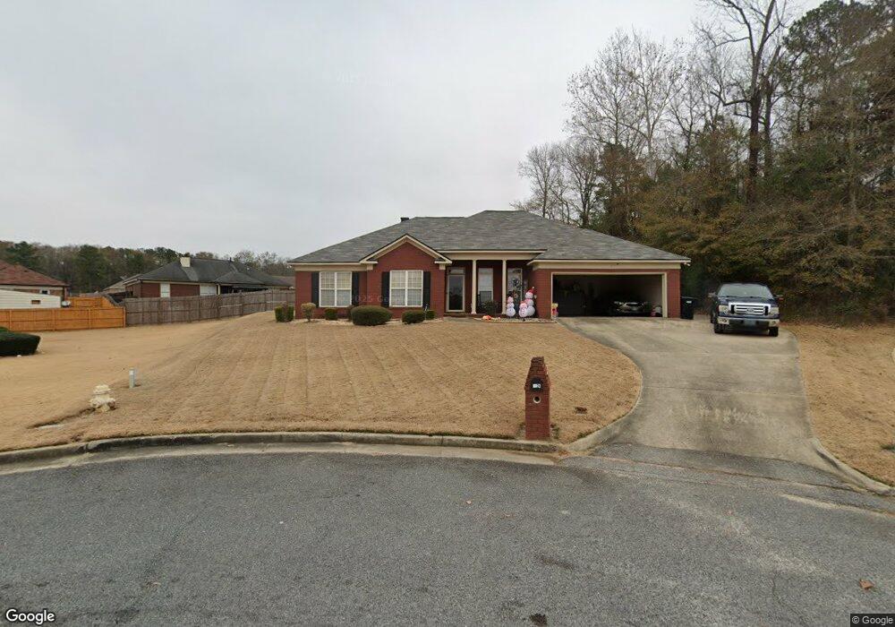
6924 Broadfield Ct Columbus, GA 31907
Midland NeighborhoodEstimated Value: $269,994 - $286,000
4
Beds
3
Baths
2,022
Sq Ft
$137/Sq Ft
Est. Value
About This Home
This home is located at 6924 Broadfield Ct, Columbus, GA 31907 and is currently estimated at $277,249, approximately $137 per square foot. 6924 Broadfield Ct is a home located in Muscogee County with nearby schools including Waddell Elementary School, Aaron Cohn Middle School, and Hardaway High School.
Ownership History
Date
Name
Owned For
Owner Type
Purchase Details
Closed on
Feb 21, 2019
Sold by
Peterson Ronnie
Bought by
Anthony Eric B
Current Estimated Value
Home Financials for this Owner
Home Financials are based on the most recent Mortgage that was taken out on this home.
Original Mortgage
$185,576
Outstanding Balance
$163,549
Interest Rate
4.62%
Mortgage Type
FHA
Estimated Equity
$113,700
Create a Home Valuation Report for This Property
The Home Valuation Report is an in-depth analysis detailing your home's value as well as a comparison with similar homes in the area
Home Values in the Area
Average Home Value in this Area
Purchase History
| Date | Buyer | Sale Price | Title Company |
|---|---|---|---|
| Anthony Eric B | $189,000 | -- |
Source: Public Records
Mortgage History
| Date | Status | Borrower | Loan Amount |
|---|---|---|---|
| Open | Anthony Eric B | $185,576 |
Source: Public Records
Tax History Compared to Growth
Tax History
| Year | Tax Paid | Tax Assessment Tax Assessment Total Assessment is a certain percentage of the fair market value that is determined by local assessors to be the total taxable value of land and additions on the property. | Land | Improvement |
|---|---|---|---|---|
| 2025 | $3,829 | $97,828 | $12,600 | $85,228 |
| 2024 | $3,829 | $97,828 | $12,600 | $85,228 |
| 2023 | $3,854 | $97,828 | $12,600 | $85,228 |
| 2022 | $3,220 | $78,856 | $12,600 | $66,256 |
| 2021 | $2,973 | $72,816 | $12,600 | $60,216 |
| 2020 | $2,974 | $72,816 | $12,600 | $60,216 |
| 2019 | $2,093 | $72,816 | $12,600 | $60,216 |
| 2018 | $2,093 | $72,816 | $12,600 | $60,216 |
| 2017 | $2,101 | $72,816 | $12,600 | $60,216 |
| 2016 | $2,110 | $80,531 | $12,218 | $68,313 |
| 2015 | $2,114 | $80,531 | $12,218 | $68,313 |
| 2014 | $2,118 | $80,531 | $12,218 | $68,313 |
| 2013 | -- | $80,531 | $12,218 | $68,313 |
Source: Public Records
Map
Nearby Homes
- 5434 Rockhurst Dr
- 6215 Parker Dr
- 6236 Olde Towne Dr
- 5717 Flat Rock Rd
- 5640 Lakeshore Rd
- 7101 Cross Tie Dr
- 5804 Dearborn Ave
- 6321 Milgen Rd Unit 3
- 4931 Woodruff Farm Rd
- 7170 Beaver Run Rd
- 6437 Woodbriar Ln
- 7265 E Wynfield Loop
- 2 Mink Ct
- 6222 Goodwin Dr
- 6454 Patriot Dr
- 6055 Psalmond Rd
- 7593 Beaver Run Rd
- 5 Mink Ct
- 5422 Colony Dr
- 5408 Old Dominion Rd
- 6917 Broadfield Ct
- 5376 Broadfield Dr
- 6918 Broadfield Ct
- 5382 Broadfield Dr
- 5370 Broadfield Dr
- 6909 Broadfield Ct
- 6912 Broadfield Ct
- 5388 Broadfield Dr
- 5364 Broadfield Dr
- 5358 Broadfield Dr
- 6906 Broadfield Ct
- 5394 Broadfield Dr
- 6681 & 6687 Macon Rd
- 6681 AND 6687 Macon Rd
- 5346 Broadfield Dr
- 5340 Broadfield Dr
- 5352 Broadfield Dr
- 5401 Broadfield Dr
- 5395 Broadfield Dr
- 5389 Broadfield Dr