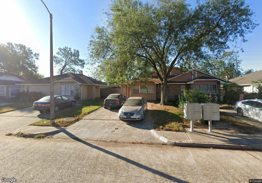
6927 Greenyard Dr Houston, TX 77086
North Houston NeighborhoodEstimated Value: $157,576 - $181,000
2
Beds
1
Bath
1,246
Sq Ft
$134/Sq Ft
Est. Value
About This Home
This home is located at 6927 Greenyard Dr, Houston, TX 77086 and is currently estimated at $167,144, approximately $134 per square foot. 6927 Greenyard Dr is a home located in Harris County with nearby schools including Kujawa EC/Pre-K/K School, Carmichael Elementary School, and Shotwell Middle School.
Ownership History
Date
Name
Owned For
Owner Type
Purchase Details
Closed on
Mar 8, 2001
Sold by
Khera Tirath S and Khera Gurpreet K
Bought by
Trahan Vierella C
Current Estimated Value
Home Financials for this Owner
Home Financials are based on the most recent Mortgage that was taken out on this home.
Original Mortgage
$51,300
Interest Rate
7.1%
Create a Home Valuation Report for This Property
The Home Valuation Report is an in-depth analysis detailing your home's value as well as a comparison with similar homes in the area
Home Values in the Area
Average Home Value in this Area
Purchase History
| Date | Buyer | Sale Price | Title Company |
|---|---|---|---|
| Trahan Vierella C | -- | American Title Co |
Source: Public Records
Mortgage History
| Date | Status | Borrower | Loan Amount |
|---|---|---|---|
| Closed | Trahan Vierella C | $51,300 |
Source: Public Records
Tax History Compared to Growth
Tax History
| Year | Tax Paid | Tax Assessment Tax Assessment Total Assessment is a certain percentage of the fair market value that is determined by local assessors to be the total taxable value of land and additions on the property. | Land | Improvement |
|---|---|---|---|---|
| 2025 | $813 | $148,137 | $29,249 | $118,888 |
| 2024 | $813 | $153,070 | $24,487 | $128,583 |
| 2023 | $813 | $153,070 | $24,487 | $128,583 |
| 2022 | $1,700 | $125,055 | $15,305 | $109,750 |
| 2021 | $1,623 | $108,669 | $15,305 | $93,364 |
| 2020 | $1,571 | $99,176 | $15,305 | $83,871 |
| 2019 | $1,521 | $90,462 | $15,305 | $75,157 |
| 2018 | $411 | $72,910 | $15,305 | $57,605 |
| 2017 | $1,333 | $59,848 | $10,203 | $49,645 |
| 2016 | $1,212 | $59,848 | $10,203 | $49,645 |
| 2015 | $828 | $55,628 | $10,203 | $45,425 |
| 2014 | $828 | $40,652 | $10,203 | $30,449 |
Source: Public Records
Map
Nearby Homes
- 11007 Tobasa Ct
- 11006 Crinkleawn Dr
- 7218 Winding Trace Dr
- 11021 Crenchrus Ct
- 6654 Brownie Campbell Rd
- 7002 Sandswept Ln
- 7222 Northleaf Dr
- 11009 Panicum Ct
- 6722 Winding Trace Dr
- 7227 Greenyard Dr
- 7023 Sandswept Ln
- 6610 Northleaf Dr
- 6630 Brownie Campbell Rd
- 5010 Kale Ct
- 10711 Heather Hill Dr
- 10614 Mackenzie Dr
- 6615 Winding Trace Dr
- 10723 Mackenzie Dr
- 6911 Silver Star Dr
- 5103 Dartmoor Ridge Trail
- 6929 Greenyard Dr
- 6925 Greenyard Dr
- 6931 Greenyard Dr
- 6923 Greenyard Dr
- 6931&6933 Greenyard Dr
- 6933 Greenyard Dr
- 6921 Greenyard Dr
- 6935 Greenyard Dr
- 6919 Greenyard Dr
- 11002 Tanglehead Ct
- 11003 Tobasa Ct
- 6917 Greenyard Dr
- 6937 Greenyard Dr
- 11004 Tanglehead Ct
- 11005 Tobasa Ct
- 6915 Greenyard Dr
- 6939 Greenyard Dr
- 11006 Tanglehead Ct
- 6913 Greenyard Dr
- 6941 Greenyard Dr