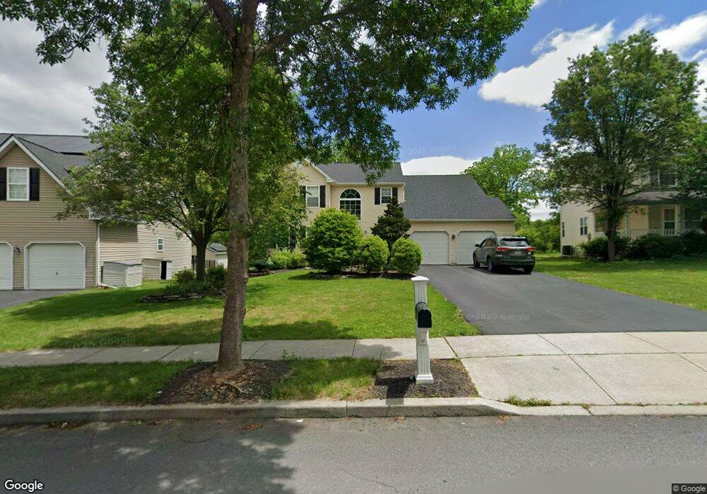
6928 Lincoln Dr Macungie, PA 18062
Lower Macungie Township West NeighborhoodEstimated Value: $510,705 - $575,000
4
Beds
3
Baths
2,570
Sq Ft
$210/Sq Ft
Est. Value
About This Home
This home is located at 6928 Lincoln Dr, Macungie, PA 18062 and is currently estimated at $540,676, approximately $210 per square foot. 6928 Lincoln Dr is a home located in Lehigh County with nearby schools including Shoemaker Elementary School, Eyer Middle School, and Emmaus High School.
Ownership History
Date
Name
Owned For
Owner Type
Purchase Details
Closed on
Feb 17, 2005
Sold by
T H Properties Lp
Bought by
George Richard and George Colleen
Current Estimated Value
Home Financials for this Owner
Home Financials are based on the most recent Mortgage that was taken out on this home.
Original Mortgage
$216,800
Outstanding Balance
$110,413
Interest Rate
5.78%
Mortgage Type
Purchase Money Mortgage
Estimated Equity
$430,263
Create a Home Valuation Report for This Property
The Home Valuation Report is an in-depth analysis detailing your home's value as well as a comparison with similar homes in the area
Home Values in the Area
Average Home Value in this Area
Purchase History
| Date | Buyer | Sale Price | Title Company |
|---|---|---|---|
| George Richard | $271,307 | Fidelity National Title Ins |
Source: Public Records
Mortgage History
| Date | Status | Borrower | Loan Amount |
|---|---|---|---|
| Open | George Richard | $216,800 |
Source: Public Records
Tax History Compared to Growth
Tax History
| Year | Tax Paid | Tax Assessment Tax Assessment Total Assessment is a certain percentage of the fair market value that is determined by local assessors to be the total taxable value of land and additions on the property. | Land | Improvement |
|---|---|---|---|---|
| 2025 | $6,357 | $249,000 | $33,600 | $215,400 |
| 2024 | $6,150 | $249,000 | $33,600 | $215,400 |
| 2023 | $6,027 | $249,000 | $33,600 | $215,400 |
| 2022 | $5,885 | $249,000 | $215,400 | $33,600 |
| 2021 | $5,760 | $249,000 | $33,600 | $215,400 |
| 2020 | $5,705 | $249,000 | $33,600 | $215,400 |
| 2019 | $5,608 | $249,000 | $33,600 | $215,400 |
| 2018 | $5,534 | $249,000 | $33,600 | $215,400 |
| 2017 | $5,437 | $249,000 | $33,600 | $215,400 |
| 2016 | -- | $249,000 | $33,600 | $215,400 |
| 2015 | -- | $249,000 | $33,600 | $215,400 |
| 2014 | -- | $249,000 | $33,600 | $215,400 |
Source: Public Records
Map
Nearby Homes
- 6903 Lincoln Dr
- 3814 Clay Dr
- 0 Clauss Hunt Knight Dr Unit 10 Units 763578
- 6709 Mountain Rd
- 0 Mountain Lot 1
- 167 Aspen Ln
- 6405 Robin Rd
- Lot 1 Mountain Rd
- 211 S Church St
- 7230 Pioneer Dr
- 2845 Donegal Dr
- 2840 Donegal Dr
- 6672 Pioneer Dr
- 6635 Blue Heather Ct
- 204 Ridings Cir Unit F204
- 4759 Sheep Rock Rd
- 2879 Sequoia Dr
- 353 Abby Rd Unit Lot 40
- 353 Abby Rd
- 6528 Carmel Dr
- 6920 Lincoln Dr
- 6936 Lincoln Dr
- 6912 Lincoln Dr
- 6944 Hearth Ln
- 6927 Lincoln Dr
- 6904 Lincoln Dr
- 6919 Lincoln Dr
- 6935 Lincoln Dr
- 6948 Hearth Ln
- 6911 Lincoln Dr
- 6945 Hearth Ln
- 6872 Scenic View Dr
- 6880 Scenic View Dr
- 6864 Scenic View Dr
- 6888 Scenic View Dr
- 3757 Clay Dr
- 3765 Clay Dr
- 3749 Clay Dr
- 6952 Hearth Ln
- 3773 Clay Dr