Estimated Value: $168,000 - $177,000
2
Beds
1
Bath
962
Sq Ft
$179/Sq Ft
Est. Value
About This Home
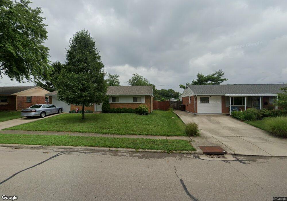
This home is located at 693 Buckskin Trail, Xenia, OH 45385 and is currently estimated at $172,547, approximately $179 per square foot. 693 Buckskin Trail is a home located in Greene County with nearby schools including Xenia High School, Summit Academy Community School for Alternative Learners - Xenia, and Legacy Christian Academy.
Ownership History
Date
Name
Owned For
Owner Type
Purchase Details
Closed on
Jun 28, 2012
Sold by
Groom Sarah E
Bought by
Sky Bank
Current Estimated Value
Purchase Details
Closed on
Jun 13, 2012
Sold by
Self Help Ventures Fund
Bought by
Altick Robert I and Altick Mary E
Purchase Details
Closed on
Sep 14, 2006
Sold by
Higgins Thomas W and Higgins Mary Lou
Bought by
Grooms Sarah E
Home Financials for this Owner
Home Financials are based on the most recent Mortgage that was taken out on this home.
Original Mortgage
$88,000
Interest Rate
6.59%
Mortgage Type
Unknown
Purchase Details
Closed on
Dec 19, 2005
Sold by
Higgins Mary Lou
Bought by
Higgins Thomas W and Higgins Mary Lou
Home Financials for this Owner
Home Financials are based on the most recent Mortgage that was taken out on this home.
Original Mortgage
$61,000
Interest Rate
6.48%
Mortgage Type
New Conventional
Purchase Details
Closed on
Dec 7, 2004
Sold by
Estate Of Doris E Thorne
Bought by
Altick Robert I and Higgins Mary Lou
Create a Home Valuation Report for This Property
The Home Valuation Report is an in-depth analysis detailing your home's value as well as a comparison with similar homes in the area
Home Values in the Area
Average Home Value in this Area
Purchase History
| Date | Buyer | Sale Price | Title Company |
|---|---|---|---|
| Sky Bank | $60,000 | None Available | |
| Altick Robert I | $45,900 | None Available | |
| Grooms Sarah E | $88,000 | None Available | |
| Higgins Thomas W | -- | None Available | |
| Higgins Mary Lou | -- | None Available | |
| Altick Robert I | -- | -- |
Source: Public Records
Mortgage History
| Date | Status | Borrower | Loan Amount |
|---|---|---|---|
| Previous Owner | Grooms Sarah E | $88,000 | |
| Previous Owner | Higgins Thomas W | $61,000 |
Source: Public Records
Tax History Compared to Growth
Tax History
| Year | Tax Paid | Tax Assessment Tax Assessment Total Assessment is a certain percentage of the fair market value that is determined by local assessors to be the total taxable value of land and additions on the property. | Land | Improvement |
|---|---|---|---|---|
| 2024 | $1,861 | $43,500 | $11,050 | $32,450 |
| 2023 | $1,861 | $43,500 | $11,050 | $32,450 |
| 2022 | $1,540 | $30,700 | $6,500 | $24,200 |
| 2021 | $1,561 | $30,700 | $6,500 | $24,200 |
| 2020 | $1,495 | $30,700 | $6,500 | $24,200 |
| 2019 | $1,242 | $24,010 | $6,370 | $17,640 |
| 2018 | $1,247 | $24,010 | $6,370 | $17,640 |
| 2017 | $1,139 | $24,010 | $6,370 | $17,640 |
| 2016 | $1,139 | $21,520 | $6,370 | $15,150 |
| 2015 | $1,142 | $21,520 | $6,370 | $15,150 |
| 2014 | $1,094 | $21,520 | $6,370 | $15,150 |
Source: Public Records
Map
Nearby Homes
- 1144 Rockwell Dr
- 1208 Bellbrook Ave
- 1272 Bellbrook Ave
- 1342 Kylemore Dr
- 1618 Navajo Dr
- 1568 Cheyenne Dr
- 1233 June Dr
- 1223 June Dr
- 1283 June Dr
- 1778 Arapaho Dr
- 1391 June Dr
- 1653 Seneca Dr
- 121 S Progress Dr
- 1769 Gayhart Dr
- 305-325 Bellbrook Ave
- 1829 Gayhart Dr
- 1866 Roxbury Dr
- 2758 Wyoming Dr
- 343 Sheelin Rd
- 453 Walnut St
- 679 Buckskin Trail
- 707 Buckskin Trail
- 717 Buckskin Trail
- 667 Buckskin Trail
- 690 Buckskin Trail
- 702 Buckskin Trail
- 678 Buckskin Trail
- 655 Buckskin Trail
- 733 Buckskin Trail
- 664 Buckskin Trail
- 726 Buckskin Trail
- 641 Buckskin Trail
- 745 Buckskin Trail
- 802 Moccasin Trail
- 807 Tomahawk Trail
- 738 Buckskin Trail
- 638 Buckskin Trail
- 801 Moccasin Trail
- 753 Buckskin Trail
- 619 Buckskin Trail