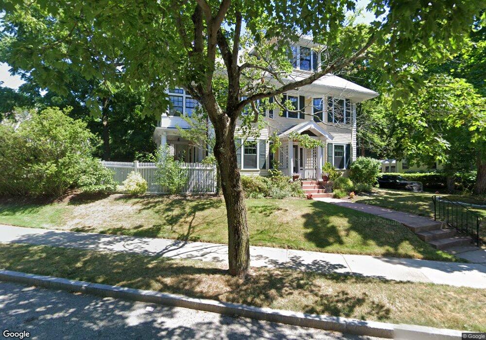
693 Commonwealth Ave Unit 1 Newton Center, MA 02459
Newton Centre NeighborhoodEstimated Value: $1,077,000 - $1,192,607
3
Beds
3
Baths
1,845
Sq Ft
$605/Sq Ft
Est. Value
About This Home
This home is located at 693 Commonwealth Ave Unit 1, Newton Center, MA 02459 and is currently estimated at $1,115,652, approximately $604 per square foot. 693 Commonwealth Ave Unit 1 is a home located in Middlesex County with nearby schools including Mason Rice Elementary School, Charles E Brown Middle School, and Newton North High School.
Ownership History
Date
Name
Owned For
Owner Type
Purchase Details
Closed on
Jul 3, 2000
Sold by
Niederman Derrick C
Bought by
Gordon Deborah M
Current Estimated Value
Home Financials for this Owner
Home Financials are based on the most recent Mortgage that was taken out on this home.
Original Mortgage
$348,000
Interest Rate
8.59%
Mortgage Type
Purchase Money Mortgage
Purchase Details
Closed on
Apr 1, 1988
Sold by
693 Comm Ave Rt
Bought by
Niederman Derick C
Create a Home Valuation Report for This Property
The Home Valuation Report is an in-depth analysis detailing your home's value as well as a comparison with similar homes in the area
Home Values in the Area
Average Home Value in this Area
Purchase History
| Date | Buyer | Sale Price | Title Company |
|---|---|---|---|
| Gordon Deborah M | $450,000 | -- | |
| Niederman Derick C | $285,000 | -- |
Source: Public Records
Mortgage History
| Date | Status | Borrower | Loan Amount |
|---|---|---|---|
| Open | Niederman Derick C | $290,000 | |
| Closed | Niederman Derick C | $348,000 | |
| Previous Owner | Niederman Derick C | $165,000 |
Source: Public Records
Tax History Compared to Growth
Tax History
| Year | Tax Paid | Tax Assessment Tax Assessment Total Assessment is a certain percentage of the fair market value that is determined by local assessors to be the total taxable value of land and additions on the property. | Land | Improvement |
|---|---|---|---|---|
| 2025 | $9,556 | $975,100 | $0 | $975,100 |
| 2024 | $9,240 | $946,700 | $0 | $946,700 |
| 2023 | $9,056 | $889,600 | $0 | $889,600 |
| 2022 | $8,913 | $847,200 | $0 | $847,200 |
| 2021 | $8,599 | $799,200 | $0 | $799,200 |
| 2020 | $8,344 | $799,200 | $0 | $799,200 |
| 2019 | $6,774 | $775,900 | $0 | $775,900 |
| 2018 | $3,625 | $749,700 | $0 | $749,700 |
| 2017 | $7,865 | $707,300 | $0 | $707,300 |
| 2016 | $7,522 | $661,000 | $0 | $661,000 |
| 2015 | $7,308 | $629,500 | $0 | $629,500 |
Source: Public Records
Map
Nearby Homes
- 1004 Centre St
- 73 Elmore St
- Lot 3 Chapin Rd
- Lot 2 Chapin Rd
- Lots 2 & 3 Chapin Rd
- 44 Irving St
- 21 Francis St Unit 21A
- 23 Francis St Unit 23-1
- 3 Cedar St
- 59 Charlotte Rd
- 887 Commonwealth Ave
- 34 Morton Rd
- 173-175 Warren St
- 92 Grant Ave
- 31 W Boulevard Rd
- 145 Warren St Unit 4
- 9 Ripley St Unit 1
- 54 Garland Rd
- 9 The Ledges Rd
- 154 Langley Rd Unit 1
- 693 Commonwealth Ave Unit 2
- 14 Ransom Rd Unit 16
- 707 Commonwealth Ave
- 683 Commonwealth Ave
- 15 Ransom Rd
- 20 Ransom Rd
- 19 Ransom Rd
- 19 Ransom Rd Unit 2
- 19 Ransom Rd Unit 1
- 715 Commonwealth Ave
- 667 Commonwealth Ave
- 692 Commonwealth Ave
- 684 Commonwealth Ave
- 21 Ransom Rd
- 30 Ransom Rd
- 21 Nathan Rd
- 47 Grafton St
- 47 Grafton St Unit 47
- 47 Grafton St
- 47 Grafton St Unit 3rd Floor