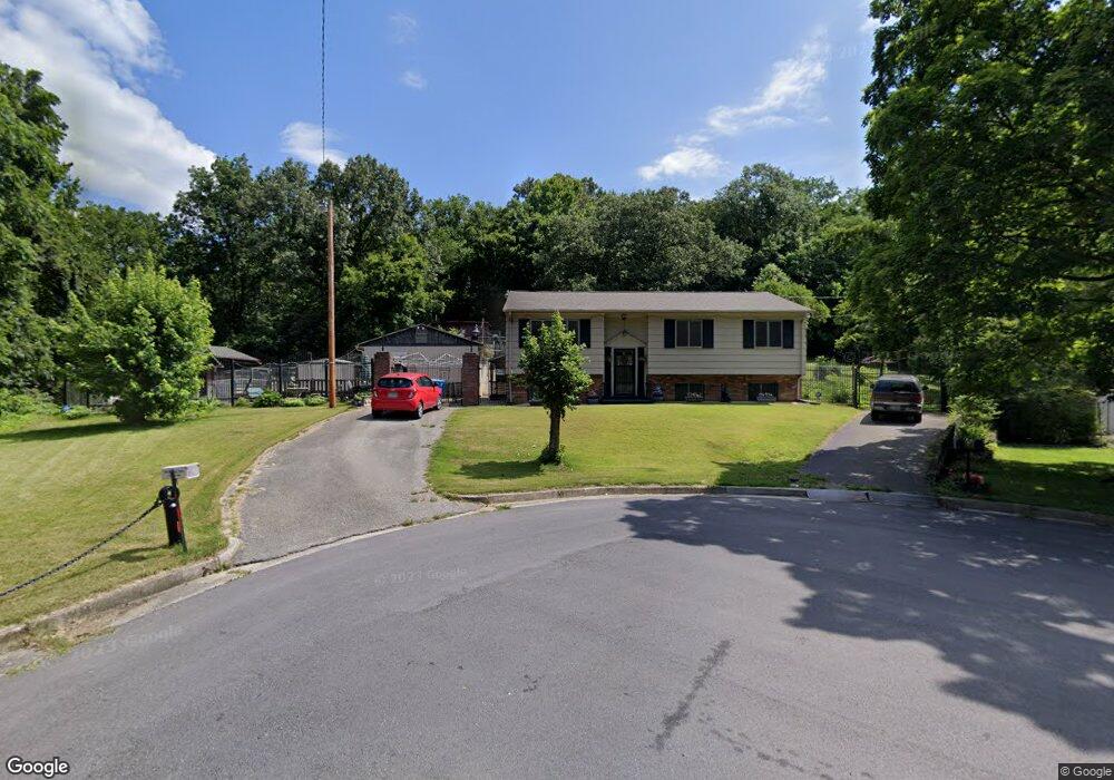
693 Westside Blvd NW Roanoke, VA 24017
Wilmont NeighborhoodEstimated Value: $192,000 - $263,368
3
Beds
2
Baths
1,164
Sq Ft
$193/Sq Ft
Est. Value
About This Home
This home is located at 693 Westside Blvd NW, Roanoke, VA 24017 and is currently estimated at $224,342, approximately $192 per square foot. 693 Westside Blvd NW is a home located in Roanoke City with nearby schools including Fairview Elementary School, Woodrow Wilson Middle School, and Patrick Henry High School.
Ownership History
Date
Name
Owned For
Owner Type
Purchase Details
Closed on
Jul 7, 2011
Sold by
Jacob Louise V and Mcdilda Louise V
Bought by
Mcdilda Charles H and Mcdilda Louise
Current Estimated Value
Home Financials for this Owner
Home Financials are based on the most recent Mortgage that was taken out on this home.
Original Mortgage
$180,000
Outstanding Balance
$123,835
Interest Rate
4.51%
Mortgage Type
Reverse Mortgage Home Equity Conversion Mortgage
Estimated Equity
$100,507
Create a Home Valuation Report for This Property
The Home Valuation Report is an in-depth analysis detailing your home's value as well as a comparison with similar homes in the area
Home Values in the Area
Average Home Value in this Area
Purchase History
| Date | Buyer | Sale Price | Title Company |
|---|---|---|---|
| Mcdilda Charles H | -- | None Available |
Source: Public Records
Mortgage History
| Date | Status | Borrower | Loan Amount |
|---|---|---|---|
| Open | Mcdilda Charles H | $180,000 |
Source: Public Records
Tax History Compared to Growth
Tax History
| Year | Tax Paid | Tax Assessment Tax Assessment Total Assessment is a certain percentage of the fair market value that is determined by local assessors to be the total taxable value of land and additions on the property. | Land | Improvement |
|---|---|---|---|---|
| 2025 | $2,866 | $201,700 | $36,500 | $165,200 |
| 2024 | $2,866 | $190,100 | $26,100 | $164,000 |
| 2023 | $2,017 | $165,300 | $26,100 | $139,200 |
| 2022 | $1,166 | $158,000 | $26,100 | $131,900 |
| 2021 | $1,680 | $137,700 | $26,100 | $111,600 |
| 2020 | $1,135 | $130,600 | $26,100 | $104,500 |
| 2019 | $1,135 | $125,400 | $26,100 | $99,300 |
| 2018 | $1,146 | $123,200 | $26,100 | $97,100 |
| 2017 | $1,086 | $118,000 | $26,100 | $91,900 |
| 2016 | $1,086 | $118,900 | $26,100 | $92,800 |
| 2015 | $891 | $121,500 | $26,100 | $95,400 |
| 2014 | $891 | $122,800 | $26,100 | $96,700 |
Source: Public Records
Map
Nearby Homes
- 3907 Wilmont Ave NW
- 4626 Autumn Ln NW
- 719 Westside Blvd NW
- 618 Gladies St NW
- 829 Westside Blvd NW
- 3728 Red Fox Dr NW
- 3721 Long Meadow Ave NW
- 3802 Panorama Ave NW
- 4915 Pomeroy Rd NW
- 3702 Troutland Ave NW
- 919 Glenn Ridge Rd NW
- 0 Gaymol Dr NW
- 307 Deaner Dr NW
- 5003 Victoria St NW
- 3731 Signal Hill Ave NW
- 348 Deaner Dr NW
- 640 36th St NW
- 5002 Morwanda St NW
- 3711 Signal Hill Ave NW
- 1008 Glenn Ridge Rd NW
- 685 Westside Blvd NW
- 3937 Green Spring Ave NW
- 3925 Green Spring Ave NW
- 3919 Green Spring Ave NW
- 3913 Green Spring Ave NW
- 663 Westside Blvd NW
- 3898 Long Meadow Ave NW
- 3909 Green Spring Ave NW
- 3922 Green Spring Ave NW
- 3894 Long Meadow Ave NW
- 655 Westside Blvd NW
- 3916 Green Spring Ave NW
- 3895 Long Meadow Ave NW
- 3890 Long Meadow Ave NW
- 3912 Green Spring Ave NW
- 3901 Green Spring Ave NW
- 3887 Green Spring Ave NW
- 651 Westside Blvd NW
- 3902 Green Spring Ave NW
- 3891 Long Meadow Ave NW