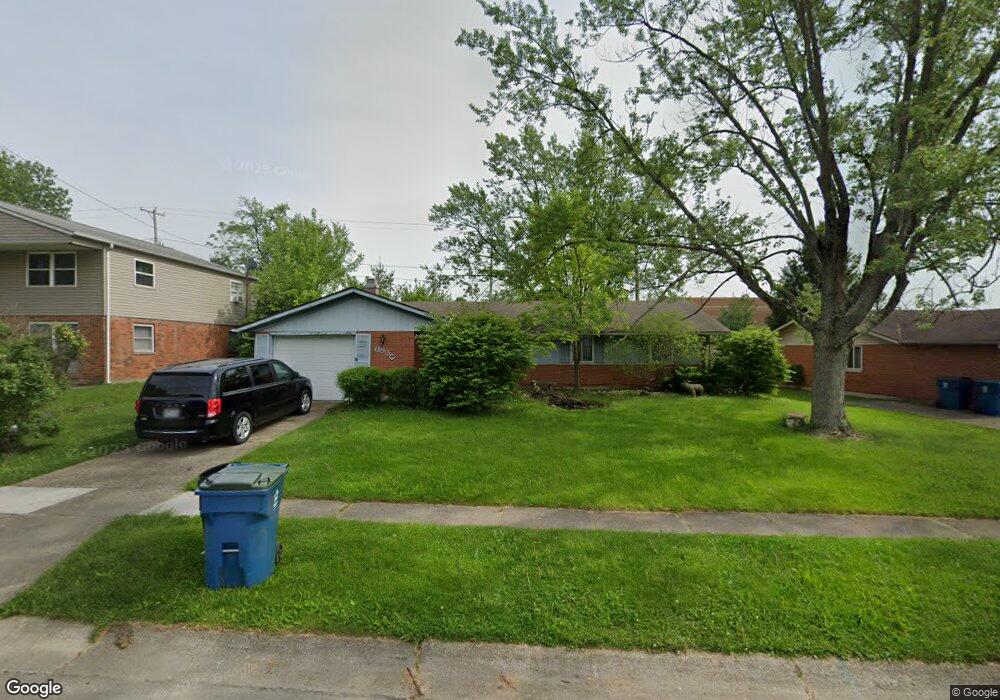
6930 Hubbard Dr Dayton, OH 45424
Estimated Value: $193,000 - $202,164
3
Beds
2
Baths
1,301
Sq Ft
$151/Sq Ft
Est. Value
About This Home
This home is located at 6930 Hubbard Dr, Dayton, OH 45424 and is currently estimated at $196,791, approximately $151 per square foot. 6930 Hubbard Dr is a home located in Montgomery County with nearby schools including Wayne High School and Huber Heights Christian Academy.
Ownership History
Date
Name
Owned For
Owner Type
Purchase Details
Closed on
Oct 23, 1996
Sold by
Raptosh Nickolas J and Raptosh Susan L
Bought by
Noaks Aragon R and Noaks Lachelle M
Current Estimated Value
Purchase Details
Closed on
Jun 22, 1995
Sold by
Spiller Timothy Hugh and Spiller Drema Annette
Bought by
Raptosh Nickolas J and Watson Susan L
Purchase Details
Closed on
Aug 31, 1994
Sold by
Dexter George J and Rivera Maritza H
Bought by
Spiller Timothy Hugh and Spiller Drema Annette
Create a Home Valuation Report for This Property
The Home Valuation Report is an in-depth analysis detailing your home's value as well as a comparison with similar homes in the area
Home Values in the Area
Average Home Value in this Area
Purchase History
| Date | Buyer | Sale Price | Title Company |
|---|---|---|---|
| Noaks Aragon R | $86,000 | -- | |
| Raptosh Nickolas J | -- | -- | |
| Spiller Timothy Hugh | -- | -- |
Source: Public Records
Tax History
| Year | Tax Paid | Tax Assessment Tax Assessment Total Assessment is a certain percentage of the fair market value that is determined by local assessors to be the total taxable value of land and additions on the property. | Land | Improvement |
|---|---|---|---|---|
| 2025 | $2,844 | $51,670 | $10,150 | $41,520 |
| 2024 | $2,750 | $51,670 | $10,150 | $41,520 |
| 2023 | $2,750 | $51,670 | $10,150 | $41,520 |
| 2022 | $2,419 | $35,600 | $7,000 | $28,600 |
| 2021 | $2,453 | $35,600 | $7,000 | $28,600 |
| 2020 | $2,455 | $35,600 | $7,000 | $28,600 |
| 2019 | $2,316 | $30,840 | $7,000 | $23,840 |
| 2018 | $2,324 | $30,840 | $7,000 | $23,840 |
| 2017 | $2,309 | $30,840 | $7,000 | $23,840 |
| 2016 | $2,193 | $28,540 | $7,000 | $21,540 |
| 2015 | $2,165 | $28,540 | $7,000 | $21,540 |
| 2014 | $2,165 | $28,540 | $7,000 | $21,540 |
| 2012 | -- | $31,120 | $8,750 | $22,370 |
Source: Public Records
Map
Nearby Homes
- 6922 Morley Ln
- 6533 Millhoff Dr
- 6730 Alter Rd
- 6800 Cicero Ct
- 6226 Hemingway Rd
- 6601 Grovehill Dr
- 6308 Hemingway Rd
- 6404 Luton Ct
- 6508 Hemingway Rd
- 6429 Leawood Dr
- 6105 Leyden Ln Unit 136105
- 6529 Larcomb Dr
- 7069 Harshmanville Rd
- 6324 Larcomb Dr
- 7371 Damascus Dr
- 7356 Natoma Place
- 6654 Harshmanville Rd
- 6483 Highbury Rd
- 7368 San Fernando Rd
- 5917 Longford Rd
- 6934 Hubbard Dr
- 6926 Hubbard Dr
- 6938 Hubbard Dr
- 6933 Hubbard Dr
- 6925 Hubbard Dr
- 6937 Hubbard Dr
- 6942 Hubbard Dr
- 6900 Morley Ln
- 6941 Hubbard Dr
- 6340 Longford Rd
- 6344 Longford Rd
- 6336 Longford Rd
- 6348 Longford Rd
- 6904 Morley Ln
- 6945 Hubbard Dr
- 6605 Alter Rd
- 6601 Alter Rd
- 6400 Longford Rd
- 6332 Longford Rd
- 6950 Hubbard Dr
Your Personal Tour Guide
Ask me questions while you tour the home.