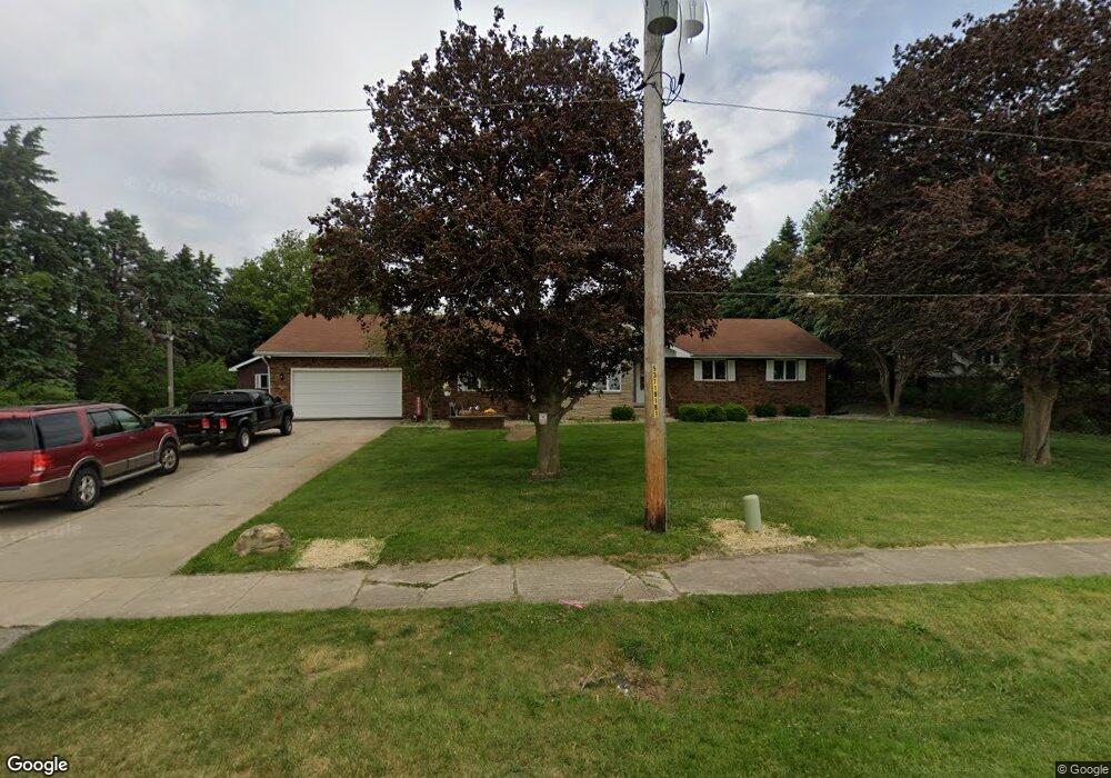
6932 W Corning Rd Peotone, IL 60468
Estimated Value: $354,000 - $405,000
--
Bed
--
Bath
--
Sq Ft
0.98
Acres
About This Home
This home is located at 6932 W Corning Rd, Peotone, IL 60468 and is currently estimated at $375,223. 6932 W Corning Rd is a home located in Will County with nearby schools including Peotone Elementary School, Peotone Intermediate Center, and Peotone Junior High School.
Ownership History
Date
Name
Owned For
Owner Type
Purchase Details
Closed on
Dec 19, 2023
Sold by
Petreikis James A and Petreikis Anthony J
Bought by
Spagnoia Paul D
Current Estimated Value
Home Financials for this Owner
Home Financials are based on the most recent Mortgage that was taken out on this home.
Original Mortgage
$333,708
Outstanding Balance
$328,169
Interest Rate
7.5%
Mortgage Type
FHA
Estimated Equity
$47,054
Purchase Details
Closed on
Nov 11, 2002
Sold by
Wilke Janice Marie and Dzurny Sandra Kay
Bought by
Peotone Bank & Trust Co and Trust #9-1238
Purchase Details
Closed on
Jun 17, 2002
Sold by
Peotone Bank & Trust
Bought by
Petreikis James A and Petreikis Sandra K
Home Financials for this Owner
Home Financials are based on the most recent Mortgage that was taken out on this home.
Original Mortgage
$192,000
Interest Rate
7%
Create a Home Valuation Report for This Property
The Home Valuation Report is an in-depth analysis detailing your home's value as well as a comparison with similar homes in the area
Home Values in the Area
Average Home Value in this Area
Purchase History
| Date | Buyer | Sale Price | Title Company |
|---|---|---|---|
| Spagnoia Paul D | $339,900 | Chicago Title | |
| Peotone Bank & Trust Co | -- | -- | |
| Petreikis James A | $192,000 | -- |
Source: Public Records
Mortgage History
| Date | Status | Borrower | Loan Amount |
|---|---|---|---|
| Open | Spagnoia Paul D | $333,708 | |
| Previous Owner | Petreikis James A | $192,000 |
Source: Public Records
Tax History Compared to Growth
Tax History
| Year | Tax Paid | Tax Assessment Tax Assessment Total Assessment is a certain percentage of the fair market value that is determined by local assessors to be the total taxable value of land and additions on the property. | Land | Improvement |
|---|---|---|---|---|
| 2024 | $5,676 | $96,327 | $9,041 | $87,286 |
| 2023 | $5,676 | $89,975 | $8,445 | $81,530 |
| 2022 | $4,991 | $82,569 | $7,750 | $74,819 |
| 2021 | $4,797 | $76,851 | $7,213 | $69,638 |
| 2020 | $4,653 | $73,087 | $6,860 | $66,227 |
| 2019 | $5,185 | $76,997 | $10,770 | $66,227 |
| 2018 | $5,274 | $73,611 | $10,296 | $63,315 |
| 2017 | $4,834 | $67,570 | $9,451 | $58,119 |
| 2016 | $4,198 | $64,414 | $9,010 | $55,404 |
| 2015 | $4,562 | $60,797 | $8,504 | $52,293 |
| 2014 | $4,562 | $59,605 | $8,337 | $51,268 |
| 2013 | $4,562 | $61,385 | $8,586 | $52,799 |
Source: Public Records
Map
Nearby Homes
- 203 Hickory St
- 712 E Hauert St
- 520 Hickory Ln
- 309b S Harlem Ave
- 529 Chestnut Ln
- 409 E Main St
- 404 E South St
- 340 N Harlem Ave
- 0 S Governors Hwy
- 205 E South St
- 200 W Crawford St
- 205 W Crawford St
- 0 W Wilmington Rd
- 00 S Center Rd
- 333 W North St
- 0 S Ridgeland Unit 21819390
- Lot 015 S Rathje Rd
- 0 W Wilmington Rd
- The Prairie II Plan at Westgate Manor
- The Stonebridge II Plan at Westgate Manor