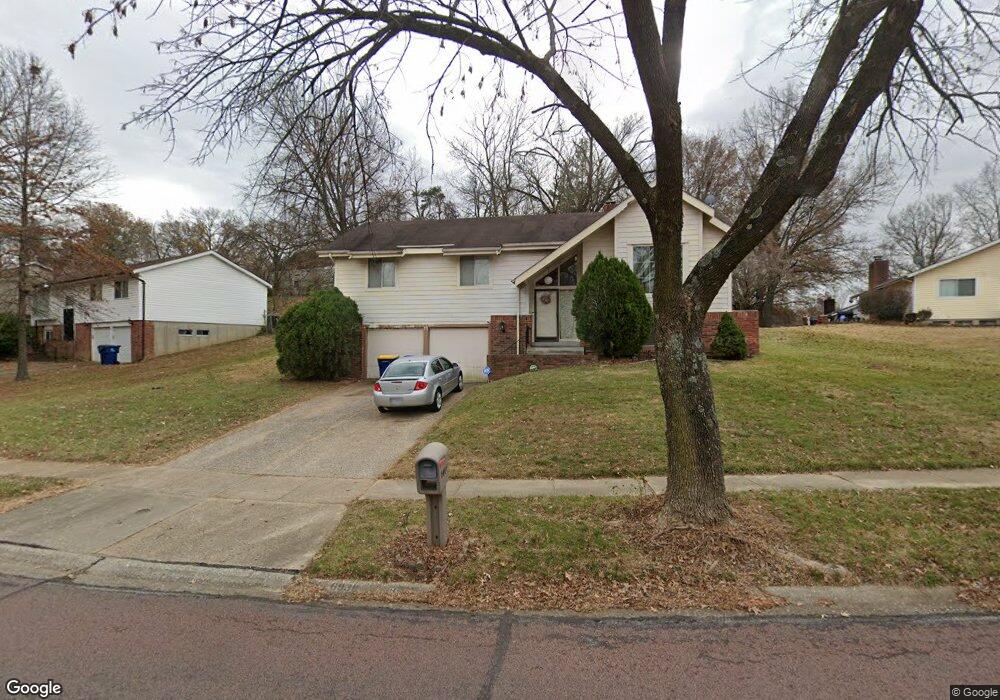
6938 Jamestown Way Dr Florissant, MO 63033
Estimated Value: $208,000 - $254,000
3
Beds
2
Baths
1,498
Sq Ft
$152/Sq Ft
Est. Value
About This Home
This home is located at 6938 Jamestown Way Dr, Florissant, MO 63033 and is currently estimated at $227,918, approximately $152 per square foot. 6938 Jamestown Way Dr is a home located in St. Louis County with nearby schools including Townsend Elementary School, Central Middle School, and Hazelwood Central High School.
Ownership History
Date
Name
Owned For
Owner Type
Purchase Details
Closed on
Mar 5, 2007
Sold by
Royal Stan R and Royal Francine
Bought by
Royal Francine
Current Estimated Value
Home Financials for this Owner
Home Financials are based on the most recent Mortgage that was taken out on this home.
Original Mortgage
$85,475
Interest Rate
6.25%
Mortgage Type
Stand Alone Refi Refinance Of Original Loan
Create a Home Valuation Report for This Property
The Home Valuation Report is an in-depth analysis detailing your home's value as well as a comparison with similar homes in the area
Home Values in the Area
Average Home Value in this Area
Purchase History
| Date | Buyer | Sale Price | Title Company |
|---|---|---|---|
| Royal Francine | -- | Old Republic Title |
Source: Public Records
Mortgage History
| Date | Status | Borrower | Loan Amount |
|---|---|---|---|
| Closed | Royal Francine | $85,475 |
Source: Public Records
Tax History Compared to Growth
Tax History
| Year | Tax Paid | Tax Assessment Tax Assessment Total Assessment is a certain percentage of the fair market value that is determined by local assessors to be the total taxable value of land and additions on the property. | Land | Improvement |
|---|---|---|---|---|
| 2025 | $3,056 | $35,980 | $4,480 | $31,500 |
| 2024 | $3,056 | $33,570 | $5,070 | $28,500 |
| 2023 | $3,056 | $33,570 | $5,070 | $28,500 |
| 2022 | $2,666 | $26,120 | $7,770 | $18,350 |
| 2021 | $2,524 | $26,120 | $7,770 | $18,350 |
| 2020 | $2,458 | $23,690 | $5,830 | $17,860 |
| 2019 | $2,418 | $23,690 | $5,830 | $17,860 |
| 2018 | $2,106 | $19,040 | $3,930 | $15,110 |
| 2017 | $2,103 | $19,040 | $3,930 | $15,110 |
| 2016 | $1,872 | $16,640 | $2,430 | $14,210 |
| 2015 | $1,829 | $16,640 | $2,430 | $14,210 |
| 2014 | $2,235 | $20,300 | $2,930 | $17,370 |
Source: Public Records
Map
Nearby Homes
- 6787 Lesli Mari Ct
- 6862 Foxbend Ct
- 6803 Foxbend Ct
- 12670 Verwood Dr
- 6646 Foothills Ct
- 12713 Partridge Run Dr
- 1828 Arrowpoint Dr
- 12845 Meadowdale Dr
- 12432 Quatre Dr
- 6665 Lakeside Hills Dr
- 12518 Woodstream Dr
- 6360 Silver Fox Dr
- 12831 Bellefontaine Rd
- 12435 Sea Lane Dr Unit 5
- 12225 Tarpon Dr
- 17 Nob Hill Dr
- 6470 White Cap Ln Unit D
- 12456 Sea Lane Dr Unit A
- 6587 Dolphin Cir E Unit 110B
- 1618 Clock Tower Dr
- 6944 Jamestown Way Dr
- 6926 Jamestown Way Dr
- 12591 Benham Rd
- 6943 Jamestown Way Dr
- 6950 Jamestown Way Dr
- 6920 Jamestown Way Dr
- 12801 Sunrise Ct E
- 12801 Sunrise East Ct
- 6931 Glenvale Ct
- 6956 Jamestown Way Dr
- 12808 Bright Oaks Ct
- 6914 Jamestown Way Dr
- 12807 Sunrise Ct E
- 12807 Sunrise East Ct
- 6925 Jamestown Way Dr
- 6911 Candlewick Way
- 6923 Candlewick Way
- 6962 Jamestown Way Dr
- 6925 Glenvale Ct
- 6919 Jamestown Way Dr