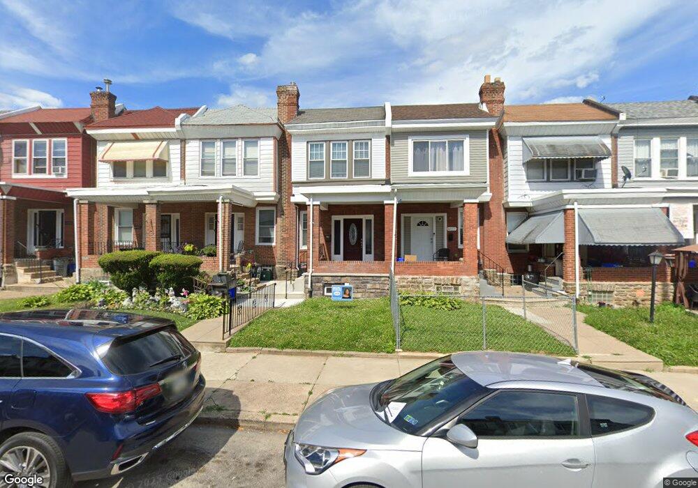
6939 Cedar Park Ave Philadelphia, PA 19138
West Oak Lane NeighborhoodEstimated Value: $222,000 - $268,000
3
Beds
3
Baths
1,314
Sq Ft
$185/Sq Ft
Est. Value
About This Home
This home is located at 6939 Cedar Park Ave, Philadelphia, PA 19138 and is currently estimated at $243,743, approximately $185 per square foot. 6939 Cedar Park Ave is a home located in Philadelphia County with nearby schools including William Rowen School, Gen. Louis Wagner Middle School, and Martin Luther King High School.
Ownership History
Date
Name
Owned For
Owner Type
Purchase Details
Closed on
Jan 21, 2021
Sold by
Ultra Rentals Llc
Bought by
Hds Llc
Current Estimated Value
Purchase Details
Closed on
Feb 26, 2004
Sold by
Mckie Sutton Jean and Estate Of Louise Graham
Bought by
Ultra Rentals Llc
Home Financials for this Owner
Home Financials are based on the most recent Mortgage that was taken out on this home.
Original Mortgage
$50,000
Interest Rate
5.65%
Mortgage Type
Purchase Money Mortgage
Create a Home Valuation Report for This Property
The Home Valuation Report is an in-depth analysis detailing your home's value as well as a comparison with similar homes in the area
Home Values in the Area
Average Home Value in this Area
Purchase History
| Date | Buyer | Sale Price | Title Company |
|---|---|---|---|
| Hds Llc | $103,000 | Springfield Abstract Inc | |
| Ultra Rentals Llc | $28,500 | -- |
Source: Public Records
Mortgage History
| Date | Status | Borrower | Loan Amount |
|---|---|---|---|
| Previous Owner | Ultra Rentals Llc | $50,000 |
Source: Public Records
Tax History Compared to Growth
Tax History
| Year | Tax Paid | Tax Assessment Tax Assessment Total Assessment is a certain percentage of the fair market value that is determined by local assessors to be the total taxable value of land and additions on the property. | Land | Improvement |
|---|---|---|---|---|
| 2025 | $2,182 | $263,000 | $52,600 | $210,400 |
| 2024 | $2,182 | $263,000 | $52,600 | $210,400 |
| 2023 | $2,182 | $155,900 | $31,180 | $124,720 |
| 2022 | $1,746 | $155,900 | $31,180 | $124,720 |
| 2021 | $1,746 | $0 | $0 | $0 |
| 2020 | $1,746 | $0 | $0 | $0 |
| 2019 | $1,823 | $0 | $0 | $0 |
| 2018 | $1,450 | $0 | $0 | $0 |
| 2017 | $1,450 | $0 | $0 | $0 |
| 2016 | $1,450 | $0 | $0 | $0 |
| 2015 | $1,388 | $0 | $0 | $0 |
| 2014 | -- | $103,600 | $10,200 | $93,400 |
| 2012 | -- | $15,552 | $2,799 | $12,753 |
Source: Public Records
Map
Nearby Homes
- 6944 Cedar Park Ave
- 6905 Forrest Ave
- 6908 Ogontz Ave
- 7001 Limekiln Pike
- 6869 Forrest Ave
- 6838 Ogontz Ave
- 1934 69th Ave
- 7092 Forrest Ave
- 2056 Eastburn Ave
- 2070 E Haines St
- 6733 N Woodstock St
- 6731 N Woodstock St
- 6732 Ogontz Ave
- 7349 E Walnut Ln
- 7277 E Walnut Ln
- 7159 N 20th St
- 6943 N 19th St
- 7206 Forrest Ave
- 7188 N Uber St
- 2061 Independence St
- 6937 Cedar Park Ave
- 6941 Cedar Park Ave
- 6943 Cedar Park Ave
- 6935 Cedar Park Ave
- 6933 Cedar Park Ave
- 6945 Cedar Park Ave
- 6947 Cedar Park Ave
- 6931 Cedar Park Ave
- 6949 Cedar Park Ave
- 6929 Cedar Park Ave
- 6951 Cedar Park Ave
- 6927 Cedar Park Ave
- 6953 Cedar Park Ave
- 6936 Forrest Ave
- 6925 Cedar Park Ave
- 6934 Forrest Ave
- 6942 Forrest Ave
- 6932 Forrest Ave
- 6938 Forrest Ave
- 6930 Forrest Ave