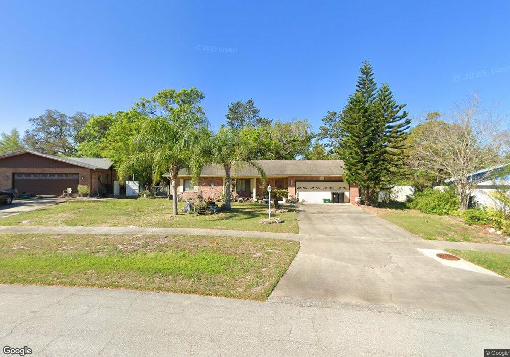
694 Branch Dr Port Orange, FL 32127
Port Orange West NeighborhoodEstimated Value: $292,000 - $338,000
2
Beds
2
Baths
1,438
Sq Ft
$214/Sq Ft
Est. Value
About This Home
This home is located at 694 Branch Dr, Port Orange, FL 32127 and is currently estimated at $307,404, approximately $213 per square foot. 694 Branch Dr is a home located in Volusia County with nearby schools including Sweetwater Elementary School, Creekside Middle School, and Spruce Creek High School.
Ownership History
Date
Name
Owned For
Owner Type
Purchase Details
Closed on
Dec 29, 1997
Sold by
Nalle Paul L and Nalle Margaret R
Bought by
Manser Dorothy May
Current Estimated Value
Home Financials for this Owner
Home Financials are based on the most recent Mortgage that was taken out on this home.
Original Mortgage
$30,000
Outstanding Balance
$5,234
Interest Rate
7.2%
Estimated Equity
$302,170
Purchase Details
Closed on
Apr 15, 1984
Bought by
Manser Dorothy May
Purchase Details
Closed on
Jan 15, 1984
Bought by
Manser Dorothy May
Purchase Details
Closed on
Dec 15, 1983
Bought by
Manser Dorothy May
Purchase Details
Closed on
Apr 15, 1983
Bought by
Manser Dorothy May
Create a Home Valuation Report for This Property
The Home Valuation Report is an in-depth analysis detailing your home's value as well as a comparison with similar homes in the area
Home Values in the Area
Average Home Value in this Area
Purchase History
| Date | Buyer | Sale Price | Title Company |
|---|---|---|---|
| Manser Dorothy May | $82,000 | -- | |
| Manser Dorothy May | $60,900 | -- | |
| Manser Dorothy May | $14,500 | -- | |
| Manser Dorothy May | $100 | -- | |
| Manser Dorothy May | $100 | -- |
Source: Public Records
Mortgage History
| Date | Status | Borrower | Loan Amount |
|---|---|---|---|
| Open | Manser Dorothy May | $30,000 |
Source: Public Records
Tax History Compared to Growth
Tax History
| Year | Tax Paid | Tax Assessment Tax Assessment Total Assessment is a certain percentage of the fair market value that is determined by local assessors to be the total taxable value of land and additions on the property. | Land | Improvement |
|---|---|---|---|---|
| 2025 | $832 | $280,403 | -- | -- |
| 2024 | $832 | $272,501 | $76,393 | $196,108 |
| 2023 | $832 | $111,656 | $0 | $0 |
| 2022 | $847 | $108,404 | $0 | $0 |
| 2021 | $828 | $105,247 | $0 | $0 |
| 2020 | $804 | $103,794 | $0 | $0 |
| 2019 | $740 | $101,460 | $0 | $0 |
| 2018 | $730 | $99,568 | $0 | $0 |
| 2017 | $722 | $97,520 | $0 | $0 |
| 2016 | $724 | $95,514 | $0 | $0 |
| 2015 | -- | $94,850 | $0 | $0 |
| 2014 | -- | $94,097 | $0 | $0 |
Source: Public Records
Map
Nearby Homes
- 771 Tumblebrook Dr
- 769 Osprey Dr
- 653 Sweetwood Dr
- 761 Tumblebrook Dr
- 5949 Kendrew Dr
- 749 Tumblebrook Dr
- 5836 Spruce Creek Woods Dr
- 714 Hawks Ridge Rd
- 5936 Boggs Ford Rd
- 5953 Boggs Ford Rd
- 823 Bayridge Ln
- 5822 Spruce Creek Woods Dr
- 740 English Oaks Dr
- 5994 Seminole Woods Dr
- 739 English Oaks Dr
- 783 Highgarden Dr
- 732 English Oaks Dr
- 6012 Sawgrass Point Dr
- 725 English Oaks Dr
- 5935 Shady Creek Ln
- 696 Branch Dr
- 692 Branch Dr
- 698 Branch Dr
- 690 Branch Dr
- 691 Branch Dr
- 700 Branch Dr
- 688 Branch Dr
- 699 Branch Dr
- 751 Hawks Ridge Rd
- 687 Branch Dr
- 686 Branch Dr
- 702 Branch Dr
- 701 Branch Dr
- 749 Hawks Ridge Rd
- 683 Branch Dr
- 755 Hawks Ridge Rd
- 684 Branch Dr
- 775 Tumblebrook Dr
- 704 Branch Dr
- 747 Hawks Ridge Rd