Estimated Value: $543,000 - $766,000
4
Beds
3
Baths
4,388
Sq Ft
$145/Sq Ft
Est. Value
About This Home
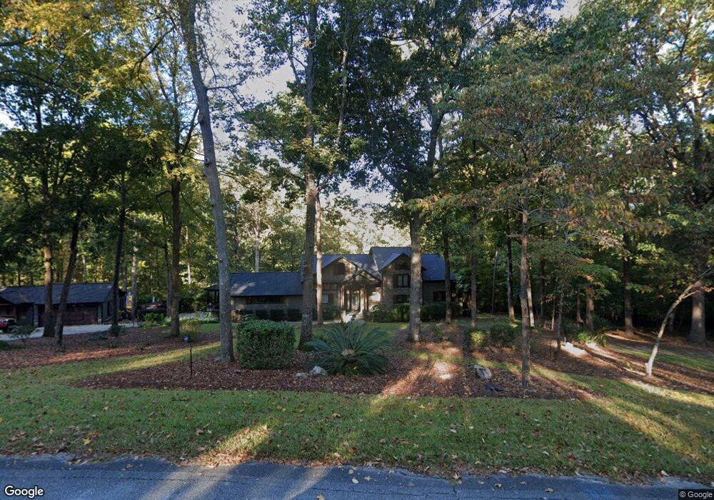
This home is located at 694 Deerwood Way, Evans, GA 30809 and is currently estimated at $636,709, approximately $145 per square foot. 694 Deerwood Way is a home located in Columbia County with nearby schools including River Ridge Elementary School, Riverside Middle School, and Lakeside High School.
Ownership History
Date
Name
Owned For
Owner Type
Purchase Details
Closed on
May 31, 2005
Sold by
Wells Fargo Bank Minnesota
Bought by
Norwood James E and Norwood Michelle L
Current Estimated Value
Home Financials for this Owner
Home Financials are based on the most recent Mortgage that was taken out on this home.
Original Mortgage
$242,250
Outstanding Balance
$124,847
Interest Rate
5.66%
Mortgage Type
New Conventional
Estimated Equity
$511,862
Purchase Details
Closed on
Sep 7, 2004
Sold by
Morris Betty W
Bought by
Wells Fargo Bank Minnesota Na and Fund America Investors Trust 1998-Ncmi C
Create a Home Valuation Report for This Property
The Home Valuation Report is an in-depth analysis detailing your home's value as well as a comparison with similar homes in the area
Home Values in the Area
Average Home Value in this Area
Purchase History
| Date | Buyer | Sale Price | Title Company |
|---|---|---|---|
| Norwood James E | $255,000 | -- | |
| Wells Fargo Bank Minnesota Na | $1,750,000 | -- |
Source: Public Records
Mortgage History
| Date | Status | Borrower | Loan Amount |
|---|---|---|---|
| Open | Norwood James E | $242,250 |
Source: Public Records
Tax History Compared to Growth
Tax History
| Year | Tax Paid | Tax Assessment Tax Assessment Total Assessment is a certain percentage of the fair market value that is determined by local assessors to be the total taxable value of land and additions on the property. | Land | Improvement |
|---|---|---|---|---|
| 2025 | $3,136 | $250,842 | $55,316 | $195,526 |
| 2024 | $2,808 | $227,069 | $42,179 | $184,890 |
| 2023 | $2,808 | $221,241 | $42,144 | $179,097 |
| 2022 | $2,698 | $203,355 | $42,144 | $161,211 |
| 2021 | $5,184 | $188,577 | $42,144 | $146,433 |
| 2020 | $5,420 | $193,188 | $41,154 | $152,034 |
| 2019 | $4,729 | $168,285 | $41,149 | $127,136 |
| 2018 | $4,838 | $171,626 | $41,144 | $130,482 |
| 2017 | $4,855 | $171,620 | $41,141 | $130,479 |
| 2016 | $4,544 | $166,460 | $41,115 | $125,345 |
| 2015 | $3,967 | $144,769 | $35,071 | $109,698 |
| 2014 | $3,824 | $137,755 | $35,061 | $102,694 |
Source: Public Records
Map
Nearby Homes
- 656 Deerwood Way
- 800 Sparkleberry Rd
- 802 Sparkleberry Rd
- 34 Plantation Hills Dr
- 14 Plantation Hills Dr
- 4489 Woodberry Ct
- 1 Woodbridge Cir
- 1 Wood Cir
- 829 Woodberry Dr
- 4629 Silver Lake Dr
- 2975 Rosewood Dr
- 726 Whitney Shoals Rd
- 4614 Stoneridge Ct
- 812 Cape Cod Ct
- 819 Cape Cod Ct
- 787 Springbrook Cir
- 4653 Washington Rd
- 322 Sandhills Ln
- 303 N Sandhills Ln
- 646 Wellington Dr
- 690 Deerwood Way
- 868 Deerwood Cir
- 864 Deerwood Cir
- 680 Deerwood Way
- 874 Deerwood Cir
- 871 Deerwood Cir
- 785 Rocky Branch Ln
- 781 Rocky Branch Ln
- 689 Deerwood Way
- 787 Rocky Branch Ln
- 877 Deerwood Cir
- 771 Rocky Branch Ln
- 775 Rocky Branch Ln
- 878 Deerwood Cir
- 865 Deerwood Cir
- 675 Deerwood Way
- 854 Deerwood Cir
- 676 Deerwood Way
- 789 Rocky Branch Ln
- 769 Rocky Branch Ln