Estimated Value: $241,000 - $261,000
3
Beds
1
Bath
1,212
Sq Ft
$206/Sq Ft
Est. Value
About This Home
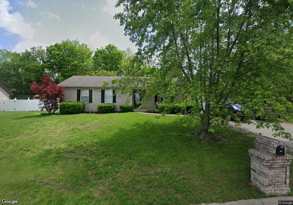
This home is located at 694 Lindsey Dr, Union, MO 63084 and is currently estimated at $249,214, approximately $205 per square foot. 694 Lindsey Dr is a home located in Franklin County with nearby schools including Union High School and Immaculate Conception School.
Ownership History
Date
Name
Owned For
Owner Type
Purchase Details
Closed on
Jan 20, 2014
Sold by
D&S Properties Llc
Bought by
Carroll Matthew and Carroll Lawrence
Current Estimated Value
Purchase Details
Closed on
Apr 7, 2006
Sold by
Emmons Rodney and Emmons Linda
Bought by
Carroll Brenda and Carroll Hurl L
Create a Home Valuation Report for This Property
The Home Valuation Report is an in-depth analysis detailing your home's value as well as a comparison with similar homes in the area
Home Values in the Area
Average Home Value in this Area
Purchase History
| Date | Buyer | Sale Price | Title Company |
|---|---|---|---|
| Carroll Matthew | -- | -- | |
| Carroll Brenda | -- | None Available |
Source: Public Records
Tax History
| Year | Tax Paid | Tax Assessment Tax Assessment Total Assessment is a certain percentage of the fair market value that is determined by local assessors to be the total taxable value of land and additions on the property. | Land | Improvement |
|---|---|---|---|---|
| 2025 | $1,688 | $33,229 | $0 | $0 |
| 2024 | $1,688 | $28,065 | $0 | $0 |
| 2023 | $1,691 | $28,065 | $0 | $0 |
| 2022 | $1,858 | $30,765 | $0 | $0 |
| 2021 | $1,861 | $30,765 | $0 | $0 |
| 2020 | $1,704 | $27,710 | $0 | $0 |
| 2019 | $1,699 | $27,710 | $0 | $0 |
| 2018 | $1,580 | $27,026 | $0 | $0 |
| 2017 | $1,584 | $27,026 | $0 | $0 |
| 2016 | $1,504 | $25,091 | $0 | $0 |
| 2015 | $1,480 | $25,091 | $0 | $0 |
| 2014 | $1,493 | $25,299 | $0 | $0 |
Source: Public Records
Map
Nearby Homes
- 26 & 30 Ridge Point Meadows
- 626 Lindsey Dr
- 702 Clearview Dr Unit 1
- 0 Lot 5 Clearview Dr Unit 19010510
- 0 Lot 4 Clearview Dr Unit 19010507
- 0 Lot 6 Clearview Dr Unit 19010511
- 0 Clearview Unit 19010495
- 154 Joel Ave
- 3 Hoffert St
- 408 Hall Ave
- 914 W State St
- 613 W State St
- 54 Hickory Cir
- 613 S Jefferson Ave
- 413 W State St
- 21 Forest Ln
- 0 Oak Grove School Rd
- 000 Shawneetown Ford Spur 4` Unit Lot
- 000 Shawneetown Ford Spur Unit Lot 2
- 1016 Westmoreland Blvd
Your Personal Tour Guide
Ask me questions while you tour the home.