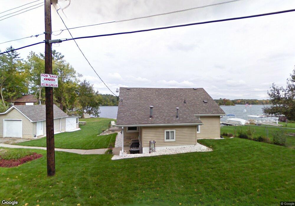
694 Manotic Leonard, MI 48367
Estimated Value: $388,000 - $541,000
About This Home
This home is located at 694 Manotic, Leonard, MI 48367 and is currently estimated at $439,256, approximately $403 per square foot. 694 Manotic is a home with nearby schools including Leonard Elementary School, Oxford Middle School, and Oxford High School.
Ownership History
We collect this data history from publicly available records. To have your information removed, we recommend requesting removal directly through your county’s website.
Purchase Details
Purchase Details
Purchase Details
Purchase Details
Purchase Details
Home Values in the Area
Average Home Value in this Area
Purchase History
We collect this data history from publicly available records. To have your information removed, we recommend requesting removal directly through your county’s website.
| Date | Buyer | Sale Price | Title Company |
|---|---|---|---|
| -- | Amrock Llc | ||
| $375,000 | None Available | ||
| $175,000 | Century Title Company | ||
| -- | None Available | ||
| -- | -- |
Tax History
We collect this data history from publicly available records. To have your information removed, we recommend requesting removal directly through your county’s website.
| Year | Tax Paid | Tax Assessment Tax Assessment Total Assessment is a certain percentage of the fair market value that is determined by local assessors to be the total taxable value of land and additions on the property. | Land | Improvement |
|---|---|---|---|---|
| 2025 | $5,934 | $164,170 | $0 | $0 |
| 2024 | $5,781 | $148,410 | $0 | $0 |
| 2023 | $5,510 | $145,730 | $0 | $0 |
| 2022 | $7,294 | $131,750 | $0 | $0 |
| 2021 | $6,818 | $133,490 | $0 | $0 |
| 2020 | $5,149 | $127,950 | $0 | $0 |
| 2019 | $6,611 | $123,070 | $0 | $0 |
| 2018 | $7,053 | $133,370 | $0 | $0 |
| 2017 | $5,466 | $133,370 | $0 | $0 |
| 2016 | $5,414 | $130,600 | $0 | $0 |
| 2015 | -- | $130,860 | $0 | $0 |
| 2014 | -- | $123,480 | $0 | $0 |
| 2011 | -- | $112,830 | $0 | $0 |
Map
- 781 Windy Fields Ct
- 1469 Milmine Rd
- 11.01 Acres Vacant L Knights Bridge
- 2.05 Acres VL - Knights Bridge
- 4.23 Acres VL - Knights Bridge
- 2.02 Acres VL - Knights Bridge
- 000 Knights Bridge
- 0000 Round Lake Ln
- 2356 Rochester Rd
- 1933 Shane Ct
- 2166 Heidi Dr
- 2212 Heidi Dr
- 202 Donna Mae
- 270 N Rochester Rd
- 2280 Heidi Dr
- 2185 Heidi Dr
- 433 Rochester Rd
- 0 Pond Unit 20251014765
- 4 Ashley Ln
- 2637 White Pine Dr
Ask me questions while you tour the home.