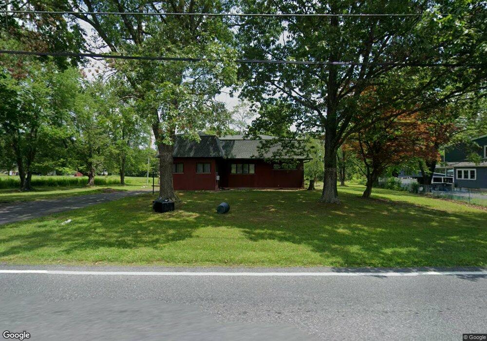
694 Mill Rd Lehighton, PA 18235
Estimated Value: $181,000 - $326,000
2
Beds
1
Bath
1,345
Sq Ft
$194/Sq Ft
Est. Value
About This Home
This home is located at 694 Mill Rd, Lehighton, PA 18235 and is currently estimated at $261,168, approximately $194 per square foot. 694 Mill Rd is a home located in Carbon County with nearby schools including Lehighton Area High School.
Ownership History
Date
Name
Owned For
Owner Type
Purchase Details
Closed on
Mar 14, 2022
Sold by
Fritz Loise P
Bought by
Pollock Bryan D
Current Estimated Value
Home Financials for this Owner
Home Financials are based on the most recent Mortgage that was taken out on this home.
Original Mortgage
$75,605
Interest Rate
3.92%
Mortgage Type
FHA
Create a Home Valuation Report for This Property
The Home Valuation Report is an in-depth analysis detailing your home's value as well as a comparison with similar homes in the area
Home Values in the Area
Average Home Value in this Area
Purchase History
| Date | Buyer | Sale Price | Title Company |
|---|---|---|---|
| Pollock Bryan D | $77,000 | Carbon Search Settlement Servi |
Source: Public Records
Mortgage History
| Date | Status | Borrower | Loan Amount |
|---|---|---|---|
| Previous Owner | Pollock Bryan D | $75,605 |
Source: Public Records
Tax History Compared to Growth
Tax History
| Year | Tax Paid | Tax Assessment Tax Assessment Total Assessment is a certain percentage of the fair market value that is determined by local assessors to be the total taxable value of land and additions on the property. | Land | Improvement |
|---|---|---|---|---|
| 2025 | $4,583 | $59,900 | $9,750 | $50,150 |
| 2024 | $4,404 | $59,900 | $9,750 | $50,150 |
| 2023 | $4,359 | $59,900 | $9,750 | $50,150 |
| 2022 | $4,299 | $59,900 | $9,750 | $50,150 |
| 2021 | $4,171 | $59,900 | $9,750 | $50,150 |
| 2020 | $4,066 | $59,900 | $9,750 | $50,150 |
| 2019 | $3,856 | $59,900 | $9,750 | $50,150 |
| 2018 | $3,811 | $59,900 | $9,750 | $50,150 |
| 2017 | $3,811 | $59,900 | $9,750 | $50,150 |
| 2016 | -- | $59,900 | $9,750 | $50,150 |
| 2015 | -- | $59,900 | $9,750 | $50,150 |
| 2014 | -- | $59,900 | $9,750 | $50,150 |
Source: Public Records
Map
Nearby Homes
- 1772 Mahoning Dr W
- 134 Huron Dr
- TBD Heron Ct
- 0 Huron Ct Unit Lot 06
- 0 Beacon Pointe Plan at Summit Ridge
- 0 Blue Ridge Plan at Summit Ridge Unit PACC2005476
- 0 Georgia Mae Plan at Summit Ridge Unit PACC2005482
- 0 Pleasant View Dr Unit Lot 02 758864
- 0 Pleasant View Dr Unit Lot 73
- 0 Pleasant View Dr Unit Lot 67 765248
- Abbey Plan at Summit Ridge
- Beacon Pointe Plan at Summit Ridge
- White Oak Plan at Summit Ridge
- Black Cherry Plan at Summit Ridge
- Blue Ridge Plan at Summit Ridge
- Copper Beech Plan at Summit Ridge
- Sweet Birch Plan at Summit Ridge
- Georgia Mae Plan at Summit Ridge
- Emily Plan at Summit Ridge
- 0 Abbey Plan at Summit Ridge Unit PACC2005470
- 672 Mill Rd
- 767 Mill Rd
- 2119 Mahoning Dr W
- 694 Mahoning Dr W
- 804 Mill Rd
- 778 Mill Rd
- 785 Mill Rd
- 2081 Mahoning Dr W
- 2201 Mahoning Dr W
- 570 Mill Rd
- 2219 Mahoning Dr W
- 2186 Mahoning Dr W
- 543 Mill Rd
- 2210 Mahoning Dr W
- 2239 Mahoning Dr W
- 2228 Mahoning Dr W
- 0 Mahoning Dr Unit 4-1501
- 2285 Mahoning Dr W
- 2264 Mahoning Dr W
- 2307 Mahoning Dr W