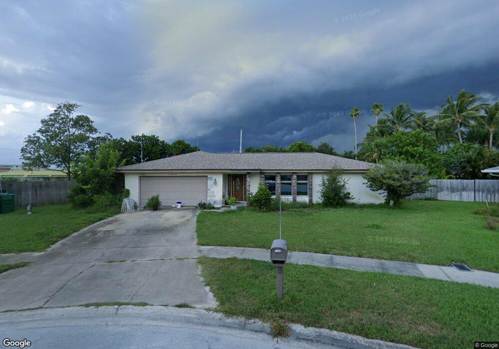
694 Trinidad Ct Satellite Beach, FL 32937
Estimated Value: $559,000 - $654,000
3
Beds
2
Baths
1,852
Sq Ft
$328/Sq Ft
Est. Value
About This Home
This home is located at 694 Trinidad Ct, Satellite Beach, FL 32937 and is currently estimated at $608,329, approximately $328 per square foot. 694 Trinidad Ct is a home located in Brevard County with nearby schools including Ocean Breeze Elementary School, Satellite Senior High School, and DeLaura Middle School.
Ownership History
Date
Name
Owned For
Owner Type
Purchase Details
Closed on
Aug 23, 1993
Sold by
Peine Leslie A and Peine Beryl A
Bought by
Blair James E and Blair Judith S
Current Estimated Value
Home Financials for this Owner
Home Financials are based on the most recent Mortgage that was taken out on this home.
Original Mortgage
$141,243
Interest Rate
7.18%
Purchase Details
Closed on
Aug 2, 1993
Sold by
Ober Eugene E and Ober Dorothy M
Bought by
Peine Leslie A and Peine Beryl A
Home Financials for this Owner
Home Financials are based on the most recent Mortgage that was taken out on this home.
Original Mortgage
$141,243
Interest Rate
7.18%
Create a Home Valuation Report for This Property
The Home Valuation Report is an in-depth analysis detailing your home's value as well as a comparison with similar homes in the area
Home Values in the Area
Average Home Value in this Area
Purchase History
| Date | Buyer | Sale Price | Title Company |
|---|---|---|---|
| Blair James E | $139,500 | -- | |
| Peine Leslie A | -- | -- |
Source: Public Records
Mortgage History
| Date | Status | Borrower | Loan Amount |
|---|---|---|---|
| Closed | Blair James E | $141,243 |
Source: Public Records
Tax History Compared to Growth
Tax History
| Year | Tax Paid | Tax Assessment Tax Assessment Total Assessment is a certain percentage of the fair market value that is determined by local assessors to be the total taxable value of land and additions on the property. | Land | Improvement |
|---|---|---|---|---|
| 2025 | $2,686 | $179,190 | -- | -- |
| 2024 | $2,639 | $174,140 | -- | -- |
| 2023 | $2,639 | $169,070 | $0 | $0 |
| 2022 | $2,469 | $164,150 | $0 | $0 |
| 2021 | $2,538 | $159,370 | $0 | $0 |
| 2020 | $2,528 | $157,170 | $0 | $0 |
| 2019 | $2,508 | $153,640 | $0 | $0 |
| 2018 | $2,507 | $150,780 | $0 | $0 |
| 2017 | $2,340 | $147,680 | $0 | $0 |
| 2016 | $2,345 | $144,650 | $102,000 | $42,650 |
| 2015 | $2,400 | $143,650 | $90,000 | $53,650 |
| 2014 | $2,402 | $142,510 | $84,000 | $58,510 |
Source: Public Records
Map
Nearby Homes
- 690 Trinidad Ct
- 620 Jamaica Blvd
- 435 Desoto Pkwy
- 43 Anchor Dr
- 699 Bimini Rd
- 431 E Amherst Cir
- 106 Tradewinds Dr Unit 106
- 527 Summerset Ct
- 138 Windward Way
- 408 Hawthorne Ct
- 7 Inwood Way
- 235 S Marco Way
- 305 Wimico Dr
- 215 S Robert Way
- 426 Hawthorne Ct Unit G2
- 443 Hawthorne Ct
- 142 Lansing Island Dr
- 210 Lynn Ave
- 4 Colonial Way
- 380 Cherry Ct
- 695 Trinidad Ct
- 695 Caribbean Rd
- 693 Caribbean Rd
- 688 Trinidad Ct
- 693 Trinidad Ct
- 685 Trinidad Ct
- 687 Caribbean Rd
- 684 Trinidad Ct
- 683 Trinidad Ct
- 694 Caribbean Rd
- 683 Caribbean Rd
- 455 Trinidad Dr
- 475 Trinidad Dr
- 465 Trinidad Dr
- 690 Caribbean Rd
- 485 Trinidad Dr
- 126 Tomahawk Dr Unit 4
- 126 Tomahawk Dr
- 140 Tomahawk Dr
- 140 Tomahawk Dr Unit 1-48