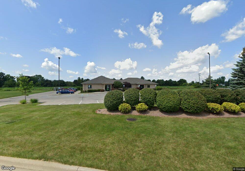
6940 Dixie Hwy Bridge Port, MI 48722
Estimated Value: $1,246,886
--
Bed
--
Bath
2,160
Sq Ft
$577/Sq Ft
Est. Value
About This Home
This home is located at 6940 Dixie Hwy, Bridge Port, MI 48722 and is currently estimated at $1,246,886, approximately $577 per square foot. 6940 Dixie Hwy is a home located in Saginaw County with nearby schools including Thomas White School, Iuka Elementary School, and Martin G. Atkins Elementary School.
Ownership History
Date
Name
Owned For
Owner Type
Purchase Details
Closed on
Jul 9, 2018
Sold by
6940 Dixie Hwy Llc
Bought by
Junction Road Llc
Current Estimated Value
Purchase Details
Closed on
Oct 19, 2012
Sold by
Junction Road Llc
Bought by
6940 Dixie Highway Llc
Purchase Details
Closed on
Oct 18, 2012
Sold by
John G Hoffmann Development Llc
Bought by
Junction Road Llc
Purchase Details
Closed on
Apr 26, 2012
Sold by
Pietrus Henryk and Pietrus Teresa
Bought by
Junction Road Llc
Purchase Details
Closed on
Apr 4, 2001
Sold by
Hoffmann John G
Bought by
Pietrus Henry K and Pietrus Teresa
Create a Home Valuation Report for This Property
The Home Valuation Report is an in-depth analysis detailing your home's value as well as a comparison with similar homes in the area
Home Values in the Area
Average Home Value in this Area
Purchase History
| Date | Buyer | Sale Price | Title Company |
|---|---|---|---|
| Junction Road Llc | -- | -- | |
| 6940 Dixie Highway Llc | -- | -- | |
| Junction Road Llc | -- | -- | |
| Junction Road Llc | $450,000 | -- | |
| Pietrus Henry K | $108,000 | -- |
Source: Public Records
Tax History Compared to Growth
Tax History
| Year | Tax Paid | Tax Assessment Tax Assessment Total Assessment is a certain percentage of the fair market value that is determined by local assessors to be the total taxable value of land and additions on the property. | Land | Improvement |
|---|---|---|---|---|
| 2025 | $17,834 | $366,000 | $0 | $0 |
| 2024 | $3,593 | $370,500 | $0 | $0 |
| 2023 | $3,422 | $367,500 | $0 | $0 |
| 2022 | $15,580 | $316,500 | $0 | $0 |
| 2021 | $14,608 | $288,000 | $0 | $0 |
| 2020 | $14,351 | $285,100 | $0 | $0 |
| 2019 | $14,042 | $278,700 | $83,100 | $195,600 |
| 2018 | $2,437 | $242,400 | $0 | $0 |
| 2017 | $10,515 | $231,600 | $0 | $0 |
| 2016 | $11,078 | $228,300 | $0 | $0 |
| 2014 | -- | $218,400 | $0 | $132,000 |
| 2013 | -- | $208,400 | $0 | $0 |
Source: Public Records
Map
Nearby Homes
- Parcel E W Rolling Hills Dr
- Parcel B W Rolling Hills Dr
- Parcel D W Rolling Hills Dr
- Parcel F W Rolling Hills Dr
- Parcel C W Rolling Hills Dr
- 6605 Bridgeport Hwy
- 5885 McGrandy Rd
- 4333 Riverview Dr
- 6412 Tin Lizzy Ln
- 7720 Rookway Rd
- 5205 Baker Rd
- 5400 Maple Rd
- 4719 Baker Rd
- 3875 Curtis Rd
- 6250 Dixie Hwy
- VL Fort Rd
- 3838 Sherman St
- 7965 Dixie Hwy
- 3927 State St
- 7110 Townline Rd
- 6917 Dixie Hwy
- 6885 Dixie Hwy
- 6879 Dixie Hwy
- 0 Rolling Hills - Dr E Unit 30014645
- 0 Rolling Hills - D Dr Unit 30014643
- 0 Rolling Hills - C Dr Unit 30014642
- 0 Rolling Hills - B Dr Unit 30014640
- 0 Rolling Hills - A Dr Unit 30014635
- 0 Rolling Hills - H Dr Unit 30014675
- 0 Rolling Hills - F Dr Unit 30014672
- 0 W Rolling Hills Dr
- 0 W Rolling Hills Dr
- 6875 Dixie Hwy
- 6865 Dixie Hwy
- 6817 Dixie Hwy
- 7000 Dixie Hwy
- 7000 Dixie Hwy
- 7004 Dixie Hwy
- 6817 Dixie Hwy
- 6107 Junction Rd