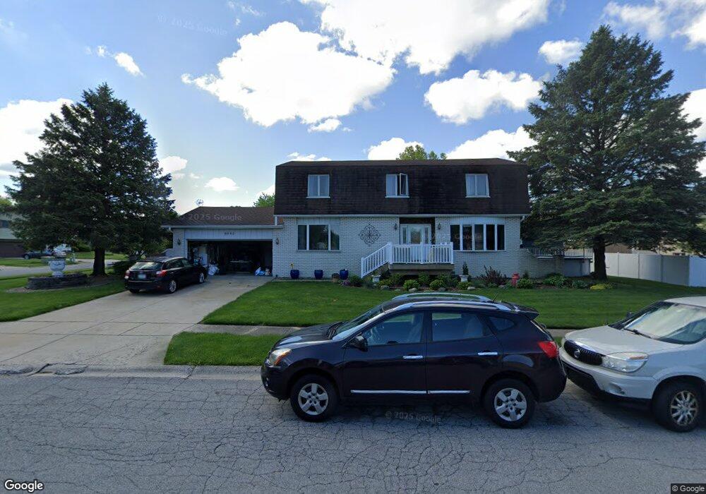
6943 Huron Ave Portage, IN 46368
Estimated Value: $298,000 - $334,000
4
Beds
3
Baths
2,408
Sq Ft
$131/Sq Ft
Est. Value
About This Home
This home is located at 6943 Huron Ave, Portage, IN 46368 and is currently estimated at $316,366, approximately $131 per square foot. 6943 Huron Ave is a home located in Porter County with nearby schools including Ethel R Jones Elementary School, Willowcreek Middle School, and Portage High School.
Ownership History
Date
Name
Owned For
Owner Type
Purchase Details
Closed on
May 30, 2008
Sold by
Moreno Jose R
Bought by
Moreno Jose R and Moreno Hortencia
Current Estimated Value
Purchase Details
Closed on
Apr 26, 2007
Sold by
Paviadakis Elias and Paviadakis Maria
Bought by
Moreno Jose R
Home Financials for this Owner
Home Financials are based on the most recent Mortgage that was taken out on this home.
Original Mortgage
$188,100
Outstanding Balance
$114,603
Interest Rate
6.2%
Mortgage Type
Purchase Money Mortgage
Estimated Equity
$201,763
Create a Home Valuation Report for This Property
The Home Valuation Report is an in-depth analysis detailing your home's value as well as a comparison with similar homes in the area
Home Values in the Area
Average Home Value in this Area
Purchase History
| Date | Buyer | Sale Price | Title Company |
|---|---|---|---|
| Moreno Jose R | -- | Indiana Title Network Co | |
| Moreno Jose R | -- | Indiana Title Network Co |
Source: Public Records
Mortgage History
| Date | Status | Borrower | Loan Amount |
|---|---|---|---|
| Open | Moreno Jose R | $188,100 |
Source: Public Records
Tax History Compared to Growth
Tax History
| Year | Tax Paid | Tax Assessment Tax Assessment Total Assessment is a certain percentage of the fair market value that is determined by local assessors to be the total taxable value of land and additions on the property. | Land | Improvement |
|---|---|---|---|---|
| 2024 | $2,963 | $300,800 | $39,200 | $261,600 |
| 2023 | $2,943 | $291,900 | $37,500 | $254,400 |
| 2022 | $2,729 | $274,800 | $37,500 | $237,300 |
| 2021 | $2,362 | $236,300 | $37,500 | $198,800 |
| 2020 | $2,095 | $210,000 | $34,100 | $175,900 |
| 2019 | $2,052 | $206,000 | $34,100 | $171,900 |
| 2018 | $2,131 | $204,200 | $34,100 | $170,100 |
| 2017 | $2,059 | $197,100 | $34,100 | $163,000 |
| 2016 | $1,875 | $178,300 | $34,800 | $143,500 |
| 2014 | $1,874 | $177,500 | $33,800 | $143,700 |
| 2013 | -- | $165,000 | $34,600 | $130,400 |
Source: Public Records
Map
Nearby Homes
- 2419 Orange St
- Tbd- 60.04 Creasy St
- 2375 Arrow St
- 2528 Mccool Rd
- 2550 Mccool Rd
- 2176 Mccool Rd
- 2168 Austin St
- TBD Lenburg Rd
- 0-TBD Lenburg Rd
- 6665 Lakewood Ave
- 6728 Joseph Ave
- 6697 Federal Ave
- 6654 Hawthorne Ave
- 2262 Rodeo St
- 2191 Hamilton St
- 2829 Cheryl St
- 2065 Jefferson St
- 6698 Monument Ave
- 2408 Doretta St
- 1935 Samuelson Rd
- 2418 Niagara St
- 6931 Huron Ave
- 2411 Ontario St
- 2424 Niagara St
- 6938 Huron Ave
- 2405 Niagara St
- 2411 Niagara St
- 6930 Huron Ave
- 2425 Ontario St
- 2397 Niagara St
- 6952 Huron Ave
- 2421 Niagara St
- 2434 Niagara St
- 6924 Huron Ave
- 2433 Ontario St
- 2412 Ontario St
- 2429 Niagara St
- 2420 Ontario St
- 2442 Niagara St
- 6912 Huron Ave