Estimated Value: $229,000 - $270,000
3
Beds
2
Baths
1,100
Sq Ft
$231/Sq Ft
Est. Value
About This Home
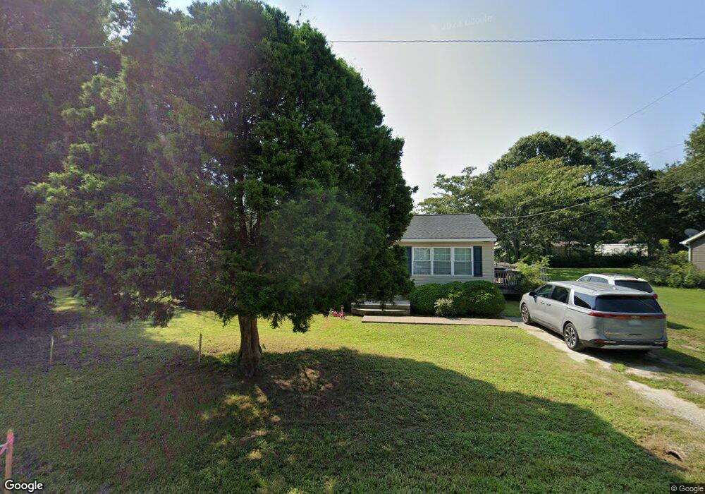
This home is located at 6946 Michael Ln, Hayes, VA 23072 and is currently estimated at $253,845, approximately $230 per square foot. 6946 Michael Ln is a home located in Gloucester County with nearby schools including Abingdon Elementary School, Page Middle School, and Gloucester High School.
Ownership History
Date
Name
Owned For
Owner Type
Purchase Details
Closed on
Aug 31, 2010
Sold by
Henry Michael and Henry Marian B
Bought by
Henry Nicolas M and Henry Rachel M
Current Estimated Value
Home Financials for this Owner
Home Financials are based on the most recent Mortgage that was taken out on this home.
Original Mortgage
$143,073
Outstanding Balance
$94,633
Interest Rate
4.55%
Mortgage Type
FHA
Estimated Equity
$159,212
Create a Home Valuation Report for This Property
The Home Valuation Report is an in-depth analysis detailing your home's value as well as a comparison with similar homes in the area
Home Values in the Area
Average Home Value in this Area
Purchase History
| Date | Buyer | Sale Price | Title Company |
|---|---|---|---|
| Henry Nicolas M | $145,000 | -- |
Source: Public Records
Mortgage History
| Date | Status | Borrower | Loan Amount |
|---|---|---|---|
| Open | Henry Nicolas M | $143,073 |
Source: Public Records
Tax History
| Year | Tax Paid | Tax Assessment Tax Assessment Total Assessment is a certain percentage of the fair market value that is determined by local assessors to be the total taxable value of land and additions on the property. | Land | Improvement |
|---|---|---|---|---|
| 2025 | $1,176 | $191,530 | $50,830 | $140,700 |
| 2024 | $1,176 | $191,530 | $50,830 | $140,700 |
| 2023 | $1,117 | $191,530 | $50,830 | $140,700 |
| 2022 | $1,000 | $137,990 | $54,040 | $83,950 |
| 2021 | $959 | $137,990 | $54,040 | $83,950 |
| 2020 | $959 | $137,990 | $54,040 | $83,950 |
| 2019 | $932 | $134,070 | $56,120 | $77,950 |
| 2017 | $933 | $134,070 | $56,120 | $77,950 |
| 2016 | $964 | $138,740 | $56,120 | $82,620 |
| 2015 | $943 | $162,800 | $58,000 | $104,800 |
| 2014 | $1,058 | $162,800 | $58,000 | $104,800 |
Source: Public Records
Map
Nearby Homes
- 6926 Colemans Crossing Ave
- 6936 Fields Landing Rd
- 6847 Williams Landing Rd
- 3044 Hughes Ln
- 6972 Crewe Rd
- 3035 Hughes Ln
- 2970 Wendy Ct
- 6967 Woodsville Rd
- 3594 George Washington Memorial Hwy
- 6999 Linda Cir
- 2663 Rail Ct
- 2678 Rail Ct
- 2795 George Washington Memorial Hwy
- 2795 George Wash Memorial Hwy
- 6454 Carmines Island Ln
- 0 Glass Rd Unit 22676715
- 7180 Cooks View Ln
- 1+ACR George Washington Memorial Hwy
- .51ac George Washington Memorial Hwy
- 000 George Washington Memorial Hwy
- 6936 Michael Ln
- 6958 Michael Ln
- 6937 Michael Ln
- 6959 Michael Ln
- 6924 Michael Ln
- 3159 Ambrose Rd
- 6927 Michael Ln
- 3139 Harwood Ln
- 3119 Ambrose Rd
- 3127 Ambrose Rd
- 3153 Harwood Ln
- 3145 Ambrose Rd
- 3082 Rachael Ln
- 3173 Ambrose Rd
- 3163 Ambrose Rd
- 0.32AC Ambrose Rd
- 7002 East View Rd
- 3165 Harwood Ln
- 7002 E View Rd
- 3081 Rachael Ln
Your Personal Tour Guide
Ask me questions while you tour the home.