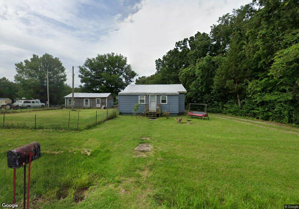
6947 Highway Jj Sullivan, MO 63080
Estimated Value: $102,847 - $167,000
2
Beds
1
Bath
812
Sq Ft
$159/Sq Ft
Est. Value
About This Home
This home is located at 6947 Highway Jj, Sullivan, MO 63080 and is currently estimated at $129,212, approximately $159 per square foot. 6947 Highway Jj is a home located in Franklin County with nearby schools including Sullivan Primary School, Sullivan Elementary School, and Sullivan Middle School.
Ownership History
Date
Name
Owned For
Owner Type
Purchase Details
Closed on
May 30, 2025
Sold by
Lawrence Organization Llc
Bought by
Kutrip Mark A and Kutrip Casey
Current Estimated Value
Purchase Details
Closed on
Nov 16, 2022
Sold by
Lawrence Robert
Bought by
Lawrence Organization Llc
Home Financials for this Owner
Home Financials are based on the most recent Mortgage that was taken out on this home.
Original Mortgage
$62,766
Interest Rate
7.08%
Mortgage Type
New Conventional
Purchase Details
Closed on
Dec 27, 2012
Sold by
Bates Charles and Bates Ina
Bought by
Lawrence Robert and Lawrence Raymond
Create a Home Valuation Report for This Property
The Home Valuation Report is an in-depth analysis detailing your home's value as well as a comparison with similar homes in the area
Purchase History
| Date | Buyer | Sale Price | Title Company |
|---|---|---|---|
| Kutrip Mark A | -- | None Listed On Document | |
| Kutrip Mark A | -- | None Listed On Document | |
| Lawrence Organization Llc | -- | None Listed On Document | |
| Lawrence Organization Llc | -- | -- | |
| Lawrence Organization Llc | -- | -- | |
| Lawrence Robert | $23,500 | None Available |
Source: Public Records
Mortgage History
| Date | Status | Borrower | Loan Amount |
|---|---|---|---|
| Previous Owner | Lawrence Organization Llc | $62,766 |
Source: Public Records
Tax History
| Year | Tax Paid | Tax Assessment Tax Assessment Total Assessment is a certain percentage of the fair market value that is determined by local assessors to be the total taxable value of land and additions on the property. | Land | Improvement |
|---|---|---|---|---|
| 2025 | $666 | $11,489 | $0 | $0 |
| 2024 | $666 | $11,271 | $0 | $0 |
| 2023 | $610 | $11,271 | $0 | $0 |
| 2022 | $518 | $9,602 | $0 | $0 |
| 2021 | $522 | $9,602 | $0 | $0 |
| 2020 | $487 | $8,818 | $0 | $0 |
| 2019 | $488 | $8,818 | $0 | $0 |
| 2018 | $463 | $8,286 | $0 | $0 |
| 2017 | $468 | $8,286 | $0 | $0 |
| 2016 | $454 | $8,145 | $0 | $0 |
| 2015 | $456 | $8,145 | $0 | $0 |
| 2014 | $443 | $8,177 | $0 | $0 |
Source: Public Records
Map
Nearby Homes
- 752 Hammer Stone Place
- 1329 N Service Rd E
- 2707 N Service Rd W
- 190 Whispering Pines Estate
- 2501 Highway Af
- 0 Ridge Rd Unit MIS26003377
- 738 Huntington Woods Dr
- 317 Fern Ct
- 36+/- Acres Highland Fling
- 22+/- Acres Highland Fling
- 000
- 994 Acid Mine Rd
- 1116 E Springfield Rd
- 107 Glaser Rd
- 1019 E Springfield Rd
- 0 Perkins Rd Unit MIS26002042
- 31 Sauk Ct
- 0 Highland Fling
- 311 S Highway 185
- 233 Bud St
- 6946 Highway Jj
- 9 Anderson Ln
- 6975 Highway Jj
- 13 Anderson Ln
- 902 Rolling Hills Rd
- 6978 Highway Jj
- 17 Anderson Ln
- 910 Rolling Hills Rd
- 379 Acorn Valley Rd
- 920 Rolling Hills Rd
- 21 Anderson Ln
- 234 Ashton Ln
- 919 Rolling Hills Rd
- 22 Anderson Ln
- 924 Rolling Hills Rd
- 25 Anderson Ln
- 24 Anderson Ln
- 28 Anderson Ln
- 929 Rolling Hills Rd
- 928 Rolling Hills Rd
Your Personal Tour Guide
Ask me questions while you tour the home.