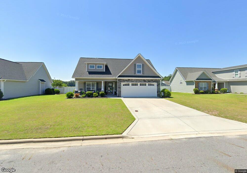
695 Brookfield Dr Winterville, NC 28590
Estimated Value: $364,000 - $403,167
--
Bed
--
Bath
2,166
Sq Ft
$177/Sq Ft
Est. Value
About This Home
This home is located at 695 Brookfield Dr, Winterville, NC 28590 and is currently estimated at $383,542, approximately $177 per square foot. 695 Brookfield Dr is a home with nearby schools including W.H. Robinson Elementary School, A.G. Cox Middle School, and South Central High School.
Ownership History
Date
Name
Owned For
Owner Type
Purchase Details
Closed on
Feb 21, 2017
Sold by
Will Kuhn Homes Llc
Bought by
Copeland Charles G and Copeland Marci
Current Estimated Value
Home Financials for this Owner
Home Financials are based on the most recent Mortgage that was taken out on this home.
Original Mortgage
$205,000
Outstanding Balance
$169,969
Interest Rate
4.25%
Mortgage Type
New Conventional
Estimated Equity
$213,573
Create a Home Valuation Report for This Property
The Home Valuation Report is an in-depth analysis detailing your home's value as well as a comparison with similar homes in the area
Home Values in the Area
Average Home Value in this Area
Purchase History
| Date | Buyer | Sale Price | Title Company |
|---|---|---|---|
| Copeland Charles G | $216,000 | None Available |
Source: Public Records
Mortgage History
| Date | Status | Borrower | Loan Amount |
|---|---|---|---|
| Open | Copeland Charles G | $205,000 |
Source: Public Records
Tax History Compared to Growth
Tax History
| Year | Tax Paid | Tax Assessment Tax Assessment Total Assessment is a certain percentage of the fair market value that is determined by local assessors to be the total taxable value of land and additions on the property. | Land | Improvement |
|---|---|---|---|---|
| 2025 | $2,602 | $392,842 | $50,000 | $342,842 |
| 2024 | $2,590 | $392,842 | $50,000 | $342,842 |
| 2023 | $2,118 | $269,982 | $34,000 | $235,982 |
| 2022 | $2,128 | $269,982 | $34,000 | $235,982 |
| 2021 | $2,118 | $269,982 | $34,000 | $235,982 |
| 2020 | $2,131 | $269,982 | $34,000 | $235,982 |
| 2019 | $1,728 | $212,840 | $29,000 | $183,840 |
| 2018 | $1,650 | $212,840 | $29,000 | $183,840 |
| 2017 | $1,232 | $212,840 | $29,000 | $183,840 |
Source: Public Records
Map
Nearby Homes
- 623 Norberry Dr
- 576 Norberry Dr
- 603 Brookfield Dr
- 613 Brookfield Dr
- 483 Primrose Ln
- 433 Drexel Ln
- 2841 Verbena Way
- 312 Brogden Ct
- 272 Primrose Ln
- 263 Laurie Ellis Rd
- 334 Gayle Blvd
- 2920 Jessica Dr Unit A
- 626 Edenbrook Dr
- 2520 Ange St
- 3011 Dearing Ct
- 626 Winterfield Dr
- Greystone Plan at Eli's Ridge
- Walden Plan at Eli's Ridge
- Haddock Plan at Eli's Ridge
- Halston Plan at Eli's Ridge
- 701 Brookfield Dr
- 689 Brookfield Dr
- 599 Norberry Dr
- 683 Brookfield Dr
- 690 Brookfield Dr
- 465 Castleford Dr
- 684 Brookfield Dr
- 585 Norberry Dr
- 589 Norberry Dr
- 676 Brookfield Dr
- 542 Brookfield Dr
- 464 Castleford Dr
- 669 Brookfield Dr
- 2807 Braemar Dr
- 520 Brookfield Dr
- 548 Brookfield Dr
- 2710 Tunsberg Ct
- 556 Brookfield Dr
- 512 Brookfield Dr
- 582 Norberry Dr