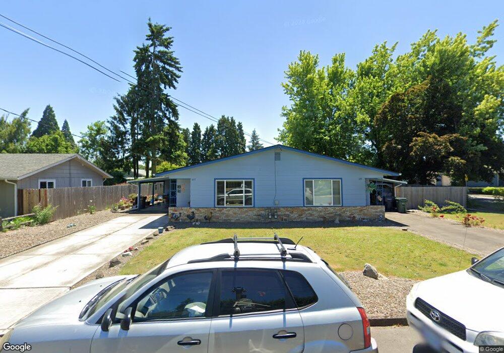
695 Dalke St E Monmouth, OR 97361
Estimated Value: $452,399 - $640,000
4
Beds
2
Baths
2,112
Sq Ft
$255/Sq Ft
Est. Value
About This Home
This home is located at 695 Dalke St E, Monmouth, OR 97361 and is currently estimated at $538,350, approximately $254 per square foot. 695 Dalke St E is a home with nearby schools including Monmouth Elementary School, Talmadge Middle School, and Central High School.
Ownership History
Date
Name
Owned For
Owner Type
Purchase Details
Closed on
Jul 2, 2018
Sold by
Thompson Joy D and Thompson Living Trust
Bought by
Pond Brian K and Smith Patricia L
Current Estimated Value
Home Financials for this Owner
Home Financials are based on the most recent Mortgage that was taken out on this home.
Original Mortgage
$92,000
Outstanding Balance
$79,908
Interest Rate
4.6%
Mortgage Type
New Conventional
Estimated Equity
$458,442
Purchase Details
Closed on
Jun 20, 2006
Sold by
Thompson Emery Jack and Thompson Joy Darlene
Bought by
Thompson Emery J and Thompson Joy D
Create a Home Valuation Report for This Property
The Home Valuation Report is an in-depth analysis detailing your home's value as well as a comparison with similar homes in the area
Home Values in the Area
Average Home Value in this Area
Purchase History
| Date | Buyer | Sale Price | Title Company |
|---|---|---|---|
| Pond Brian K | $115,000 | Ticor Title | |
| Thompson Emery J | -- | None Available |
Source: Public Records
Mortgage History
| Date | Status | Borrower | Loan Amount |
|---|---|---|---|
| Open | Pond Brian K | $92,000 |
Source: Public Records
Tax History
| Year | Tax Paid | Tax Assessment Tax Assessment Total Assessment is a certain percentage of the fair market value that is determined by local assessors to be the total taxable value of land and additions on the property. | Land | Improvement |
|---|---|---|---|---|
| 2025 | $3,552 | $215,480 | $80,290 | $135,190 |
| 2024 | $3,552 | $209,210 | $77,950 | $131,260 |
| 2023 | $3,701 | $203,120 | $75,680 | $127,440 |
| 2022 | $3,330 | $197,210 | $73,470 | $123,740 |
| 2021 | $3,292 | $191,470 | $71,330 | $120,140 |
| 2020 | $3,162 | $185,900 | $69,250 | $116,650 |
| 2019 | $3,070 | $180,490 | $67,240 | $113,250 |
| 2018 | $2,964 | $175,240 | $65,280 | $109,960 |
| 2017 | $2,948 | $170,140 | $63,380 | $106,760 |
| 2016 | $2,950 | $165,190 | $61,540 | $103,650 |
Source: Public Records
Map
Nearby Homes
- 790 Clay St E
- 191 Catron St S
- 406 Madrona (-408) St E
- 505 Broad St S
- 952 Main St E
- 0 S Pacific Hwy W
- 0 S Pacific Hwy W Unit 1100+ 24617884
- 145 Ecols St N
- 1115 Gwinn St E
- 545 Warren St S
- 545 Warren St S Unit 12
- 750 Beaton Ln
- 631 Martin Way S
- 738 E Fen Way
- 260 Jacobson Way S
- 1390 Gwinn St E
- 1329 Price Ln E
- 1515 Bentley St E
- 412 Monmouth Ave S
- 228 Clay St W
- 711 Dalke St E
- 716 Bentley St E
- 692 Dalke St E
- 391 Southgate Dr S
- 740 Bentley St E
- 725 Dalke St E
- 400 Southgate Dr S
- 380 Southgate Dr S
- 412 Southgate Dr S
- 358 Southgate Dr S
- 722 Dalke St E
- 323 Southgate Dr S
- 414 Southgate Dr S
- 739 Dalke St E
- 711 Bentley St E
- 699 Bentley St E
- 336 Southgate Dr S
- 424 Southgate Dr S
- 707 Madrona St E
- 786 Bentley St E
Your Personal Tour Guide
Ask me questions while you tour the home.