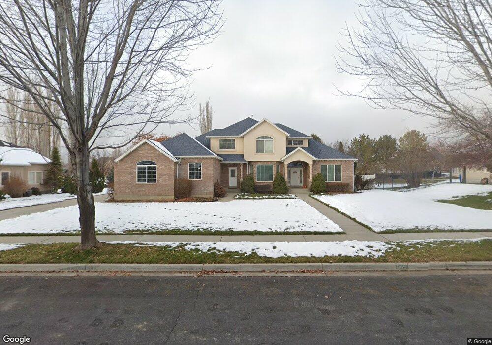
695 E Center St Alpine, UT 84004
Estimated Value: $848,000 - $1,226,000
7
Beds
4
Baths
3,008
Sq Ft
$354/Sq Ft
Est. Value
About This Home
This home is located at 695 E Center St, Alpine, UT 84004 and is currently estimated at $1,065,877, approximately $354 per square foot. 695 E Center St is a home located in Utah County with nearby schools including Alpine School, Timberline Middle School, and Lone Peak High School.
Ownership History
Date
Name
Owned For
Owner Type
Purchase Details
Closed on
May 23, 2006
Sold by
Tamang Benoy and Tamang Angela
Bought by
Tamang Benoy and Tamang Angela D
Current Estimated Value
Home Financials for this Owner
Home Financials are based on the most recent Mortgage that was taken out on this home.
Original Mortgage
$465,000
Outstanding Balance
$271,152
Interest Rate
6.52%
Mortgage Type
New Conventional
Estimated Equity
$794,725
Purchase Details
Closed on
Mar 25, 2003
Sold by
Tamang Benoy and Tamang Angela D
Bought by
Tamang Benoy and Tamang Angela
Home Financials for this Owner
Home Financials are based on the most recent Mortgage that was taken out on this home.
Original Mortgage
$245,000
Interest Rate
5.78%
Purchase Details
Closed on
Nov 26, 1997
Sold by
C K Development Inc
Bought by
Tamang Benoy and Tamang Angela D
Create a Home Valuation Report for This Property
The Home Valuation Report is an in-depth analysis detailing your home's value as well as a comparison with similar homes in the area
Home Values in the Area
Average Home Value in this Area
Purchase History
| Date | Buyer | Sale Price | Title Company |
|---|---|---|---|
| Tamang Benoy | -- | Metro National Title Orem | |
| Tamang Benoy | -- | Empire Land Title Company | |
| Tamang Benoy | -- | -- | |
| C K Development Inc | -- | -- | |
| Royal Associates L C | -- | -- |
Source: Public Records
Mortgage History
| Date | Status | Borrower | Loan Amount |
|---|---|---|---|
| Open | Tamang Benoy | $465,000 | |
| Closed | Tamang Benoy | $245,000 |
Source: Public Records
Tax History
| Year | Tax Paid | Tax Assessment Tax Assessment Total Assessment is a certain percentage of the fair market value that is determined by local assessors to be the total taxable value of land and additions on the property. | Land | Improvement |
|---|---|---|---|---|
| 2025 | $4,247 | $540,265 | -- | -- |
| 2024 | $4,247 | $495,000 | $0 | $0 |
| 2023 | $3,931 | $491,810 | $0 | $0 |
| 2022 | $4,127 | $501,545 | $0 | $0 |
| 2021 | $3,699 | $698,300 | $274,500 | $423,800 |
| 2020 | $3,600 | $665,000 | $249,500 | $415,500 |
| 2019 | $3,167 | $610,800 | $249,500 | $361,300 |
| 2018 | $2,933 | $558,900 | $221,800 | $337,100 |
| 2017 | $2,793 | $283,195 | $0 | $0 |
| 2016 | $2,712 | $256,410 | $0 | $0 |
| 2015 | $2,648 | $236,830 | $0 | $0 |
| 2014 | $2,554 | $225,940 | $0 | $0 |
Source: Public Records
Map
Nearby Homes
- 887 E Village Way
- 202 E Alpine Dr
- 1063 E Alpine Dr
- 48 N 100 E
- 475 Grove Dr
- 30 S Main St
- 76 N Bald Mountain Dr
- 196 Holly Dr
- 250 S Main St Unit 25
- 250 S Main St Unit 20
- 250 S Main St Unit 9
- 250 S Main St Unit 7
- 151 Glacier Lily Dr
- 259 Twin River Loop
- 88 W Cascade Ave
- 986 N Sunbrook Cir
- 1263 E Chapman Ct
- 682 Healey Blvd
- 381 E Watkins Cir Unit 28
- 463 Heritage Hills Dr
Your Personal Tour Guide
Ask me questions while you tour the home.