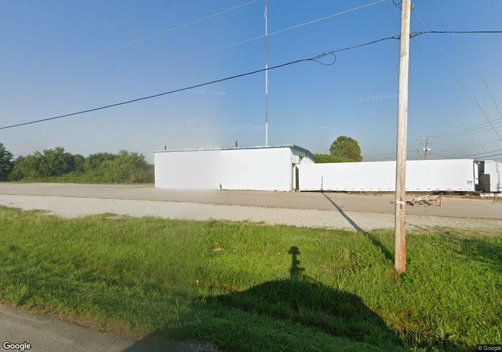
695 Industrial Dr Franklin, IN 46131
Estimated Value: $648,282
--
Bed
--
Bath
4,800
Sq Ft
$135/Sq Ft
Est. Value
About This Home
This home is located at 695 Industrial Dr, Franklin, IN 46131 and is currently estimated at $648,282, approximately $135 per square foot. 695 Industrial Dr is a home located in Johnson County with nearby schools including Northwood Elementary School, Franklin Community Middle School, and Custer Baker Intermediate School.
Ownership History
Date
Name
Owned For
Owner Type
Purchase Details
Closed on
Jun 30, 2021
Sold by
Pn Properties Llc
Bought by
Smythe Levi
Current Estimated Value
Home Financials for this Owner
Home Financials are based on the most recent Mortgage that was taken out on this home.
Original Mortgage
$232,000
Outstanding Balance
$210,504
Interest Rate
2.9%
Mortgage Type
New Conventional
Estimated Equity
$437,778
Purchase Details
Closed on
Sep 15, 2011
Sold by
Petro Family L P
Bought by
Rainbow 3 Llc
Create a Home Valuation Report for This Property
The Home Valuation Report is an in-depth analysis detailing your home's value as well as a comparison with similar homes in the area
Home Values in the Area
Average Home Value in this Area
Purchase History
| Date | Buyer | Sale Price | Title Company |
|---|---|---|---|
| Smythe Levi | -- | None Available | |
| Rainbow 3 Llc | -- | None Available |
Source: Public Records
Mortgage History
| Date | Status | Borrower | Loan Amount |
|---|---|---|---|
| Open | Smythe Levi | $232,000 |
Source: Public Records
Tax History Compared to Growth
Tax History
| Year | Tax Paid | Tax Assessment Tax Assessment Total Assessment is a certain percentage of the fair market value that is determined by local assessors to be the total taxable value of land and additions on the property. | Land | Improvement |
|---|---|---|---|---|
| 2025 | $6,720 | $247,200 | $119,800 | $127,400 |
| 2024 | $6,720 | $243,100 | $119,800 | $123,300 |
| 2023 | $6,686 | $230,800 | $107,500 | $123,300 |
| 2022 | $6,863 | $224,100 | $105,100 | $119,000 |
| 2021 | $6,622 | $205,000 | $108,900 | $96,100 |
| 2020 | $6,076 | $188,100 | $95,200 | $92,900 |
| 2019 | $5,930 | $183,600 | $88,100 | $95,500 |
| 2018 | $5,487 | $183,600 | $88,100 | $95,500 |
| 2017 | $5,455 | $181,500 | $88,100 | $93,400 |
| 2016 | $3,903 | $131,100 | $88,100 | $43,000 |
| 2014 | $3,876 | $129,200 | $88,100 | $41,100 |
| 2013 | $3,876 | $129,200 | $88,100 | $41,100 |
Source: Public Records
Map
Nearby Homes
- 1102 Branifield Ct
- 2644 Branigan Creek Blvd
- 2867 Branifield Dr
- 1151 N Aberdeen Dr
- 2855 Fieldstone Ct
- 1195 S Aberdeen Dr
- 2774 Woodfield Blvd
- 2488 Woodfield Blvd
- 2160 Meadow Glen Blvd
- 1145 Southpointe Dr
- 1081 Country Meadow Ct
- 1134 Spring Meadow Ct
- 1081 Torino Ln Unit 1083
- 2087 Mach Ln
- 1624 Roberts Rd
- 1942 Turning Leaf Dr
- 315 Schoolhouse Rd
- 1804 Acorn Rd
- 2490 Bridlewood Dr
- 2458 Bristol Dr
- 555 Industrial Dr Unit A
- 555 Industrial Dr
- 225 Industrial Dr
- 215 Industrial Dr
- 2765 N Morton St
- 2797 N Morton St
- 2851 N Morton St
- 772 International Dr
- 2800 N Morton St
- 2820 N Morton St
- 2690 N Morton St
- 600 International Dr
- 2770 N Morton St
- 1101 Branigin Creek Ct
- 1106 Branigin Creek Ct
- 500 International Dr
- 1103 Branifield Ct
- 2725 Branigin Creek Blvd
- 1115 Branigin Creek Ct
- 2719 Branigin Creek Blvd