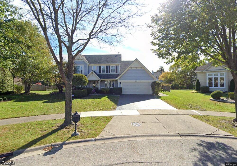
695 Mayfair Ct S Buffalo Grove, IL 60089
South Buffalo Grove NeighborhoodEstimated Value: $626,531 - $733,000
4
Beds
3
Baths
2,929
Sq Ft
$237/Sq Ft
Est. Value
About This Home
This home is located at 695 Mayfair Ct S, Buffalo Grove, IL 60089 and is currently estimated at $694,633, approximately $237 per square foot. 695 Mayfair Ct S is a home located in Cook County with nearby schools including Henry W Longfellow Elementary School, Cooper Middle School, and Buffalo Grove High School.
Ownership History
Date
Name
Owned For
Owner Type
Purchase Details
Closed on
Oct 12, 2009
Sold by
Toushin Steven D and Ross Toushin Janet Gail
Bought by
Toushin Steven D and Ross Toushin Janet Gail
Current Estimated Value
Purchase Details
Closed on
Aug 25, 2000
Sold by
Fagelsen Lee N and Fagelsen Arlene M
Bought by
Ross Janet G
Create a Home Valuation Report for This Property
The Home Valuation Report is an in-depth analysis detailing your home's value as well as a comparison with similar homes in the area
Home Values in the Area
Average Home Value in this Area
Purchase History
| Date | Buyer | Sale Price | Title Company |
|---|---|---|---|
| Toushin Steven D | -- | None Available | |
| Ross Janet G | $381,000 | -- |
Source: Public Records
Tax History Compared to Growth
Tax History
| Year | Tax Paid | Tax Assessment Tax Assessment Total Assessment is a certain percentage of the fair market value that is determined by local assessors to be the total taxable value of land and additions on the property. | Land | Improvement |
|---|---|---|---|---|
| 2024 | $12,492 | $45,000 | $9,835 | $35,165 |
| 2023 | $11,961 | $45,000 | $9,835 | $35,165 |
| 2022 | $11,961 | $45,000 | $9,835 | $35,165 |
| 2021 | $12,634 | $41,755 | $6,966 | $34,789 |
| 2020 | $12,436 | $41,755 | $6,966 | $34,789 |
| 2019 | $12,470 | $46,447 | $6,966 | $39,481 |
| 2018 | $13,434 | $45,193 | $6,147 | $39,046 |
| 2017 | $13,223 | $45,193 | $6,147 | $39,046 |
| 2016 | $13,418 | $47,003 | $6,147 | $40,856 |
| 2015 | $12,204 | $40,419 | $5,327 | $35,092 |
| 2014 | $12,646 | $40,419 | $5,327 | $35,092 |
| 2013 | $11,672 | $40,419 | $5,327 | $35,092 |
Source: Public Records
Map
Nearby Homes
- 665 Thornwood Dr
- 476 Raupp Blvd
- 455 Mayfair Ln
- 250 Old Oak Dr Unit 275
- 234 Mohawk Trail
- 561 Park View Terrace Unit 153
- 820 Weidner Rd Unit 409
- 12 Oak Creek Dr Unit 2212
- 3300 N Carriageway Dr Unit 317
- 813 Stradford Cir Unit 21B2
- 535 Estate Dr
- 3401 N Ellen Dr
- 310 Rosewood Ave
- 10 Old Oak Dr Unit 103
- 859 Beechwood Rd
- 443 Diane Dr
- 51 Old Oak Dr Unit 414
- 51 Old Oak Dr Unit 302
- 410 Chatham Cir
- 720 Weidner Rd Unit 302
- 685 Mayfair Ct S
- 705 Mayfair Ct S
- 470 Bradley Rd
- 480 Bradley Rd
- 460 Bradley Rd
- 490 Bradley Rd
- 714 Patton Dr
- 675 Mayfair Ct S
- 704 Patton Dr
- 715 Mayfair Ct S
- 724 Patton Dr
- 694 Patton Dr
- 734 Patton Dr
- 500 Bradley Rd
- 665 Mayfair Ct S
- 684 Patton Dr
- 725 Mayfair Ln
- 475 Bradley Rd
- 674 Patton Dr
- 485 Bradley Rd