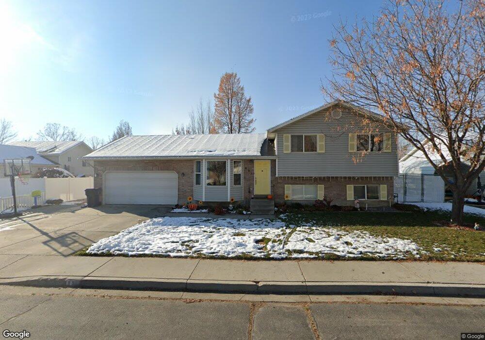
695 N 1010 W Pleasant Grove, UT 84062
Estimated Value: $496,000 - $555,000
4
Beds
2
Baths
1,684
Sq Ft
$311/Sq Ft
Est. Value
About This Home
This home is located at 695 N 1010 W, Pleasant Grove, UT 84062 and is currently estimated at $523,558, approximately $310 per square foot. 695 N 1010 W is a home located in Utah County with nearby schools including Mount Mahogany School, Pleasant Grove Junior High School, and Pleasant Grove High School.
Ownership History
Date
Name
Owned For
Owner Type
Purchase Details
Closed on
Aug 1, 2011
Sold by
Johnson Scott
Bought by
Johnson Scott and Johnson Sabrina M
Current Estimated Value
Home Financials for this Owner
Home Financials are based on the most recent Mortgage that was taken out on this home.
Original Mortgage
$137,000
Outstanding Balance
$94,045
Interest Rate
4.54%
Mortgage Type
New Conventional
Estimated Equity
$429,513
Purchase Details
Closed on
Jun 24, 2011
Sold by
Keen Bruce L and Keen Jennifer L
Bought by
Johnson Scott
Home Financials for this Owner
Home Financials are based on the most recent Mortgage that was taken out on this home.
Original Mortgage
$137,000
Outstanding Balance
$94,045
Interest Rate
4.54%
Mortgage Type
New Conventional
Estimated Equity
$429,513
Purchase Details
Closed on
Aug 28, 2007
Sold by
Davenport Robert L
Bought by
Keen Bruce L and Keen Jennifer L
Home Financials for this Owner
Home Financials are based on the most recent Mortgage that was taken out on this home.
Original Mortgage
$240,000
Interest Rate
6.67%
Mortgage Type
Purchase Money Mortgage
Purchase Details
Closed on
Jul 18, 2005
Sold by
Simpson Brian R
Bought by
Davenport Robert L
Home Financials for this Owner
Home Financials are based on the most recent Mortgage that was taken out on this home.
Original Mortgage
$154,800
Interest Rate
6.87%
Mortgage Type
Fannie Mae Freddie Mac
Purchase Details
Closed on
Apr 1, 2005
Sold by
Simpson Brian R
Bought by
Davenport Robert L
Home Financials for this Owner
Home Financials are based on the most recent Mortgage that was taken out on this home.
Original Mortgage
$125,600
Interest Rate
5.92%
Mortgage Type
Seller Take Back
Purchase Details
Closed on
Aug 8, 2002
Sold by
Clark Stacy J and Clark Andrea
Bought by
Simpson Brian R
Home Financials for this Owner
Home Financials are based on the most recent Mortgage that was taken out on this home.
Original Mortgage
$127,200
Interest Rate
6.12%
Create a Home Valuation Report for This Property
The Home Valuation Report is an in-depth analysis detailing your home's value as well as a comparison with similar homes in the area
Home Values in the Area
Average Home Value in this Area
Purchase History
| Date | Buyer | Sale Price | Title Company |
|---|---|---|---|
| Johnson Scott | -- | Gateway Title Insurance Agen | |
| Johnson Scott | -- | Gateway Title Insurance Agen | |
| Johnson Scott | -- | Unity Title | |
| Keen Bruce L | -- | Equity Title Insurance Agen | |
| Davenport Robert L | -- | Precision Title Company | |
| Davenport Robert L | -- | Precision Title Company | |
| Simpson Brian R | -- | Sundance Title Insurance Co |
Source: Public Records
Mortgage History
| Date | Status | Borrower | Loan Amount |
|---|---|---|---|
| Open | Johnson Scott | $137,000 | |
| Previous Owner | Keen Bruce L | $240,000 | |
| Previous Owner | Davenport Robert L | $154,800 | |
| Previous Owner | Davenport Robert L | $125,600 | |
| Previous Owner | Simpson Brian R | $127,200 |
Source: Public Records
Tax History Compared to Growth
Tax History
| Year | Tax Paid | Tax Assessment Tax Assessment Total Assessment is a certain percentage of the fair market value that is determined by local assessors to be the total taxable value of land and additions on the property. | Land | Improvement |
|---|---|---|---|---|
| 2025 | $1,966 | $253,165 | $192,600 | $267,700 |
| 2024 | $1,966 | $234,685 | $0 | $0 |
| 2023 | $1,946 | $237,710 | $0 | $0 |
| 2022 | $2,011 | $244,420 | $0 | $0 |
| 2021 | $1,773 | $328,100 | $129,000 | $199,100 |
| 2020 | $1,624 | $294,600 | $115,200 | $179,400 |
| 2019 | $1,457 | $273,500 | $111,700 | $161,800 |
| 2018 | $1,383 | $245,400 | $104,700 | $140,700 |
| 2017 | $1,339 | $126,445 | $0 | $0 |
| 2016 | $1,226 | $111,815 | $0 | $0 |
| 2015 | $1,158 | $100,045 | $0 | $0 |
| 2014 | $1,034 | $88,440 | $0 | $0 |
Source: Public Records
Map
Nearby Homes
- 854 N 1010 W
- 1130 W State Rd
- 685 W 1000 N
- 909 W 1180 N
- 1443 W 1010 N
- 123 N Romney Ln Unit 103
- 1078 W 70 N
- 150 N 1300 W
- 1491 W 1010 N
- 1065 N 1420 W
- 1096 N 1420 St W Unit 27
- 1515 W 1010 St N
- 1249 W Cambria Dr Unit 101
- 1598 W 220 N
- 1525 W 300 N
- 295 N 1580 W
- 1498 W 1060 N Unit 5
- Lytham Plan at Grove Acres
- 1541 W 250 N
- 1541 W 1060 N