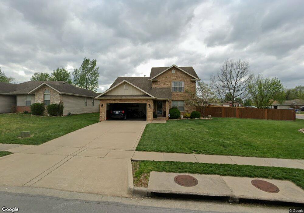
695 S Brecklyn Rd Springfield, MO 65802
Estimated Value: $301,000 - $354,000
5
Beds
3
Baths
2,272
Sq Ft
$144/Sq Ft
Est. Value
About This Home
This home is located at 695 S Brecklyn Rd, Springfield, MO 65802 and is currently estimated at $326,685, approximately $143 per square foot. 695 S Brecklyn Rd is a home located in Greene County with nearby schools including Willard Orchard Hills Elementary School and Willard Intermediate-South.
Ownership History
Date
Name
Owned For
Owner Type
Purchase Details
Closed on
Sep 15, 2005
Sold by
Mace Homes Inc
Bought by
Davis David W and Davis Martha L
Current Estimated Value
Home Financials for this Owner
Home Financials are based on the most recent Mortgage that was taken out on this home.
Original Mortgage
$137,738
Outstanding Balance
$73,459
Interest Rate
5.8%
Mortgage Type
FHA
Estimated Equity
$253,226
Create a Home Valuation Report for This Property
The Home Valuation Report is an in-depth analysis detailing your home's value as well as a comparison with similar homes in the area
Home Values in the Area
Average Home Value in this Area
Purchase History
| Date | Buyer | Sale Price | Title Company |
|---|---|---|---|
| Davis David W | -- | None Available |
Source: Public Records
Mortgage History
| Date | Status | Borrower | Loan Amount |
|---|---|---|---|
| Open | Davis David W | $137,738 |
Source: Public Records
Tax History
| Year | Tax Paid | Tax Assessment Tax Assessment Total Assessment is a certain percentage of the fair market value that is determined by local assessors to be the total taxable value of land and additions on the property. | Land | Improvement |
|---|---|---|---|---|
| 2025 | $2,293 | $40,600 | $8,550 | $32,050 |
| 2024 | $1,905 | $33,970 | $3,800 | $30,170 |
| 2023 | $1,896 | $33,970 | $3,800 | $30,170 |
| 2022 | $1,684 | $29,890 | $3,800 | $26,090 |
| 2021 | $1,684 | $29,890 | $3,800 | $26,090 |
| 2020 | $1,405 | $27,090 | $3,800 | $23,290 |
| 2019 | $1,400 | $27,090 | $3,800 | $23,290 |
| 2018 | $1,369 | $26,350 | $3,800 | $22,550 |
| 2017 | $1,358 | $26,350 | $3,800 | $22,550 |
| 2016 | $1,351 | $26,350 | $3,800 | $22,550 |
| 2015 | $1,341 | $26,350 | $3,800 | $22,550 |
| 2014 | $1,338 | $26,110 | $3,800 | $22,310 |
Source: Public Records
Map
Nearby Homes
- 5439 W Harrison St
- 820 S Quade Rd
- 795 S Natalie Ave
- 875 S Natalie Ave
- 5163 W Sunstruck St
- 5175 W Sunstruck St
- 5131 W Sunstruck St
- 5817 W Alexa Ln
- 5355 Basswood Ct W
- 5441 Basswood Ct W
- 768 S Long Dr
- 5021 W Tarkio St
- 5560 W Longleaf Dr
- 5669 W Sunflower Dr
- 413 S Dove Valley Ave
- 5182 W Sunstruck St
- 000 W Independence Dr
- 4800 W Mount Vernon St
- 5145 W Sunstruck St
- 5635 W Mangrove St
- 707 S Brecklyn Rd
- 706 S Jester Ave
- 719 S Brecklyn Rd
- 718 S Jester Ave
- 5451 W Harrison St
- 708 S Brecklyn Rd
- 5463 W Harrison St
- 731 S Brecklyn Rd
- 5415 W Harrison St
- 730 S Jester Ave
- 720 S Brecklyn Rd
- 5475 W Harrison St
- 5403 W Harrison St
- 743 S Brecklyn Rd
- 5487 W Harrison St
- 732 S Brecklyn Rd
- 742 S Jester Ave
- 693 S Jester Ave
- 705 S Jester Ave
- 5511 W Harrison St
Your Personal Tour Guide
Ask me questions while you tour the home.