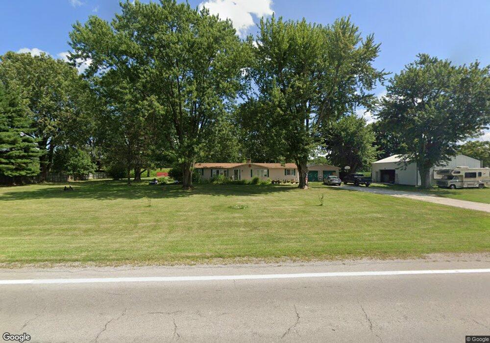
695 State Route 4 Bucyrus, OH 44820
Estimated Value: $182,000 - $228,000
3
Beds
2
Baths
1,584
Sq Ft
$127/Sq Ft
Est. Value
About This Home
This home is located at 695 State Route 4, Bucyrus, OH 44820 and is currently estimated at $200,896, approximately $126 per square foot. 695 State Route 4 is a home located in Crawford County with nearby schools including Wynford Elementary School and Wynford High School.
Ownership History
Date
Name
Owned For
Owner Type
Purchase Details
Closed on
Sep 10, 2020
Sold by
Turner Deborah and Turner Deborah M
Bought by
Dorsey Lisa R
Current Estimated Value
Home Financials for this Owner
Home Financials are based on the most recent Mortgage that was taken out on this home.
Original Mortgage
$114,845
Outstanding Balance
$97,928
Interest Rate
2.9%
Mortgage Type
Commercial
Estimated Equity
$102,968
Purchase Details
Closed on
May 9, 2019
Sold by
Estate Of Larry J Turner
Bought by
Turner Deborah
Create a Home Valuation Report for This Property
The Home Valuation Report is an in-depth analysis detailing your home's value as well as a comparison with similar homes in the area
Home Values in the Area
Average Home Value in this Area
Purchase History
| Date | Buyer | Sale Price | Title Company |
|---|---|---|---|
| Dorsey Lisa R | $125,000 | Old Crawford Land Title | |
| Turner Deborah | -- | None Available |
Source: Public Records
Mortgage History
| Date | Status | Borrower | Loan Amount |
|---|---|---|---|
| Open | Dorsey Lisa R | $114,845 |
Source: Public Records
Tax History Compared to Growth
Tax History
| Year | Tax Paid | Tax Assessment Tax Assessment Total Assessment is a certain percentage of the fair market value that is determined by local assessors to be the total taxable value of land and additions on the property. | Land | Improvement |
|---|---|---|---|---|
| 2024 | $1,725 | $46,450 | $5,680 | $40,770 |
| 2023 | $1,725 | $39,830 | $4,610 | $35,220 |
| 2022 | $1,841 | $39,830 | $4,610 | $35,220 |
| 2021 | $1,928 | $39,830 | $4,610 | $35,220 |
| 2020 | $1,395 | $31,150 | $4,610 | $26,540 |
| 2019 | $1,406 | $31,150 | $4,610 | $26,540 |
| 2018 | $1,422 | $31,150 | $4,610 | $26,540 |
| 2017 | $1,162 | $26,250 | $4,610 | $21,640 |
| 2016 | $961 | $26,250 | $4,610 | $21,640 |
| 2015 | $976 | $26,250 | $4,610 | $21,640 |
| 2014 | $1,059 | $26,250 | $4,610 | $21,640 |
| 2013 | $1,059 | $26,250 | $4,610 | $21,640 |
Source: Public Records
Map
Nearby Homes
- Morral Kirkpatrick Rd
- 5198 Columbus-Sandusky Rd N
- 1773 Marion-Melmore Rd
- 0 Linn-Hipsher Rd
- 1123 Hillcrest Dr
- 2440 Wyandot Rd
- 1315 Lynne Ave
- 1112 Hillcrest Dr
- 1149 Farmview Dr
- 275 Brentwood St
- 0 Lynne Ave
- 1145 Lynne Ave
- 130 Brentwood St
- 2273 Kerstetter Rd
- 452 Pleasant Ln
- 3090 Schell Dr
- 1683 Linn Hipsher Rd
- 182 Williams St
- 3602 Marion-Bucyrus Rd
- 3602 Marion Bucyrus Rd
- 713 State Route 4
- 700 State Route 4
- 719 State Route 4
- 723 State Route 4
- 672 State Route 4
- 620 Ohio 4
- 620 State Route 4
- 615 State Route 4
- 615 Ohio 4
- 585 State Route 4
- 571 State Route 4
- 664 Monnett Rd
- 1295 Scioto Chapel Rd
- 1482 Malcolm Rd
- 525 Ohio 4
- 525 State Route 4
- 525 State Route 4
- 526 State Route 4
- 526 State Route 4
- 552 Monnett Rd